MyTopo
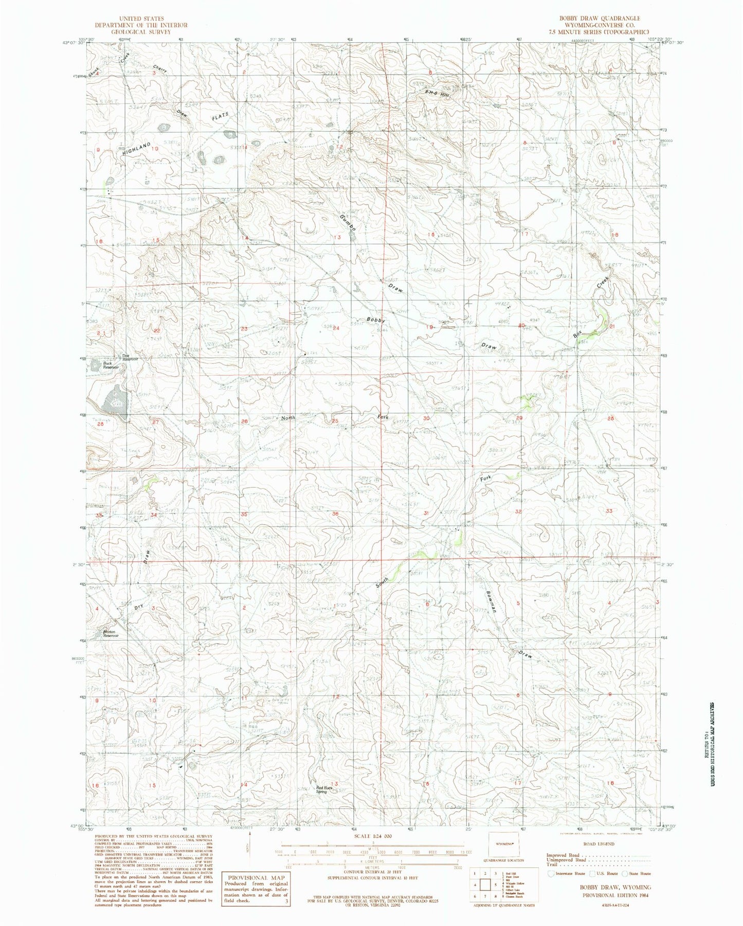
Classic USGS Bobby Draw Wyoming 7.5'x7.5' Topo Map
Couldn't load pickup availability
Historical USGS topographic quad map of Bobby Draw in the state of Wyoming. Map scale may vary for some years, but is generally around 1:24,000. Print size is approximately 24" x 27"
This quadrangle is in the following counties: Converse.
The map contains contour lines, roads, rivers, towns, and lakes. Printed on high-quality waterproof paper with UV fade-resistant inks, and shipped rolled.
Contains the following named places: Antone Dike, Bobby Draw, Bowman Draw, Box Creek Ranch, Cherry Draw, Clausen Ranch, Doe Dam, Doe Reservoir, Dry Draw, Enlargement Tailings Basin Evaporation Reservoir, Enlargement Tailings Basin Evaporation Reservoir Dam, Fink Ranch, Fowler Ranch, Gumbo Draw, Lightning Dike, Morton Reservoir, Nine-H-6 Hill, North Fork Box Creek, Red Rock Spring, South Fork Box Creek, Weston Ranch, ZIP Code: 82633