MyTopo
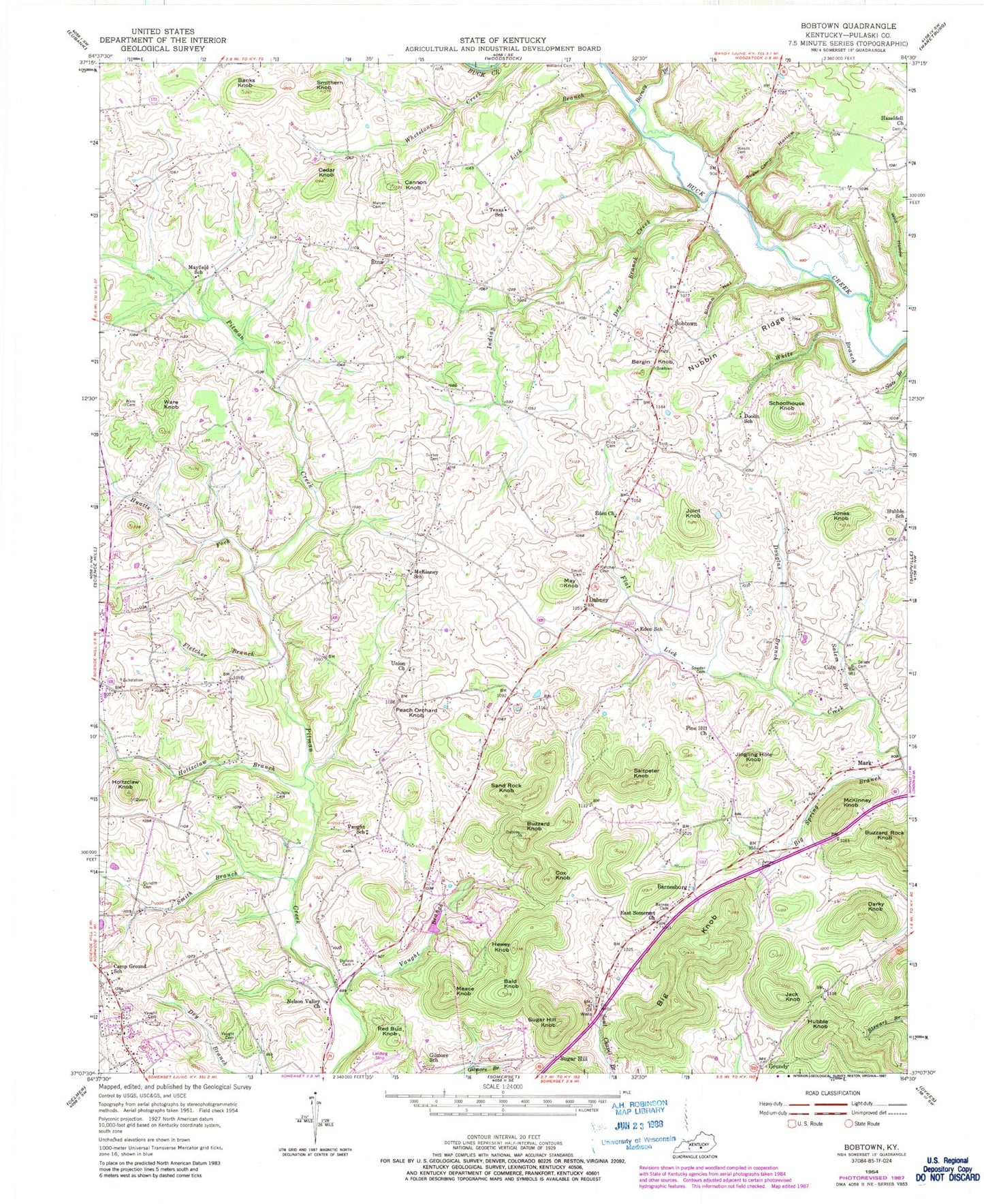
Classic USGS Bobtown Kentucky 7.5'x7.5' Topo Map
Couldn't load pickup availability
Historical USGS topographic quad map of Bobtown in the state of Kentucky. Map scale may vary for some years, but is generally around 1:24,000. Print size is approximately 24" x 27"
This quadrangle is in the following counties: Pulaski.
The map contains contour lines, roads, rivers, towns, and lakes. Printed on high-quality waterproof paper with UV fade-resistant inks, and shipped rolled.
Contains the following named places: Bald Knob, Banks Knob, Barnes Cemetery, Barnesburg, Barney Branch, Bergin Knob, Big Knob, Big Knob Lookout Tower, Big Spring Branch, Bobtown, Buzzard Knob, Buzzard Rock Knob, Camp Ground School, Cannon Knob, Cedar Knob, Coin, Cox Knob, Cundiff Cemetery, Dabney, Dabney Fire Department, Darky Knob, Dollens Cemetery, Doolin School, Douglas Branch, Dry Branch, East Somerset Church, Eden Church, Eden School, Etna, Etna Church of Christ Cemetery, Fletcher Branch, Gilmore School, Grundy, Hewey Knob, Holtzclaw Branch, Holtzclaw Knob, Hubble Cemetery, Hubble Knob, Hubble School, Hyatts Fork, Indian Creek, Jack Knob, James Cemetery, Jingling Hole Knob, Joint Knob, Jones Knob, Lick Branch, Mark, May Knob, Mayfield School, McKinney Knob, McKinney School, Meace Knob, Mercer Cemetery, Nelson Valley Church, Peach Orchard Knob, Pine Hill Church, Price Cemetery, Red Bud Knob, Salem Branch, Salem Cemetery, Saltpeter Knob, Sand Rock Knob, Schoolhouse Knob, Simon Hollow, Smith Branch, Smith Cemetery, Smithern Knob, Sowder Cemetery, Sugar Camp Hollow, Sugar Hill, Sugar Hill Knob, Surber Cemetery, Sweeney's Chapel Cemetery, Texas School, Union Church, Vaught Branch, Vaught Cemetery, Vaught School, Ware Cemetery, Ware Knob, White Branch, Williams Cemetery, Woods Cemetery, WTHL-FM (Somerset), ZIP Code: 42503