MyTopo
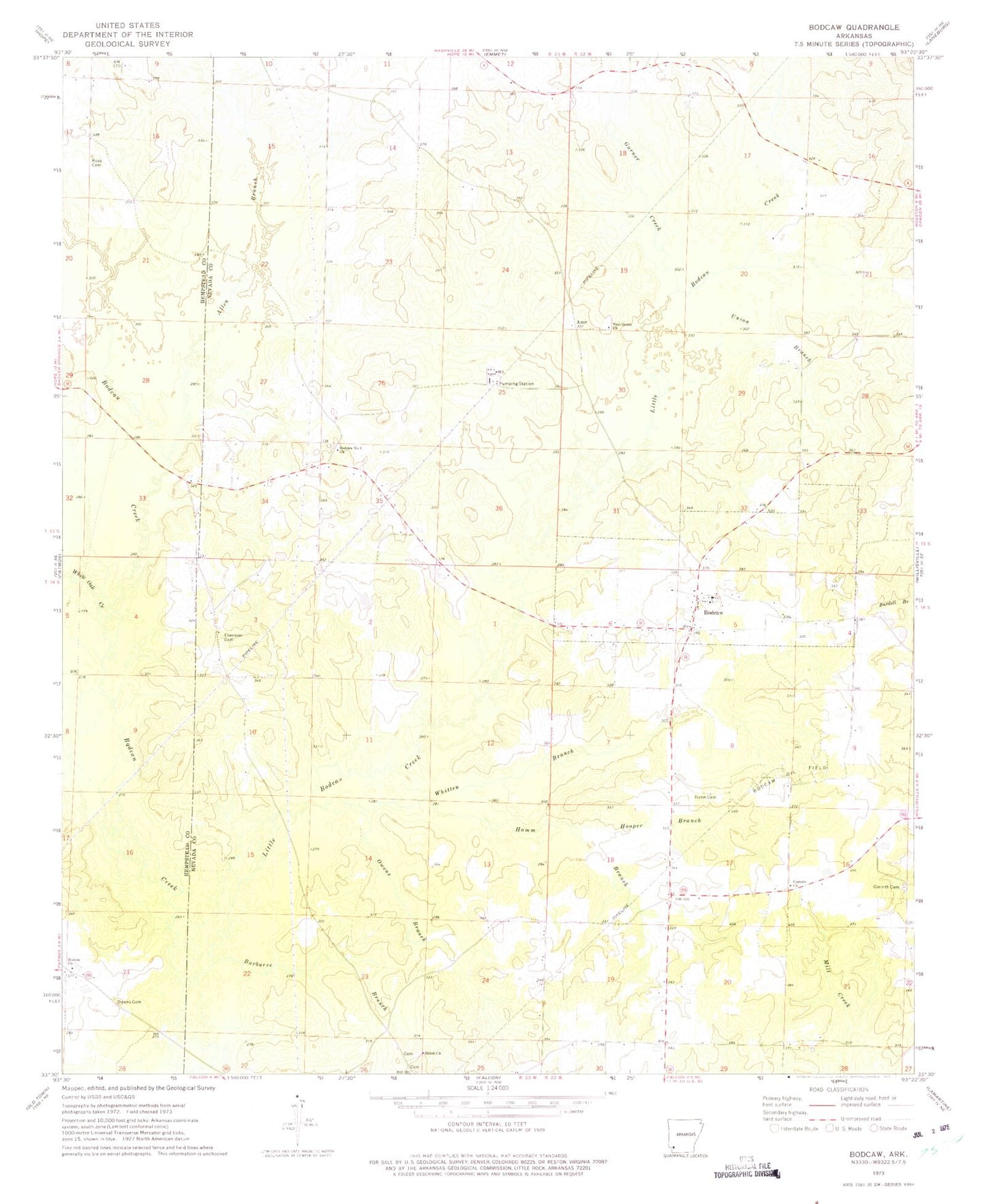
Classic USGS Bodcaw Arkansas 7.5'x7.5' Topo Map
Couldn't load pickup availability
Historical USGS topographic quad map of Bodcaw in the state of Arkansas. Map scale may vary for some years, but is generally around 1:24,000. Print size is approximately 24" x 27"
This quadrangle is in the following counties: Hempstead, Nevada.
The map contains contour lines, roads, rivers, towns, and lakes. Printed on high-quality waterproof paper with UV fade-resistant inks, and shipped rolled.
Contains the following named places: Allen Branch, Azar Cemetery, Azor, Barbaree Branch, Bodcaw, Bodcaw Baptist Church, Bodcaw Number 1 Church Cemetery, Bodcaw Number 1 Missionary Baptist Church, Bodcaw Oil Field, Bodcaw Volunteer Fire Department, Brockmans Store, Corinth Cemetery, Corinth Church, Downs Cemetery, Dunn Cemetery, Ebenezer Church, Forest Hill School, Garner Creek, Hamm Branch, Hinton United Methodist Church, Hooper Branch, Little Bodcau Creek, Little Bodcaw School, New Hope Cemetery, Owens Branch, Providence Church, Register, Ross Cemetery, Shiloh Church, Shiloh Grove Church Cemetery, Shiloh School, Town of Bodcaw, Township of Parker, Union Branch, White Oak Creek, Whitten Branch