MyTopo
Classic USGS Bodines Pennsylvania 7.5'x7.5' Topo Map
Couldn't load pickup availability
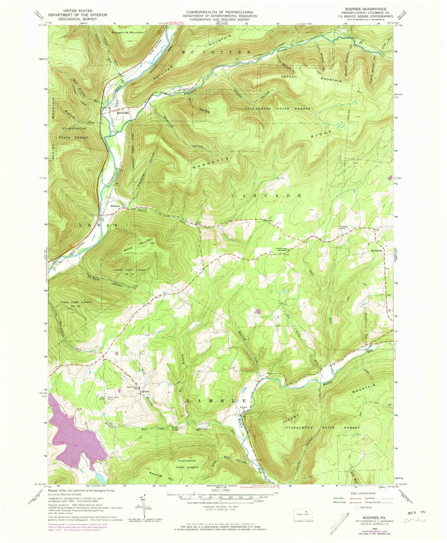
Historical USGS topographic quad map of Bodines in the state of Pennsylvania. Typical map scale is 1:24,000, but may vary for certain years, if available. Print size: 24" x 27"
This quadrangle is in the following counties: Lycoming.
The map contains contour lines, roads, rivers, towns, and lakes. Printed on high-quality waterproof paper with UV fade-resistant inks, and shipped rolled.
Contains the following named places: Logue Field, Rose Valley Lake Dam, Hall Pond, Beech Valley Cemetery, Beech Valley School, Burnetts Ridge, Calvert, Church of the Assumption, Darr Hollow, Hoffman Church, Jacoby Mountain, Long Run, Marsh Hill, Pennsdale Cemetery, Pickenville Mountain, Pleasant Stream, Potash Mountain, Sixth Bottom Hollow, Batys Mountain, Beartrap Hollow, Blessing Mountain, Brewer Run, Cold Run Hollow, De Bois Hollow, East Branch Murray Run, Eighth Bottom Hollow, Fifth Bottom Hollow, Fourth Bottom Hollow, Frozen Run, Heylmun Run, Joe Gray Run, Mill Hollow, Mill Hollow Run, Miller Run, Murray Run, Potash Hollow, Roaring Run, Salt Run, Seventh Bottom Hollow, Slacks Run, Slaughter Hollow, West Branch Murray Run, Bodines, Kellyburg, Potash Trail, Potash Hollow Run, Halls Pond, Township of Cascade, Township of Gamble, Assumption Catholic Cemetery, Apker Cemetery