MyTopo
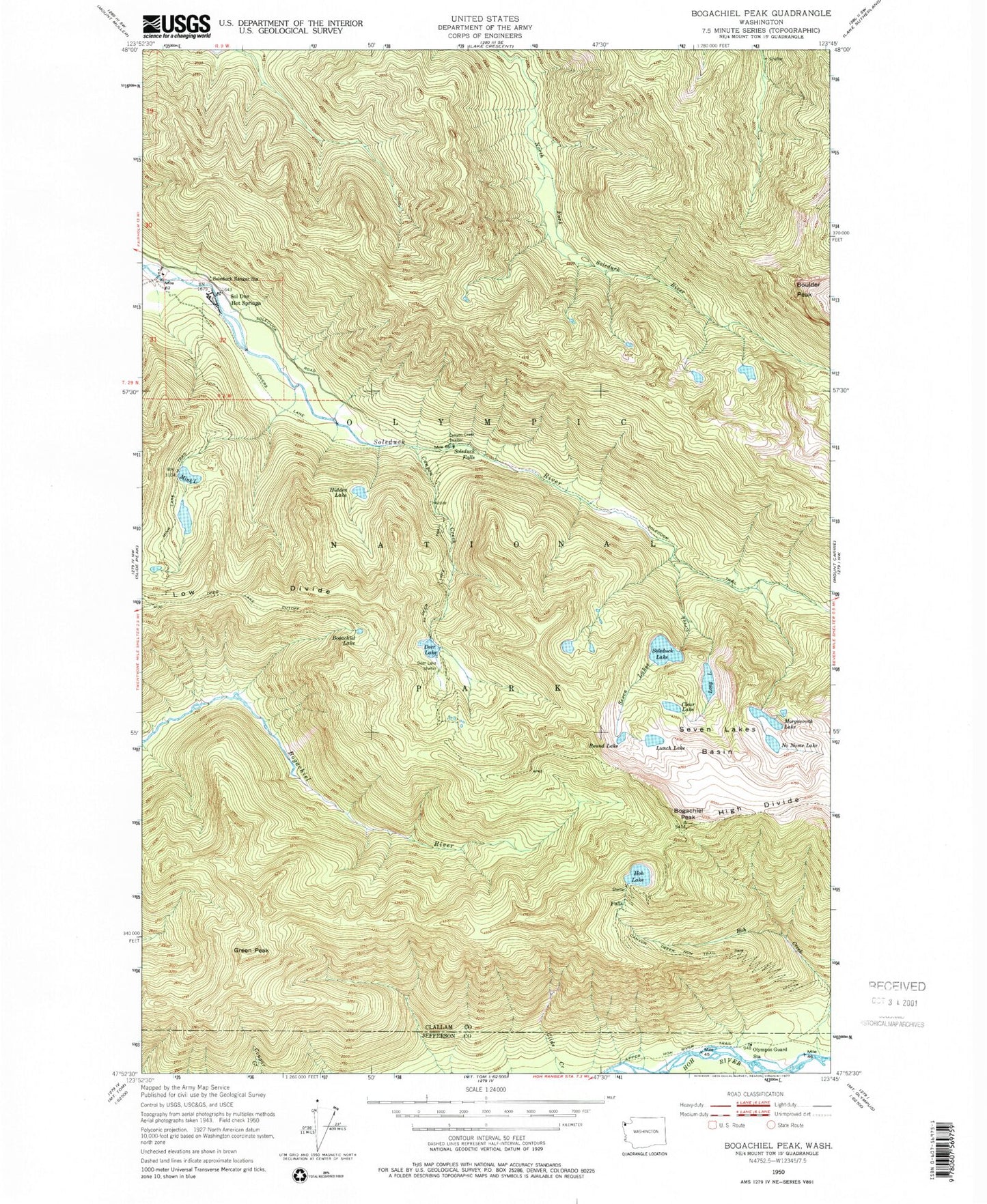
USGS Classic Bogachiel Peak Washington 7.5'x7.5' Topo Map
Couldn't load pickup availability
Historical USGS topographic quad map of Bogachiel Peak in the state of Washington. Scale: 1:24000. Print size: 24" x 27"
This quadrangle is in the following counties: Clallam, Jefferson.
The map contains contour lines, roads, rivers, towns, lakes, and grids including latitude / longitude and UTM / MGRS. Printed on high-quality waterproof paper with UV fade-resistant inks.
Contains the following named places: Bogachiel Lake, Bogachiel Peak, Boulder Lake Shelter, Boulder Peak, Canyon Creek, Canyon Creek Hoh Trail, Canyon Creek Shelter, Clear Lake, Deer Lake, Deer Lake Cutoff, Deer Lake Shelter, Deer Lake Trail, Green Peak, Hidden Lake, High Divide, Hoh Creek, Hoh Lake, Long Lake, Lovers Lane, Lunch Lake, Mink Lake, Mink Lake Trail, No Name Lake, Olympus Guard Station, Round Lake, Seven Lakes Creek, Seven Lakes Basin, Sol Duc Hot Springs, Sol Duc Falls, Sol Duc Lake, Soleduck Ranger Station, Soleduck Trail, Upper Hoh River Trail, Olympus Ranger Station, Seven Lakes Ranger Station, Soleduck Campground, Bogachiel Park, Y Lake, Morgenroth Lake, Solduc Post Office (historical)