MyTopo
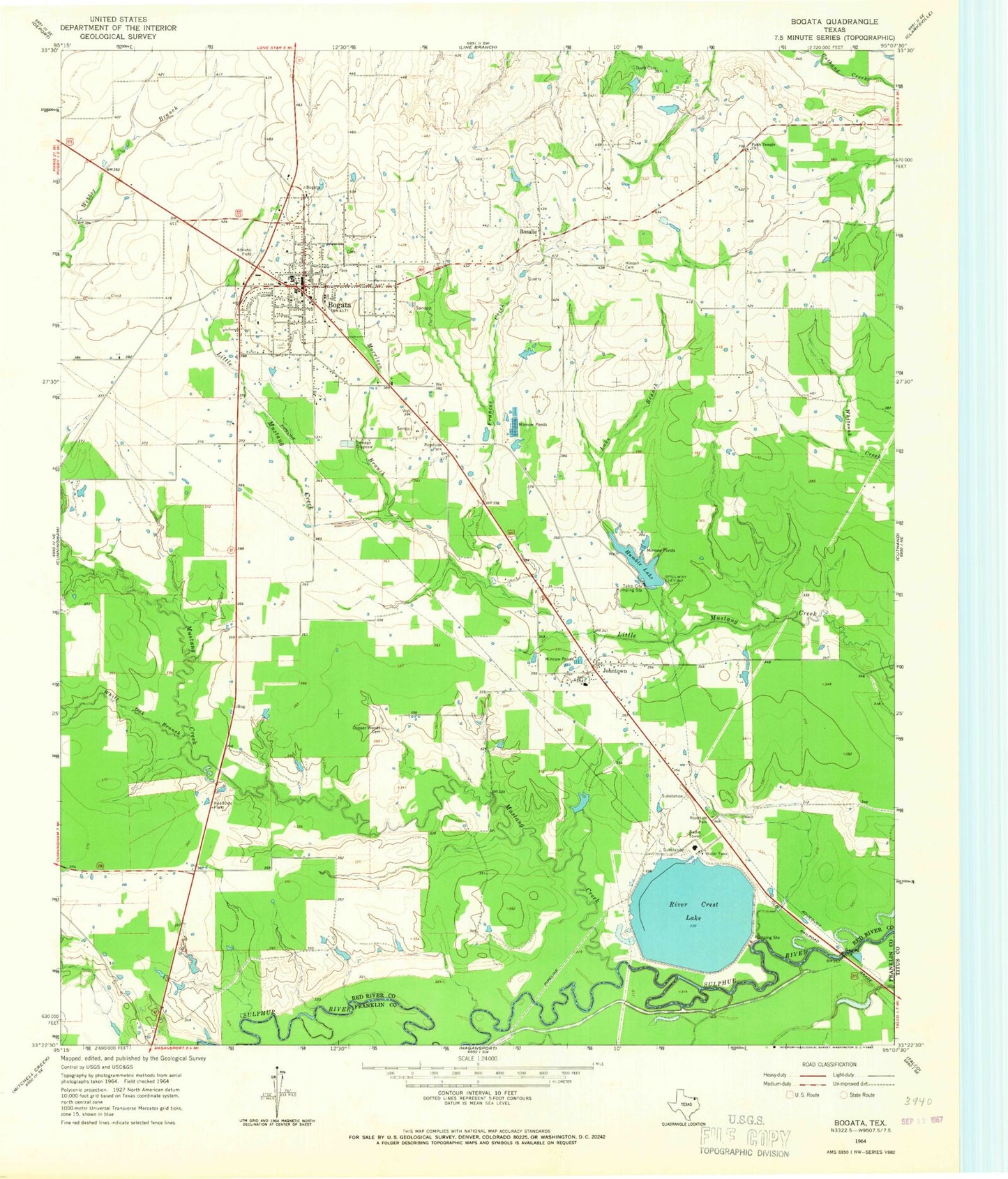
Classic USGS Bogata Texas 7.5'x7.5' Topo Map
Couldn't load pickup availability
Historical USGS topographic quad map of Bogata in the state of Texas. Map scale may vary for some years, but is generally around 1:24,000. Print size is approximately 24" x 27"
This quadrangle is in the following counties: Franklin, Red River, Titus.
The map contains contour lines, roads, rivers, towns, and lakes. Printed on high-quality waterproof paper with UV fade-resistant inks, and shipped rolled.
Contains the following named places: Bogata, Bogata Cemetery, Bogata City Hall, Bogata Division, Bogata Fire Department, Bogata Police Department, Bogata Post Office, City of Bogata, Cooper-Woods Cemetery, Dodd Cemetery, Faith Temple Church, Frances Creek, Harvey Estate Dam, Hinson Cemetery, Humble Lake, Johntown, Lake Branch, Morrison Branch, Mustang Creek, River Crest Lake, River Crest Lake Levee, Rosalie, Rosalie Community Center and Volunteer Fire Department, Smith - Rosalie Cemetery, Talco City Pumping Station, White Oak Branch, ZIP Code: 75417