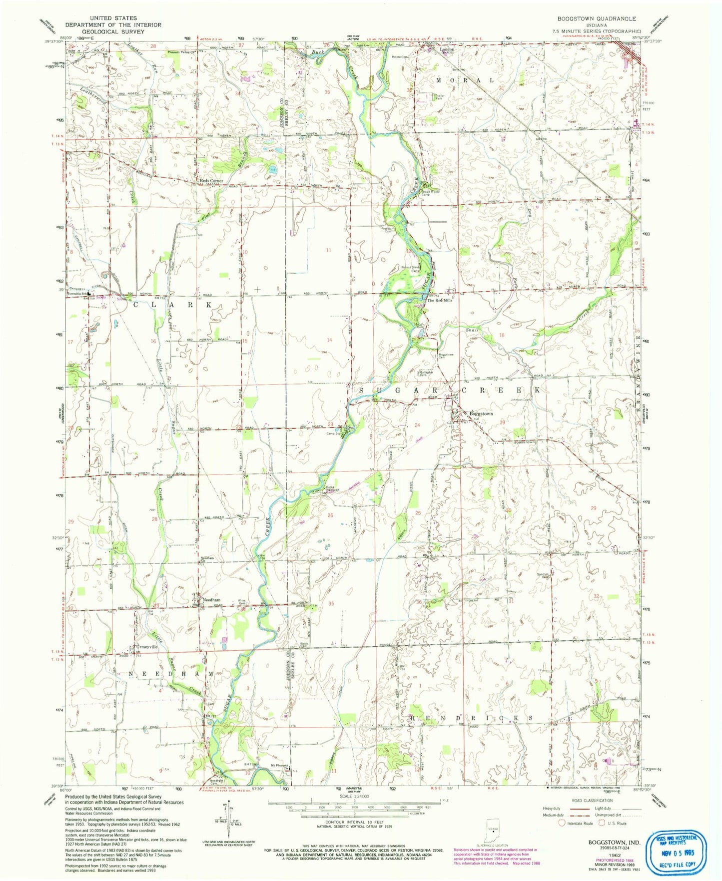
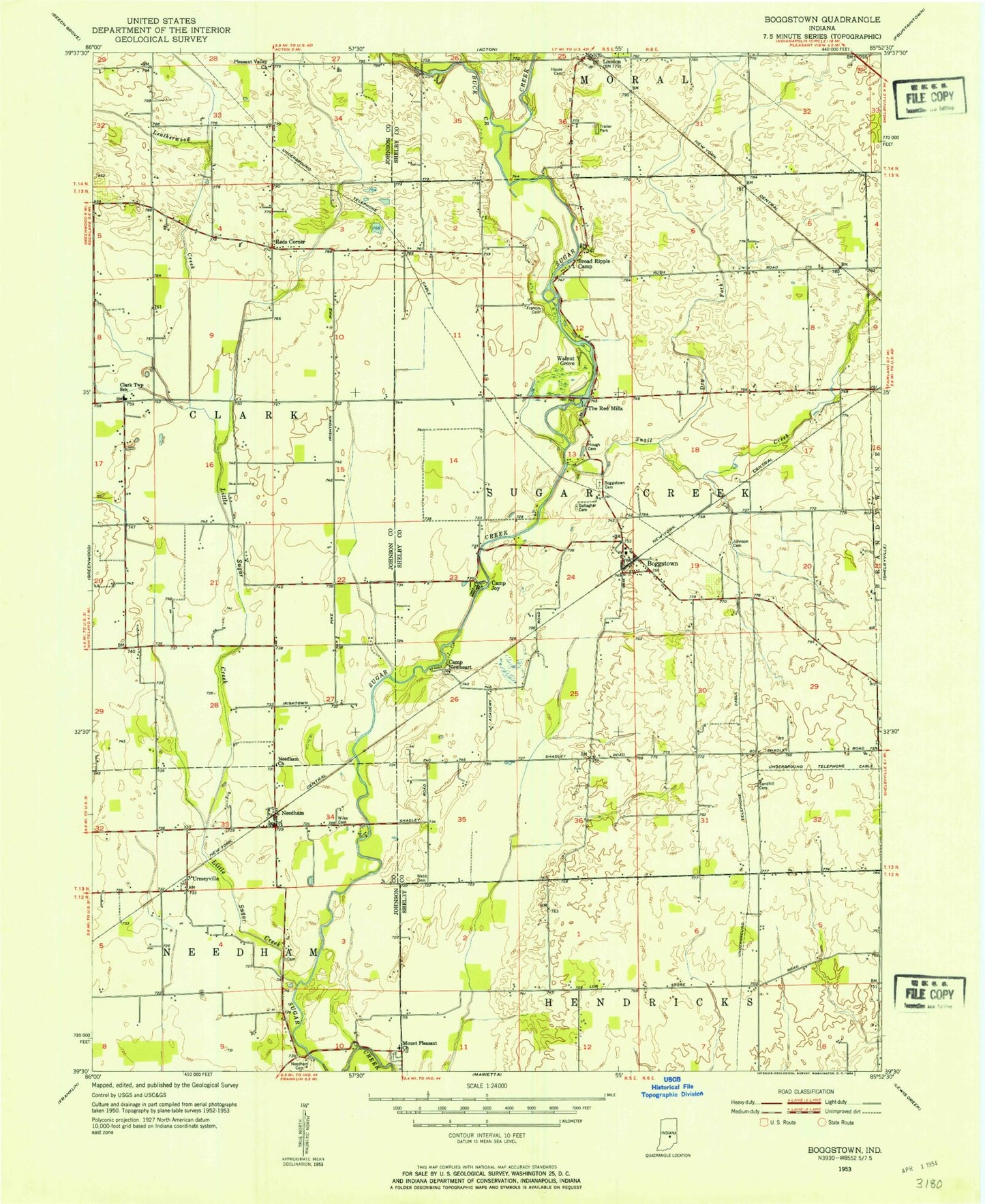
MyTopo
Classic USGS Boggstown Indiana 7.5'x7.5' Topo Map
Couldn't load pickup availability
Historical USGS topographic quad map of Boggstown in the state of Indiana. Map scale may vary for some years, but is generally around 1:24,000. Print size is approximately 24" x 27"
This quadrangle is in the following counties: Johnson, Shelby.
The map contains contour lines, roads, rivers, towns, and lakes. Printed on high-quality waterproof paper with UV fade-resistant inks, and shipped rolled.
Contains the following named places: Boggstown, Boggstown Cemetery, Broad Ripple Camp, Buck Creek, Camp Joy, Camp Newheart, Campbell Ditch, Cardinals Nest Airport, Cutsinger Ditch, Dry Fork, Fenns Post Office, Flat Branch, Francis Cemetery, Gallagher Cemetery, Gardner Airport, Gray Airport, Hough Cemetery, House Cemetery, Johnson Cemetery, Leather Run, Leatherwood Creek, Little Sugar Creek, Mount Pleasant Church, Needham, Needham Cemetery, Needham Church, Needham Community Volunteer Fire Department, Needham Community Volunteer Fire Department Station 82, Needham Volunteer Fire Department, Pleasant Valley Church, Ransdell Ditch, Reds Corner, Sandhill Cemetery, Snail Creek, The Red Mills, Township of Clark, Township of Sugar Creek, Urmeyville, Walnut Grove Camp, Webb Cemetery, West Little Sugar Creek, Wiles Cemetery, ZIP Codes: 46110, 46126, 46162