MyTopo
Classic USGS Boggy Draw Texas 7.5'x7.5' Topo Map
Regular price
$16.95
Regular price
Sale price
$16.95
Unit price
per
Couldn't load pickup availability
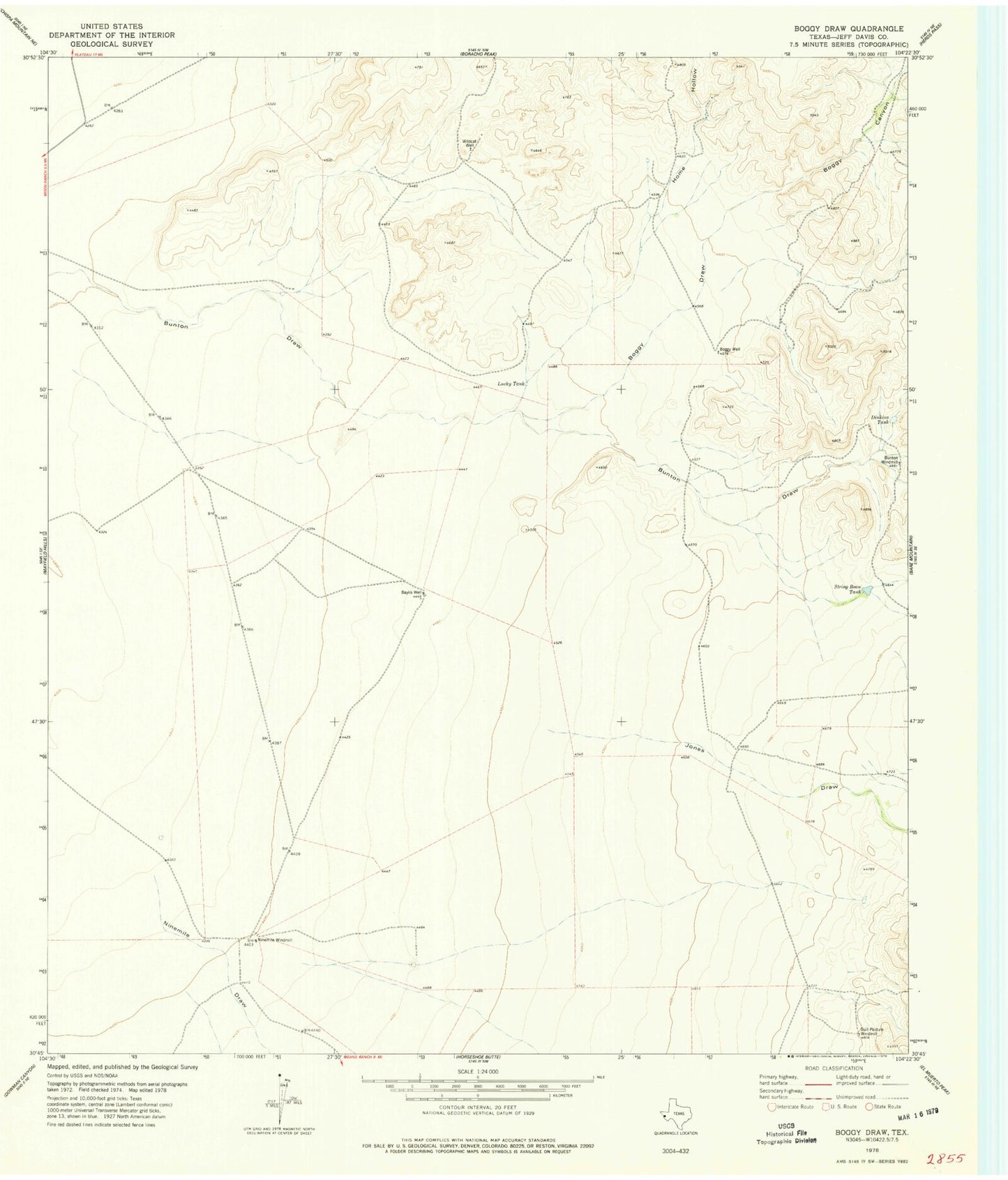
Historical USGS topographic quad map of Boggy Draw in the state of Texas. Map scale may vary for some years, but is generally around 1:24,000. Print size is approximately 24" x 27"
This quadrangle is in the following counties: Jeff Davis.
The map contains contour lines, roads, rivers, towns, and lakes. Printed on high-quality waterproof paper with UV fade-resistant inks, and shipped rolled.
Contains the following named places: Baylis Well, Boggy Canyon, Boggy Draw, Boggy Well, Bull Pasture Windmill, Bunton Windmill, Dinkins Tank, Home Hollow, Jones Draw, Lucky Tank, Ninemile Draw, Ninemile Windmill, String Bean Tank, Wildcat Well