MyTopo
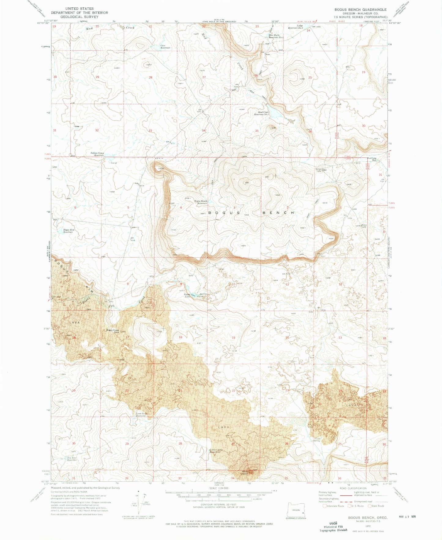
Classic USGS Bogus Bench Oregon 7.5'x7.5' Topo Map
Couldn't load pickup availability
Historical USGS topographic quad map of Bogus Bench in the state of Oregon. Map scale may vary for some years, but is generally around 1:24,000. Print size is approximately 24" x 27"
This quadrangle is in the following counties: Malheur.
The map contains contour lines, roads, rivers, towns, and lakes. Printed on high-quality waterproof paper with UV fade-resistant inks, and shipped rolled.
Contains the following named places: Bogus Bench, Bogus Bench Reservoir, Bogus Lake, Bogus Rim Reservoir, Cave Reservoir, Deer Butte Reservoir Number Two, Indian Camp Reservoir, Lava Sinks Reservoir, Little Crater Reservoir, Lodge Reservoir Number Two, Mud Creek Reservoir Number One, Mud Lake Well, Ten Year Reservoir, Venta Spring, West Crater