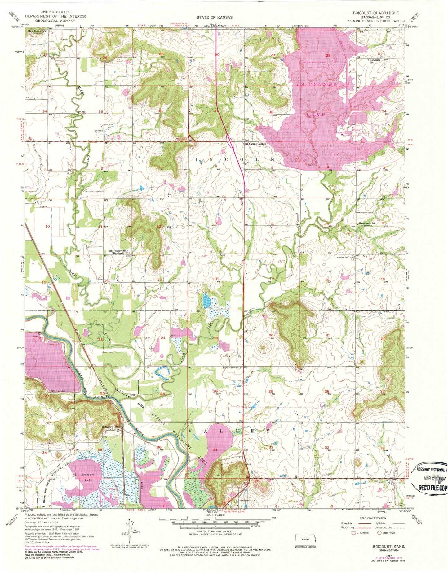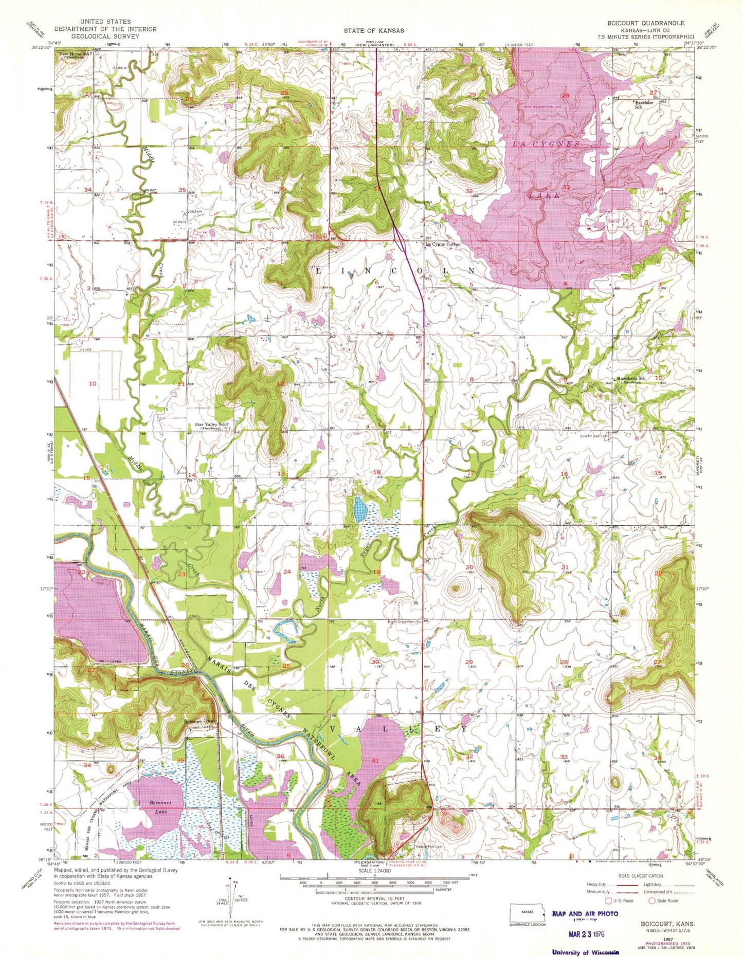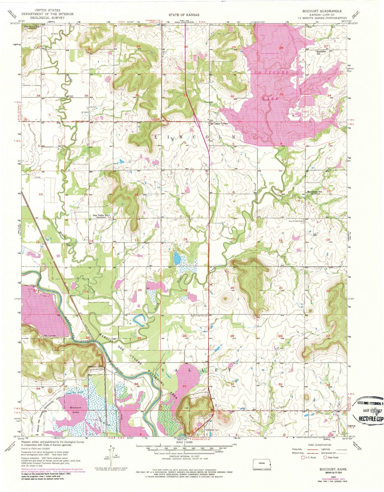

MyTopo
Classic USGS Boicourt Kansas 7.5'x7.5' Topo Map
Couldn't load pickup availability
Historical USGS topographic quad map of Boicourt in the state of Kansas. Map scale is 1:24000. Print size is approximately 24" x 27"
This quadrangle is in the following counties: Linn.
The map contains contour lines, roads, rivers, towns, and lakes. Printed on high-quality waterproof paper with UV fade-resistant inks, and shipped rolled.
Contains the following named places: Boicourt, Boicourt Lake, Deer Trace Golf Course, East Mount Zion Cemetery, Excelsior School (historical), La Cygne Corner, La Cygne Lake, La Cygne State Fishing Lake and Wildlife Area, Linn County Park Campground, Linn County Park Marina, Linn County Park Wastewater Treatment Plant, Linn County Rural Fire District 1 Station 950, Linn Valley Community Church, Linn Valley Police Department, Linn Valley Volunteer Fire Department Substation, Marais des Cygnes Waterfowl Area, Middle Creek, New Home School, Ninety Six Cemetery, North Sugar Creek, Orchard (historical), Star Valley School, Sway Back Cemetery, Township of Lincoln, Township of Valley, Trading Post Cemetery, Trading Post Museum