MyTopo
Classic USGS Boiling Springs South North Carolina 7.5'x7.5' Topo Map
Couldn't load pickup availability
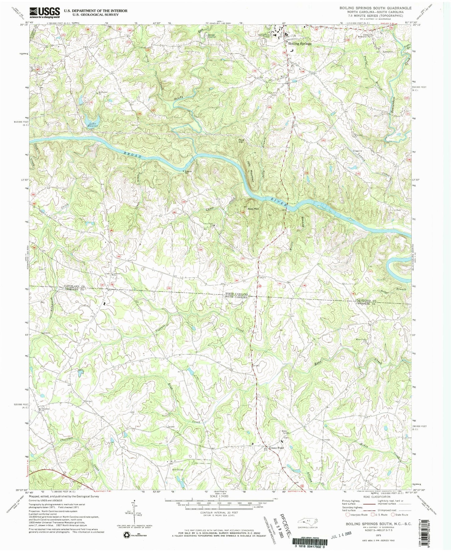
Historical USGS topographic quad map of Boiling Springs South in the states of North Carolina, South Carolina. Map scale may vary for some years, but is generally around 1:24,000. Print size is approximately 24" x 27"
This quadrangle is in the following counties: Cherokee, Cleveland, Rutherford.
The map contains contour lines, roads, rivers, towns, and lakes. Printed on high-quality waterproof paper with UV fade-resistant inks, and shipped rolled.
Contains the following named places: Abes Mountain, Asevorts School, Ashworth Creek, Assembly of God Church, Beulah Cemetery, Boiling Springs Baptist Church, Boiling Springs Baptist Church Cemetery, Boiling Springs Elementary School, Boiling Springs Rural Volunteer Fire Department Station 2, Boiling Springs Township 2, Byersville, Camp Creek, Camp Creek Baptist Church, Camps Creek Baptist Church Graveyard, Cherokee Baptist Church, Cherokee Creek Baptist Church Graveyard, Cherokee Creek Volunteer Fire Department, Christian Fellowship Cemetery, Cleveland County Emergency Medical Services Station 4, Cleveland Memorial Park, Crawley Memorial Hospital, Diller Branch, Ellis Cemetery, Flint Hill, Flint Hill Church, Flint Hill School, Freewill Church, Furnace Place Cemetery, Gaffney Airport, Gardner - Webb University, Goforth Cross Road, Grassy Pond, Grassy Pond Baptist Church, Grassy Pond School, Grassy Pond Volunteer Fire Department, Grog Creek, Holly Springs School, Houser Dam, Humphrey Gin, Huskins Cemetery, Island Creek School, Island Ford, Jolley Cemetery, Jolley Store, Jolly Branch, Jolly Cemetery, Jolly Mountain, Jones Branch, Jones Ferry, Lake Houser, Lavonia Baptist Church, Lavonia Cemetery, Maud, McCraw Cemetery, McGraw Store, Mike Creek School, Mikes Creek Baptist Church, Mikes Creek Baptist Church Graveyard, Mount Joy Church, Mount Pleasant Baptist Church, Mount Pleasant Fishing Lake, Mount Pleasant Fishing Lake Dam, New Pleasant School, Nicholsville, Palmer School, Poplar Branch, River Township 1, Robbs Cemetery, Robbs School, Ruppe Cemetery, Sandpit Cemetery, Sandy Run, Sarratt Cemetery, Sarratt Creek, Simmons Ford, Suck Creek, Sugar Branch, Willis Branch, Wood Cemetery, ZIP Codes: 28017, 28114