MyTopo
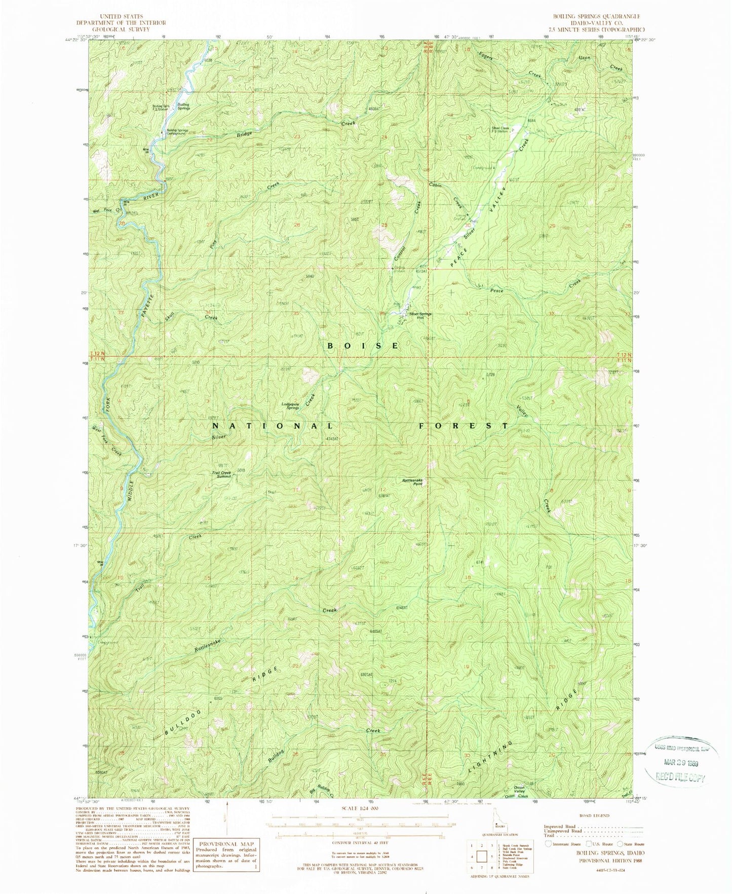
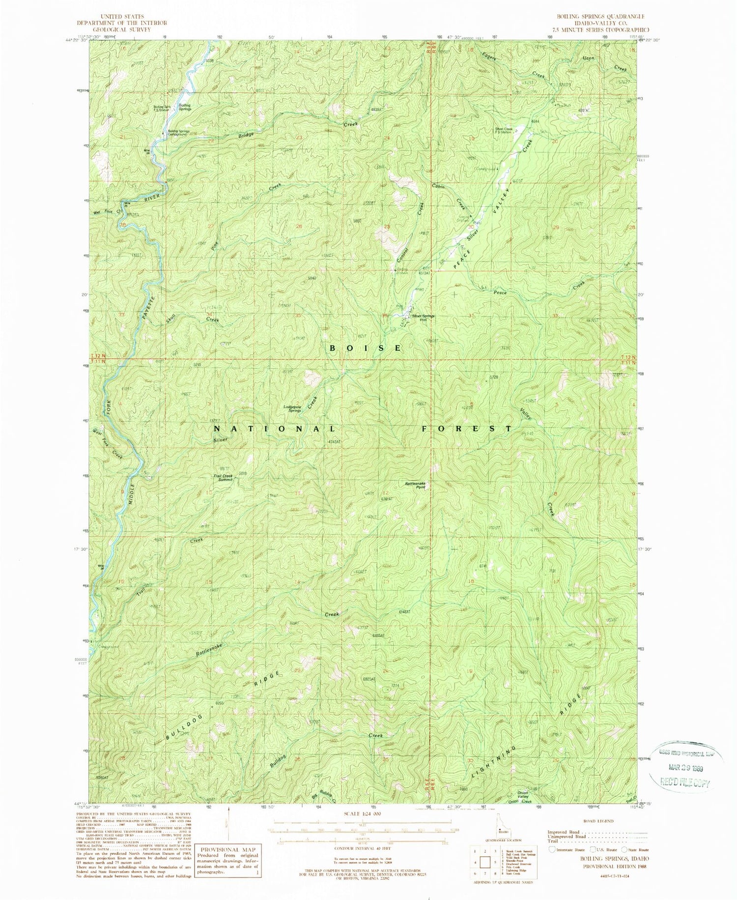
Classic USGS Boiling Springs Idaho 7.5'x7.5' Topo Map
Couldn't load pickup availability
Historical USGS topographic quad map of Boiling Springs in the state of Idaho. Map scale may vary for some years, but is generally around 1:24,000. Print size is approximately 24" x 27"
This quadrangle is in the following counties: Valley.
The map contains contour lines, roads, rivers, towns, and lakes. Printed on high-quality waterproof paper with UV fade-resistant inks, and shipped rolled.
Contains the following named places: Boiling Springs, Boiling Springs Campground, Boiling Springs Driveway, Boiling Springs Work Center, Bridge Creek, Bulldog Ridge, Cabin Creek, Control Creek, Eggers Creek, Lightning Ridge, Lodgepole Springs, Peace Creek, Peace Valley, Pine Creek, Rattlesnake Point, Rattlesnake Trail, Silver Creek, Silver Creek Campground, Silver Creek Plunge, Silver Creek Work Center, Siver Springs, Sixmile Project Camp, Skull Creek, Trail Creek Campground, Trail Creek Summit, Ucon Creek, Valley Creek, West Fork Creek, Wet Foot Creek