MyTopo
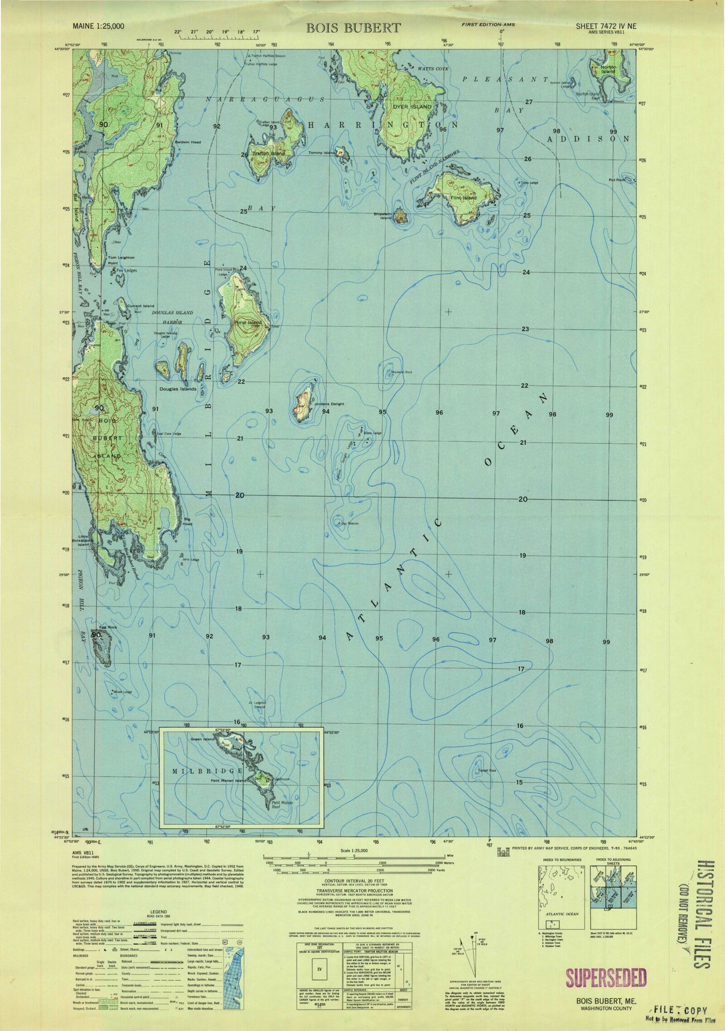
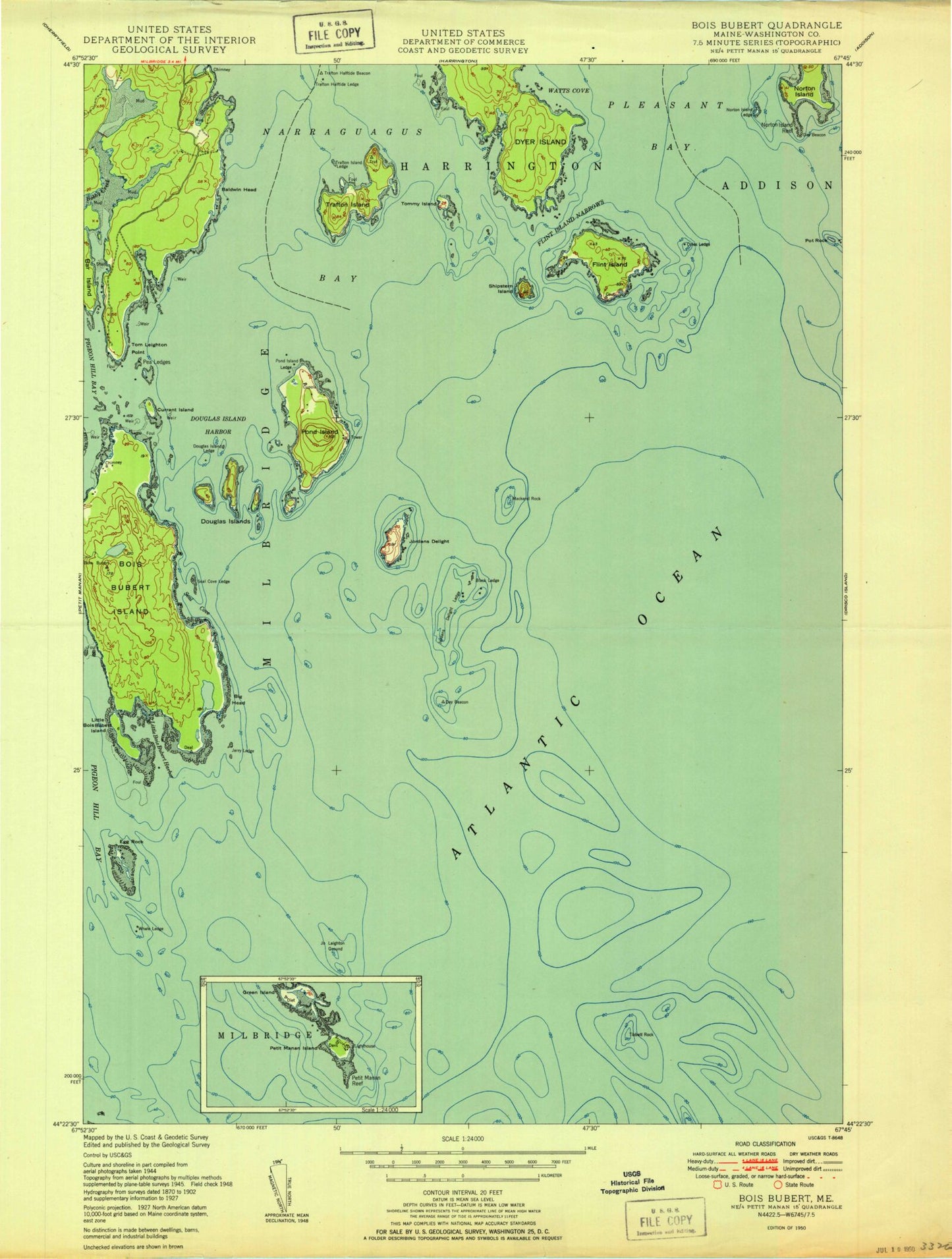
Classic USGS Bois Bubert Maine 7.5'x7.5' Topo Map
Couldn't load pickup availability
Historical USGS topographic quad map of Bois Bubert in the state of Maine. Map scale may vary for some years, but is generally around 1:24,000. Print size is approximately 24" x 27"
This quadrangle is in the following counties: Washington.
The map contains contour lines, roads, rivers, towns, and lakes. Printed on high-quality waterproof paper with UV fade-resistant inks, and shipped rolled.
Contains the following named places: Baldwin Head, Bar Ledge, Big Head, Black Ledge, Bois Bubert Island, Coles Ledge, Currant Island, Douglas Island Harbor, Douglas Island Ledge, Douglas Islands, Dyer Island, Egg Rock, Flint Island, Flint Island Narrows, Jerry Ledge, Jo Leighton Ground, Jordans Delight, Jordans Delight Ledge, Little Bois Bubert Harbor, Little Bois Bubert Island, Lower Middle Ground, Mackerel Rock, Monhonan Cove, Narraguagus Light Station, Norton Island, Norton Island Ledge, Norton Island Reef, Pea Ledges, Pond Island, Pond Island Ledge, Pot Rock, Seal Cove, Seal Cove Ledge, Shipstern Island, Southwest Cove, Stover Cove, Tibbett Rock, Tom Leighton Point, Tommy Island, Town of Milbridge, Trafton Halftide Beacon, Trafton Halftide Ledge, Trafton Island, Trafton Island Ledge, Watts Cove, Western Reef, Whale Ledge