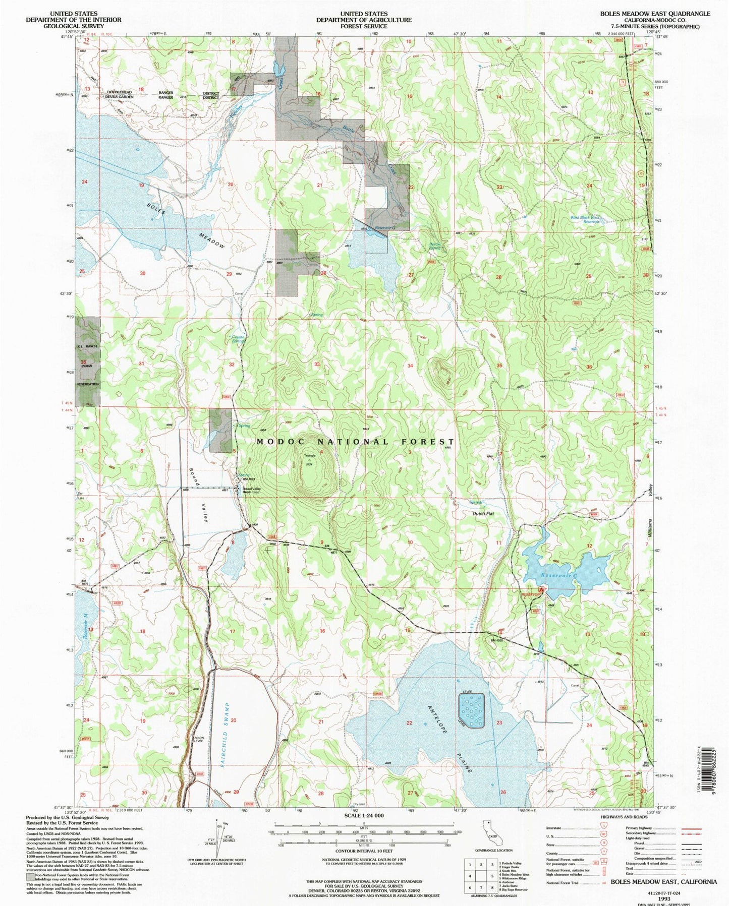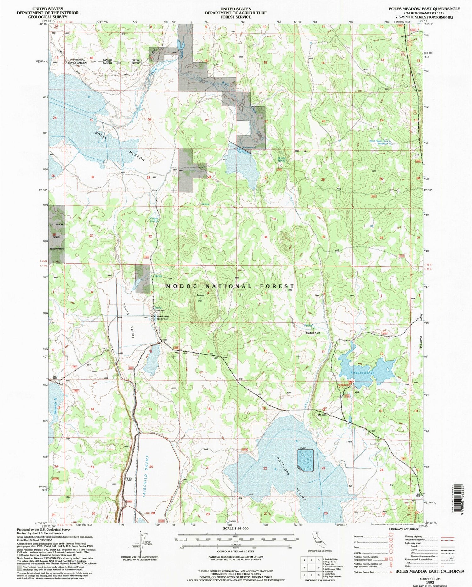
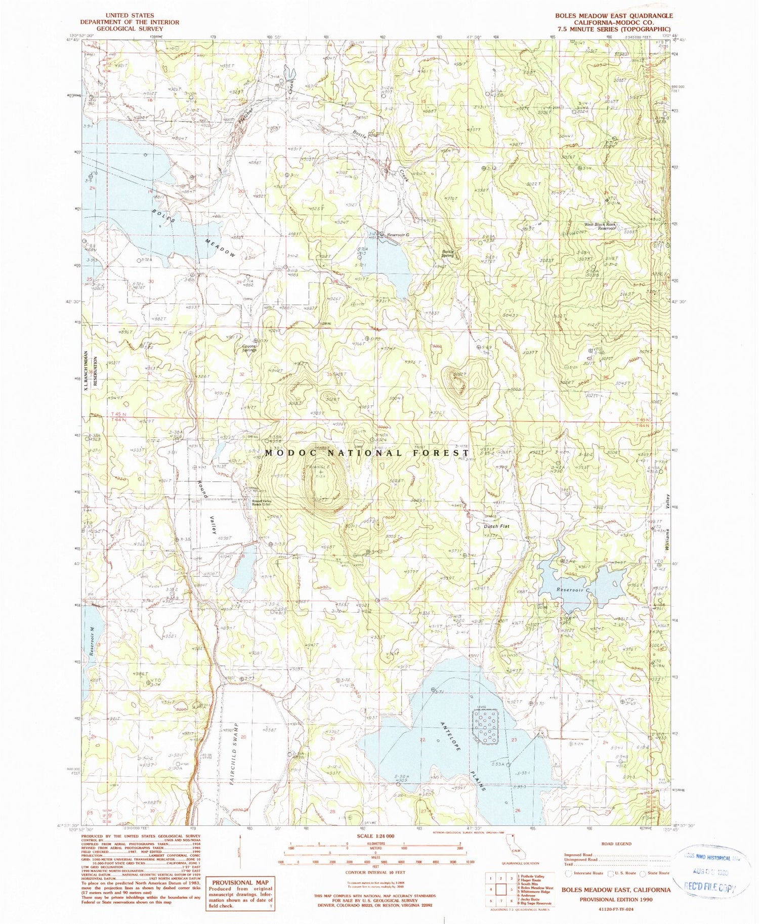
MyTopo
Classic USGS Boles Meadow East California 7.5'x7.5' Topo Map
Regular price
$16.95
Regular price
Sale price
$16.95
Unit price
per
Couldn't load pickup availability
Historical USGS topographic quad map of Boles Meadow East in the state of California. Map scale may vary for some years, but is generally around 1:24,000. Print size is approximately 24" x 27"
This quadrangle is in the following counties: Modoc.
The map contains contour lines, roads, rivers, towns, and lakes. Printed on high-quality waterproof paper with UV fade-resistant inks, and shipped rolled.
Contains the following named places: Antelope Plains, Bottle Creek, Bottle Spring, Coyote Springs, Dutch Flat, Fletcher Creek, Reservoir C, Reservoir C Campground, Reservoir G, Round Valley, Round Valley Ranch, Triangle Headquarters, Ulbright, West Black Rock Reservoir