MyTopo
Classic USGS Boles Arkansas 7.5'x7.5' Topo Map
Couldn't load pickup availability
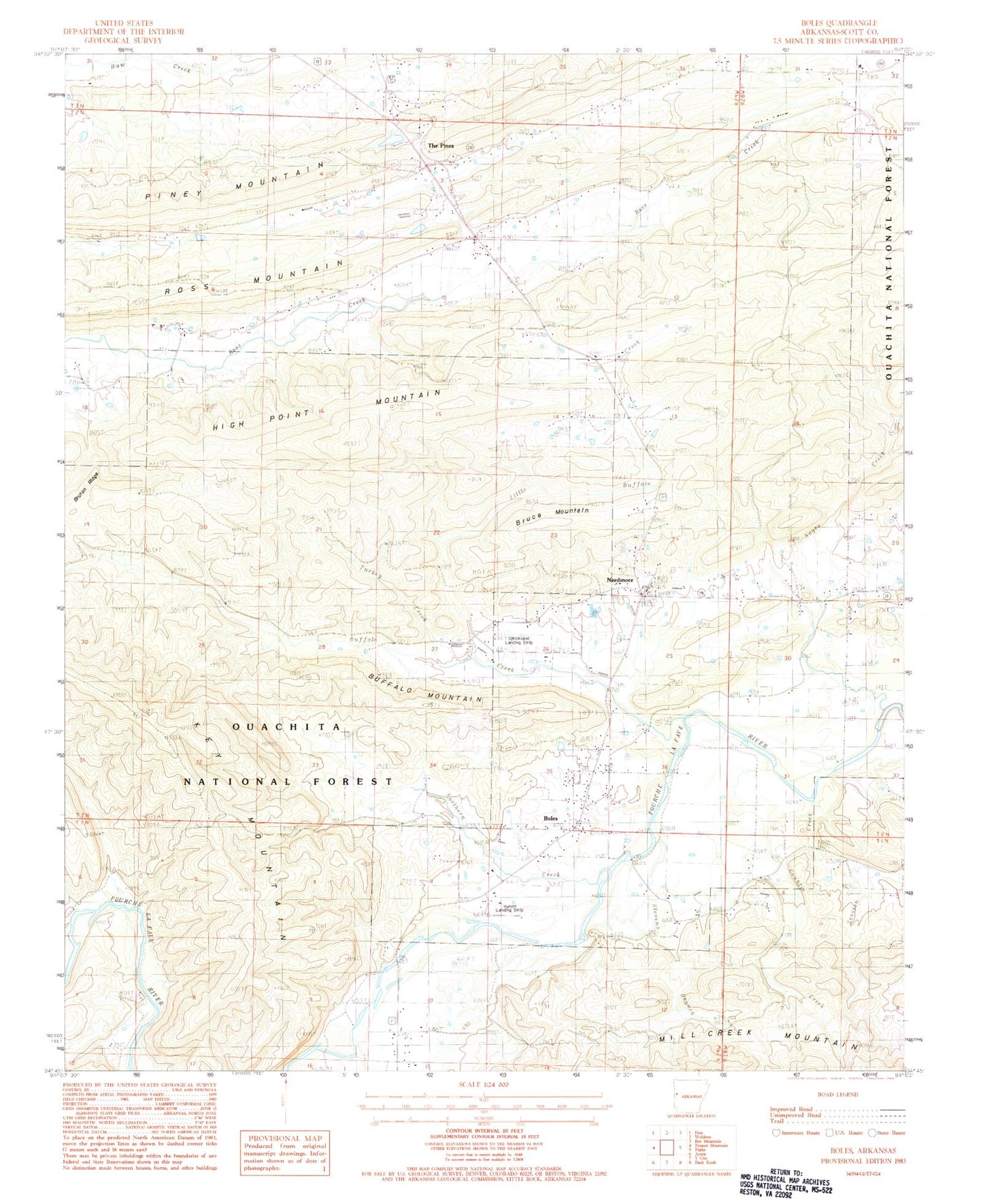
Historical USGS topographic quad map of Boles in the state of Arkansas. Map scale may vary for some years, but is generally around 1:24,000. Print size is approximately 24" x 27"
This quadrangle is in the following counties: Scott.
The map contains contour lines, roads, rivers, towns, and lakes. Printed on high-quality waterproof paper with UV fade-resistant inks, and shipped rolled.
Contains the following named places: Boles, Boles Census Designated Place, Boles Freewill Baptist Church, Boles Post Office, Boles School, Boles Volunteer Fire Department, Bruce Mountain, Buffalo, Buffalo Bridge, Buffalo Cemetery, Buffalo Creek, Buffalo Mountain, Buffalo School, Bush School, Countis Creek, Countiss Grave Yard, High Point Mountain, Jenkins School, Keener, Key Mountain, KRWA-FM (Waldron), Lamb School, Little Buffalo Creek, Long View Church, Mill Creek, Needmore, Needmore Assembly of God Church, Needmore Cemetery, Negro Creek, Northern Creek, Piney Mountain, Ratliff and Sons Ranch Airport, Scott County, Session Creek, Stevens Branch, Strickland Landing Strip, The Pines, Township of Mountain, Truman Baker Lake, Truman Baker Lake Dam, Turkey Creek