MyTopo
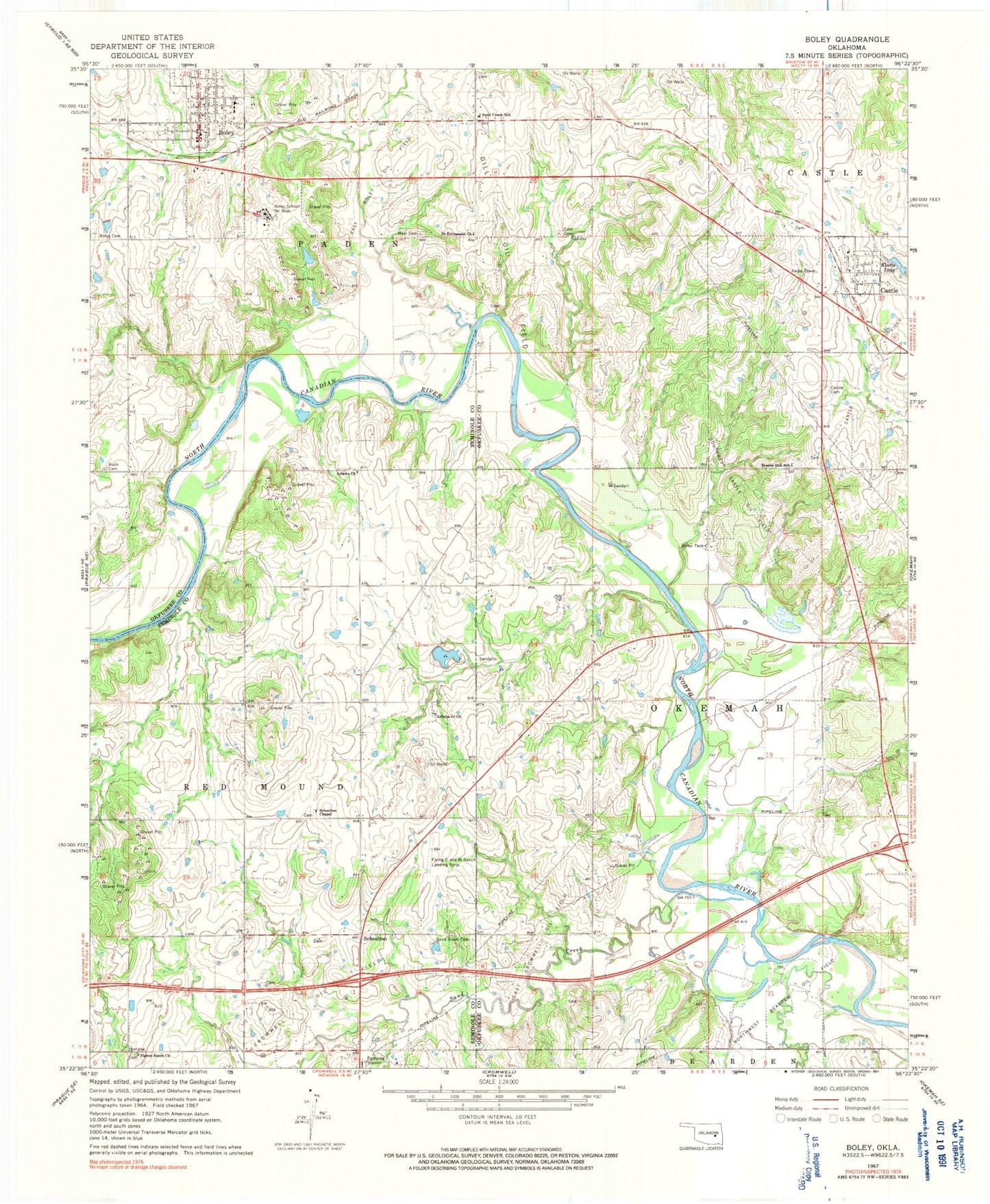
Classic USGS Boley Oklahoma 7.5'x7.5' Topo Map
Couldn't load pickup availability
Historical USGS topographic quad map of Boley in the state of Oklahoma. Map scale may vary for some years, but is generally around 1:24,000. Print size is approximately 24" x 27"
This quadrangle is in the following counties: Okfuskee, Seminole.
The map contains contour lines, roads, rivers, towns, and lakes. Printed on high-quality waterproof paper with UV fade-resistant inks, and shipped rolled.
Contains the following named places: Arbeka Church, Arbeka Junior Church, Boley, Boley Cemetery, Boley Elementary School, Boley Fire Department, Boley High School, Boley Historic District, Boley Post Office, Boley School for Boys, Castle, Castle Cemetery, Castle Oil Field, Castle Post Office, Dill Oil Field, East Boley Oil Field, East Cromwell Oil Field, East Saint Emmanuel Church Cemetery, Eastlawn Cemetery, John H Lilley Correctional Center, Klutts Lake, Klutts Lake Dam, Northwest Bearden Oil Field, Oknoname 107003 Dam, Oknoname 107003 Reservoir, Oknoname 107004 Dam, Oknoname 107004 Reservoir, Oknoname 107006 Dam, Oknoname 107006 Reservoir, Pigeon Roost Church, Prairie Dell School, Rusk Cemetery, Saint Emmanuel Baptist Church, Sand Creek, Sand Creek Cemetery, Sand Creek School, Schoolton, Schoolton Cemetery, Schoolton Chapel, Southwest Castle Oil Field, Town of Boley, Town of Castle, West Cemetery