
MyTopo
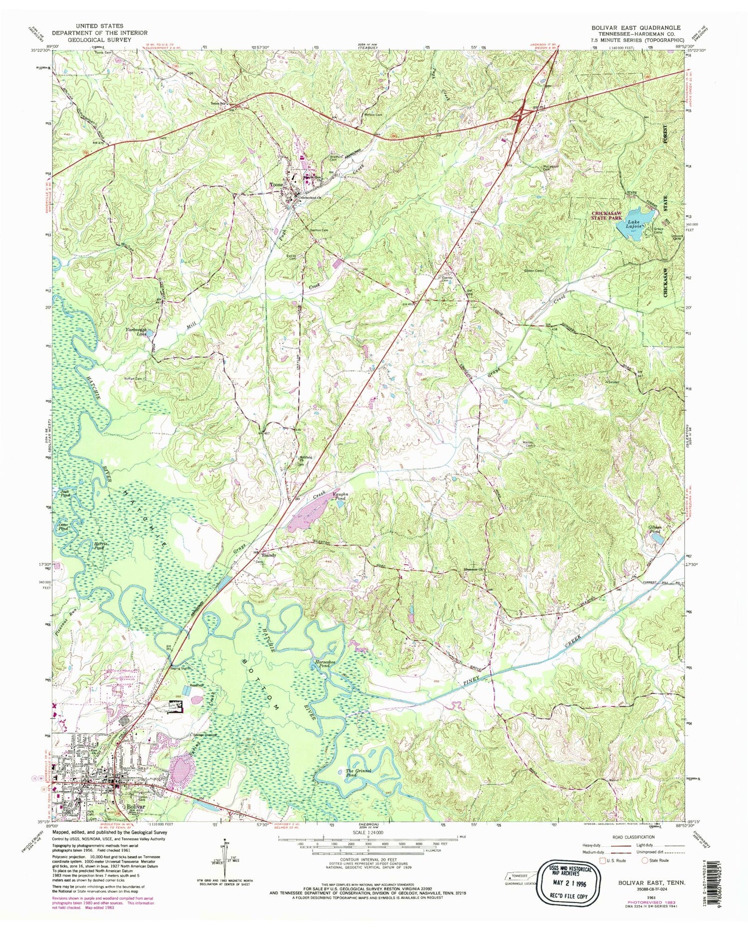
Classic USGS Bolivar East Tennessee 7.5'x7.5' Topo Map
Couldn't load pickup availability
Historical USGS topographic quad map of Bolivar East in the state of Tennessee. Map scale may vary for some years, but is generally around 1:24,000. Print size is approximately 24" x 27"
This quadrangle is in the following counties: Hardeman.
The map contains contour lines, roads, rivers, towns, and lakes. Printed on high-quality waterproof paper with UV fade-resistant inks, and shipped rolled.
Contains the following named places: Beaver Pond, Bills-McNeal Historic District, Bolivar, Bolivar City Hall, Bolivar Courthouse Square Historic District, Bolivar Fire Department, Bolivar First Baptist Church, Bolivar General Hospital, Bolivar Industrial School, Bolivar Methodist Church, Bolivar Police Department, Bolivar Post Office, Bradford Cemetery, Cearley Cemetery, Commissioner District 7, Concord Cemetery, Cumberland Church, Ebenezer Church, Gibson Cemetery, Gibson Pond, Grays Creek, Hardeman County Ambulance Service, Hardeman county Courthouse, Hardeman County Jail, Hardeman County Library, Hardeman County Sheriff's Office, Harris Pond, Hillfield Church, Horseshoe Pond, Jack Pond, Lake Lajoice, Lake Lajoie Dam, McLendon Cemetery, Mill Creek, Mount Zion Church, North Main Street Historic District, Otter Pond, Overton Cemetery, Piney Creek, Pleasant Run, Polk Cemetery, Pugh Creek, Ruffian Cemetery, Saint James Episcopal Church, Saint Pauls Christian Methodist Episcopal Church, Shandy, Shandy Baptist Church, Spring Creek, Springfield Baptist Church, The Grinnel Pond, Toone, Toone Division, Toone Elementary School, Toone Post Office, Toone School, Toone Volunteer Fire Department, Town of Toone, Union Cemetery, Vaughn Pond, Walton Cemetery, Watson Cemetery, WBOL-AM (Bolivar), WVST-FM (Bolivar), Yarbrough Lake, Zion Church, ZIP Code: 38381


