MyTopo
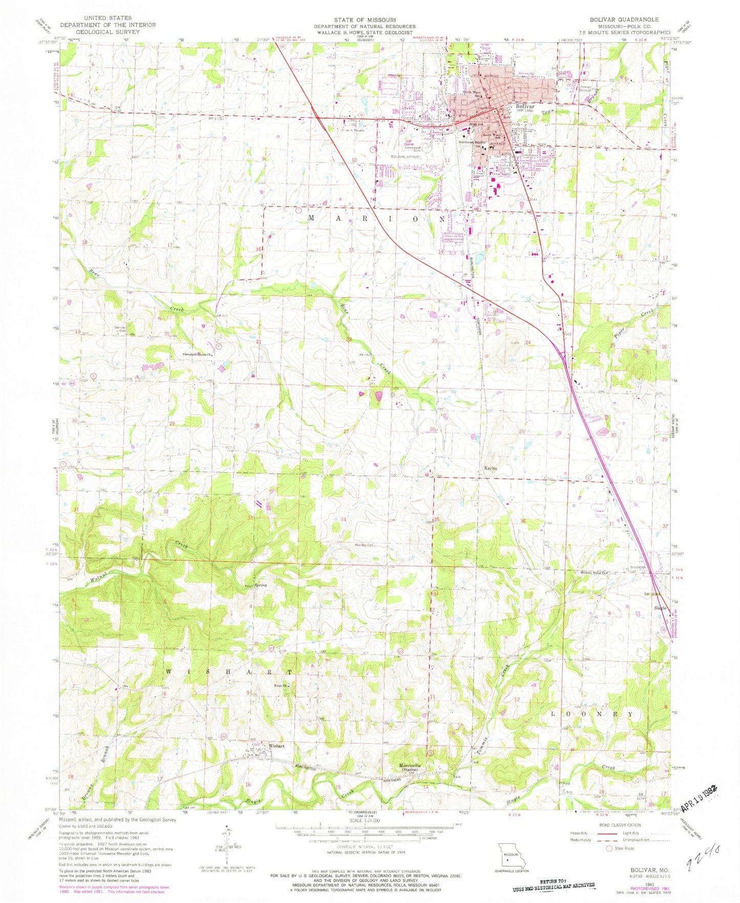
Classic USGS Bolivar Missouri 7.5'x7.5' Topo Map
Couldn't load pickup availability
Historical USGS topographic quad map of Bolivar in the state of Missouri. Map scale may vary for some years, but is generally around 1:24,000. Print size is approximately 24" x 27"
This quadrangle is in the following counties: Polk.
The map contains contour lines, roads, rivers, towns, and lakes. Printed on high-quality waterproof paper with UV fade-resistant inks, and shipped rolled.
Contains the following named places: Bolivar, Bolivar Fire Department Station 1, Bolivar Fire Department Station 2, Bolivar Memorial Airport, Bolivar Police Department, Bolivar Post Office, Campbell Grove Church, Central Polk County Fire and Rescue, Cherokee Airpark, City Cemetery, City of Bolivar, Collins School, Department of Conservation Southwest Field Fire Facility Bolivar, Elm Grove School, Enon Church, Forest Grove School, Greenwood Cemetery, Hensley Cemetery, Hickory Point Church, Hickory Point School, Independence School, Karlin, KYOO-FM (Bolivar), Morrisville, Morrisville Fire and Rescue Station 3, North Ward School, Oak Grove School, Pleasant Vale School, Polk County, Polk County Sheriff's Office, Runyan School, Slagle, South Ward School, Southwest Baptist University, Spencer Cemetery, Tommie Creek, Township of Southwest Marion, Township of Wishart, Wishart