MyTopo
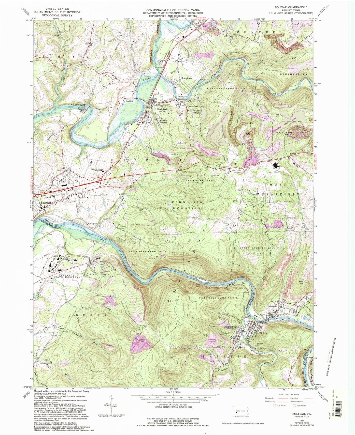
Classic USGS Bolivar Pennsylvania 7.5'x7.5' Topo Map
Couldn't load pickup availability
Historical USGS topographic quad map of Bolivar in the state of Pennsylvania. Map scale is 1:24000. Print size is approximately 24" x 27"
This quadrangle is in the following counties: Indiana, Westmoreland.
The map contains contour lines, roads, rivers, towns, and lakes. Printed on high-quality waterproof paper with UV fade-resistant inks, and shipped rolled.
Contains the following named places: Bear Rocks, Black Lick, Black Lick Census Designated Place, Black Lick Post Office, Black Lick Volunteer Fire Department Station 140, Blairsville Joint High School, Bolivar, Bolivar Post Office, Bolivar Volunteer Fire Company, Borough of Bolivar, Campbells Mill, Chestnut Ridge Golf Course, Conemaugh Water Gap, Coral, Coral Lutheran Cemetery, Coral Post Office, Dixon Row, Dixon School, Edwards Dam, Edwards Pond, Evergreen Landfill, Fairfield Heights, Fort Hill, Freeman Run, Graceton Dam, Gracetown Reservoir, Grafton, Grays, Jericho School, Josephine, Laurel Run, Mahan School, Marshall Heights, Maxwell School, McCrea Row, Mount Tabor Cemetery, Mount Tabor Church, Muddy Run, Old Pennsylvania Canal, Packsaddle, Palmertown, Penn View Lookout Tower, Penn View Mountain, Pine Ridge County Park, Reisinger School (historical), Richards Run, Ridge School, Roaring Run, Robinson, Robinson Census Designated Place, Robinson Post Office, Smith, State Game Lands Number 153, State Game Lands Number 276, Strangford, Tannery Hollow, Toms Run, Torrance, Torrance Post Office, Torrance Post Office (historical), Torrance State Hospital, Township of Burrell, Tubmill Creek, Two Lick Creek, Weirs Run, West Bolivar, West View Cemetery