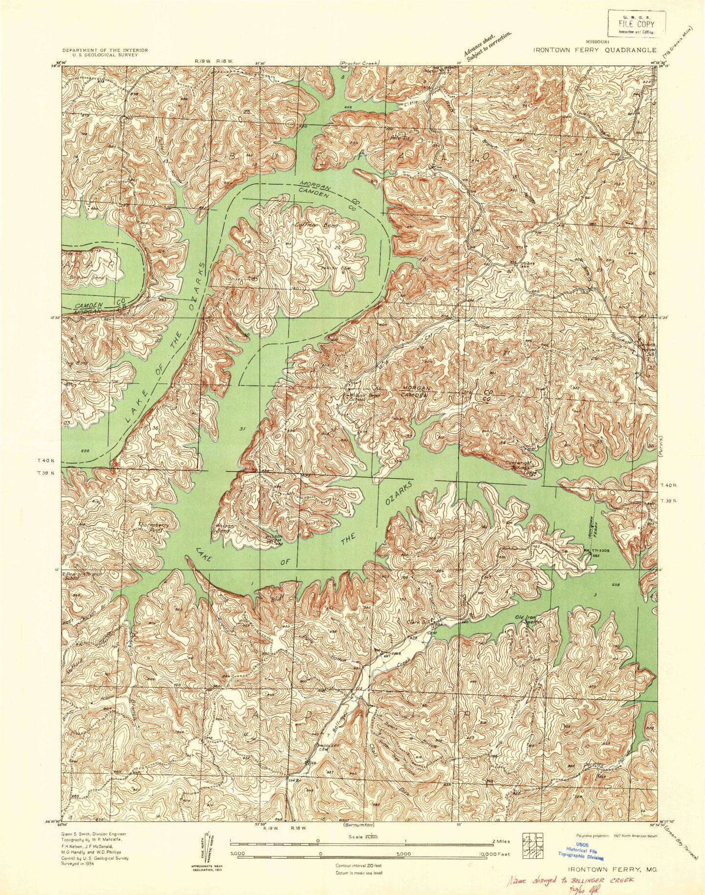
MyTopo
Classic USGS Bollinger Creek Missouri 7.5'x7.5' Topo Map
Couldn't load pickup availability
Historical USGS topographic quad map of Bollinger Creek in the state of Missouri. Map scale may vary for some years, but is generally around 1:24,000. Print size is approximately 24" x 27"
This quadrangle is in the following counties: Camden, Morgan.
The map contains contour lines, roads, rivers, towns, and lakes. Printed on high-quality waterproof paper with UV fade-resistant inks, and shipped rolled.
Contains the following named places: Apache Point, Bishop Hollow, Bollinger Creek, Brown Bend, Bunns Hollow, Camp Horn, Carver, Carver Cemetery, Chalk Hollow, Christian Church of the Ozarks, Clarks School, Coffman Bend, Coffman Bend Fire Department Association Station 2, Coffman Bend Fire Protection Association Station 1 Headquarters, Corum, Dodds, Duffer Hollow, Gravois Fire Protection District Station 3, Ivy Bend, Ivy Bend Airport, Ivy Bend Fire Department Station 2, Ivy Bend Mission, Jenkins School, King Bluff, Lake of the Ozarks, Little Niangua Arm, Little Proctor Creek, Mefford Hollow, Mose Clark Cemetery, Northwest Fire Protection District Station 2, Northwest Fire Protection District Station 4, Osage Iron Works, Parish Cemetery, Parmley Hollow, Pearson Branch, Pearson Branch School, Polly Hollow, Prairie Hollow, Shop Hollow, Sugar Tree Hollow, Thornsberry Point, Township of Adair, Wells Branch Hollow, West Pearson Branch, Wildcat Hollow, Wilson Bend, Wilson Bend School, Wilson Cemetery, Woolery Cemetery