MyTopo
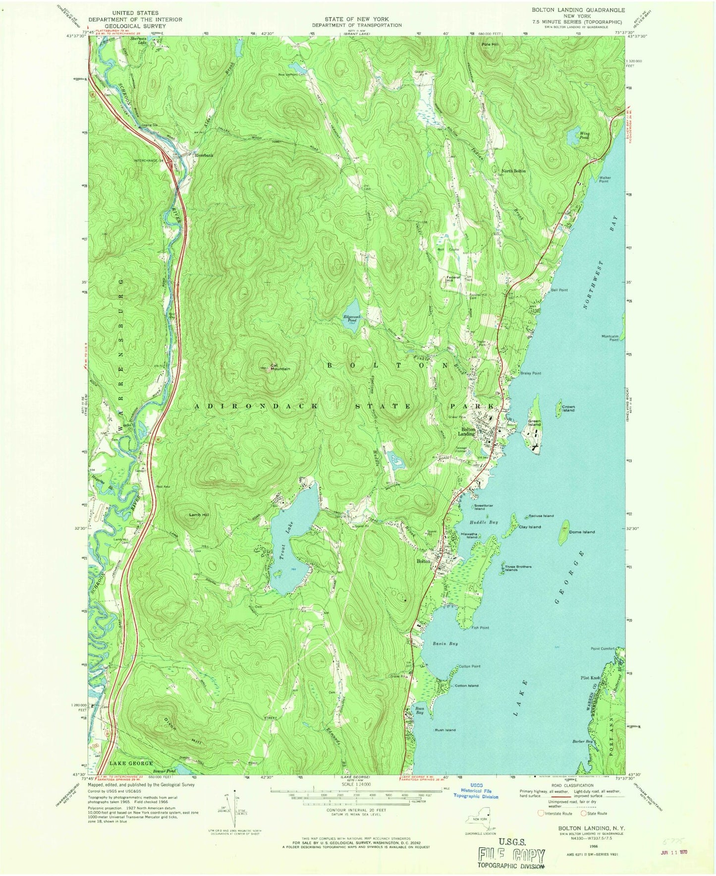
Classic USGS Bolton Landing New York 7.5'x7.5' Topo Map
Couldn't load pickup availability
Historical USGS topographic quad map of Bolton Landing in the state of New York. Typical map scale is 1:24,000, but may vary for certain years, if available. Print size: 24" x 27"
This quadrangle is in the following counties: Warren, Washington.
The map contains contour lines, roads, rivers, towns, and lakes. Printed on high-quality waterproof paper with UV fade-resistant inks, and shipped rolled.
Contains the following named places: Alder Brook, Barber Bay, Basin Bay, Bell Point, Bolton, Bolton Landing, Boon Bay, Braley Point, Butternut Brook, Cat Mountain, Clay Island, Cotton Island, Cotton Point, Crown Island, Dixon Hill, Dome Island, Edgecomb Pond, Federal Hill, Federal Hill Cemetery, Finkle Brook, Fish Point, Green Island, Hiawatha Island, Huddle Bay, Huddle Brook, Huggins Brook, Indian Brook, Lamb Hill, Lamb Hill Cemetery, Montcalm Point, New Vermont Cemetery, Pilot Knob, Point Comfort, Pole Hill, Recluse Island, Rush Island, Sweetbriar Island, Three Brothers Islands, Trout Lake, Walker Point, Wing Pond, North Bolton, Riverbank, Town of Bolton, Beswick Cemetery, Bolton Rural Cemetery, Herrick Cemetery, Alms House Cemetery, Bolton Central School, Adirondack Adventure Resort, Lake George Schroon Valley Resort, The Sagamore Resort and Golf Club, Bolton Free Library, Bolton Historical Museum, Bolton Landing Census Designated Place, Pilot Knob Volunteer Fire Company, Bolton Landing Volunteer Fire Company, Bolton Landing Volunteer Fire Company Station 2, Bolton Landing Post Office, Town of Bolton Police Department