MyTopo
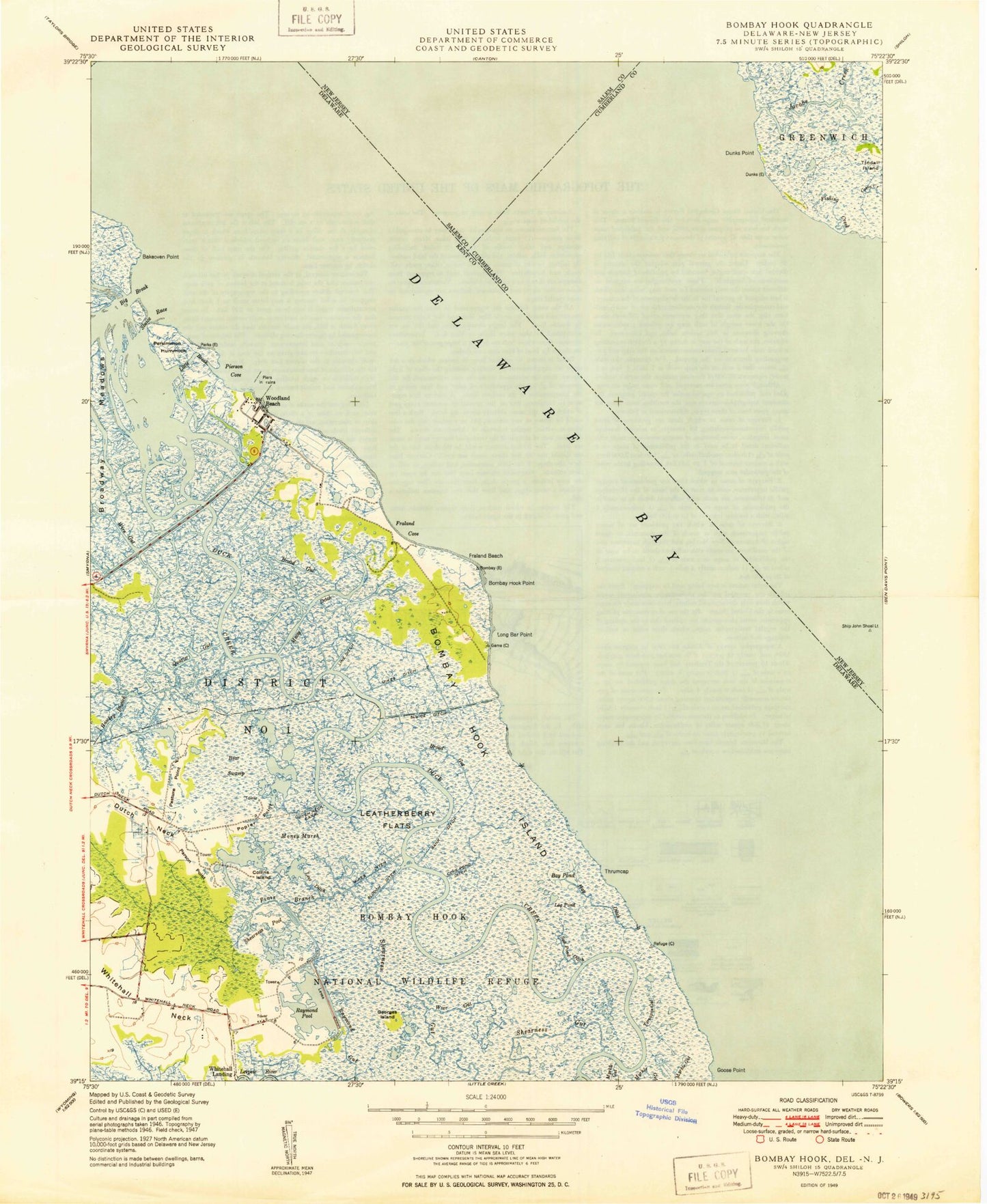
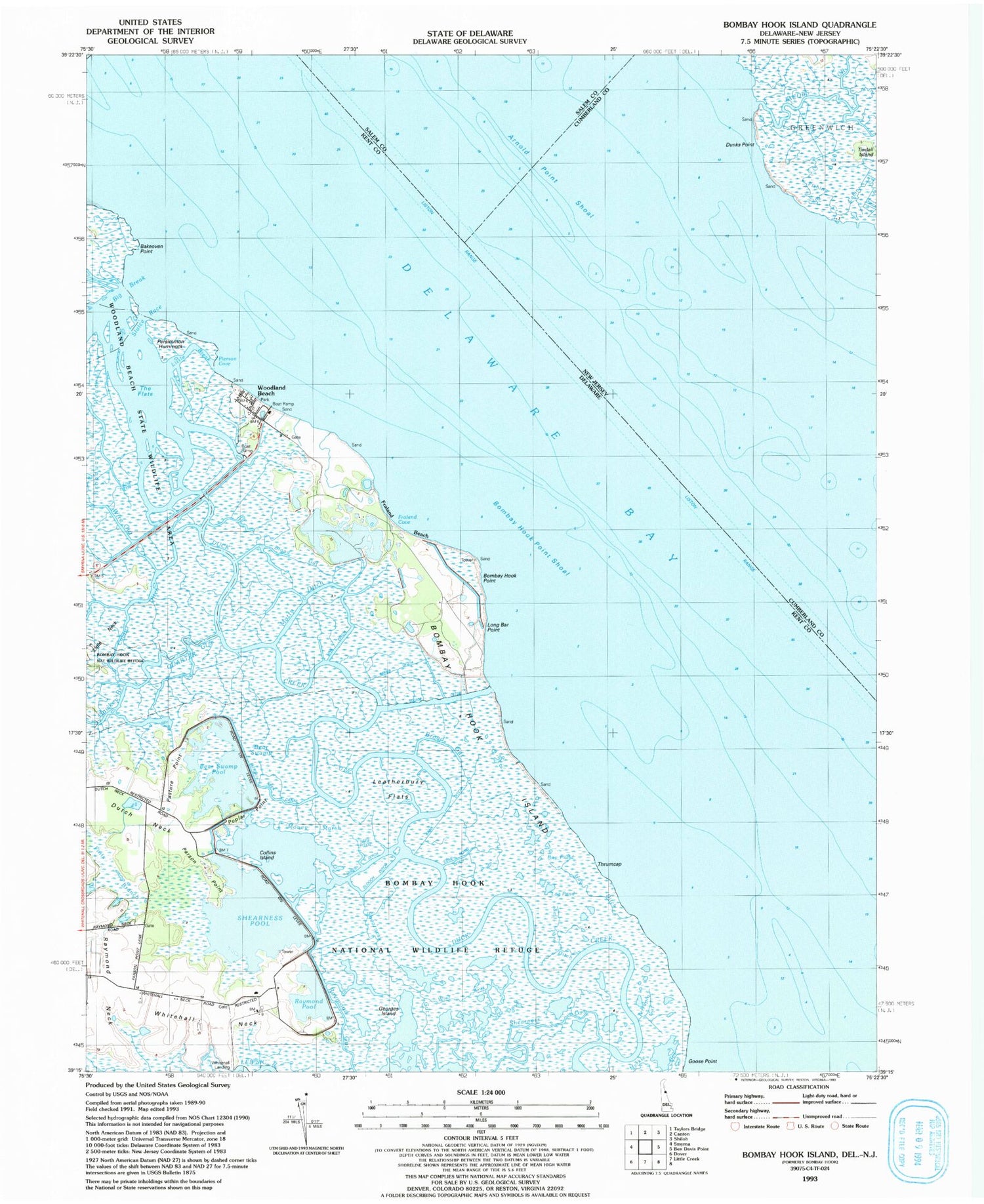
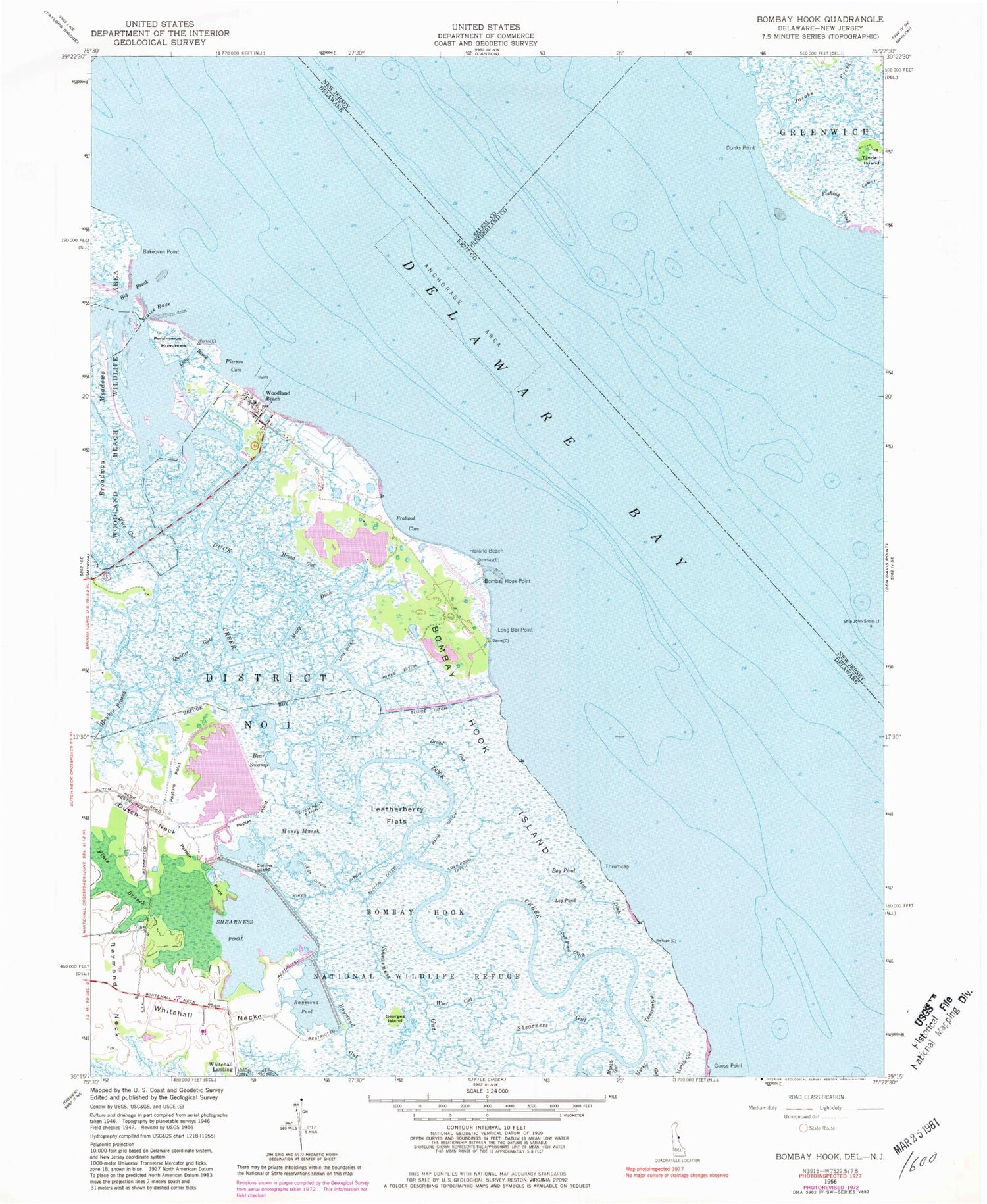
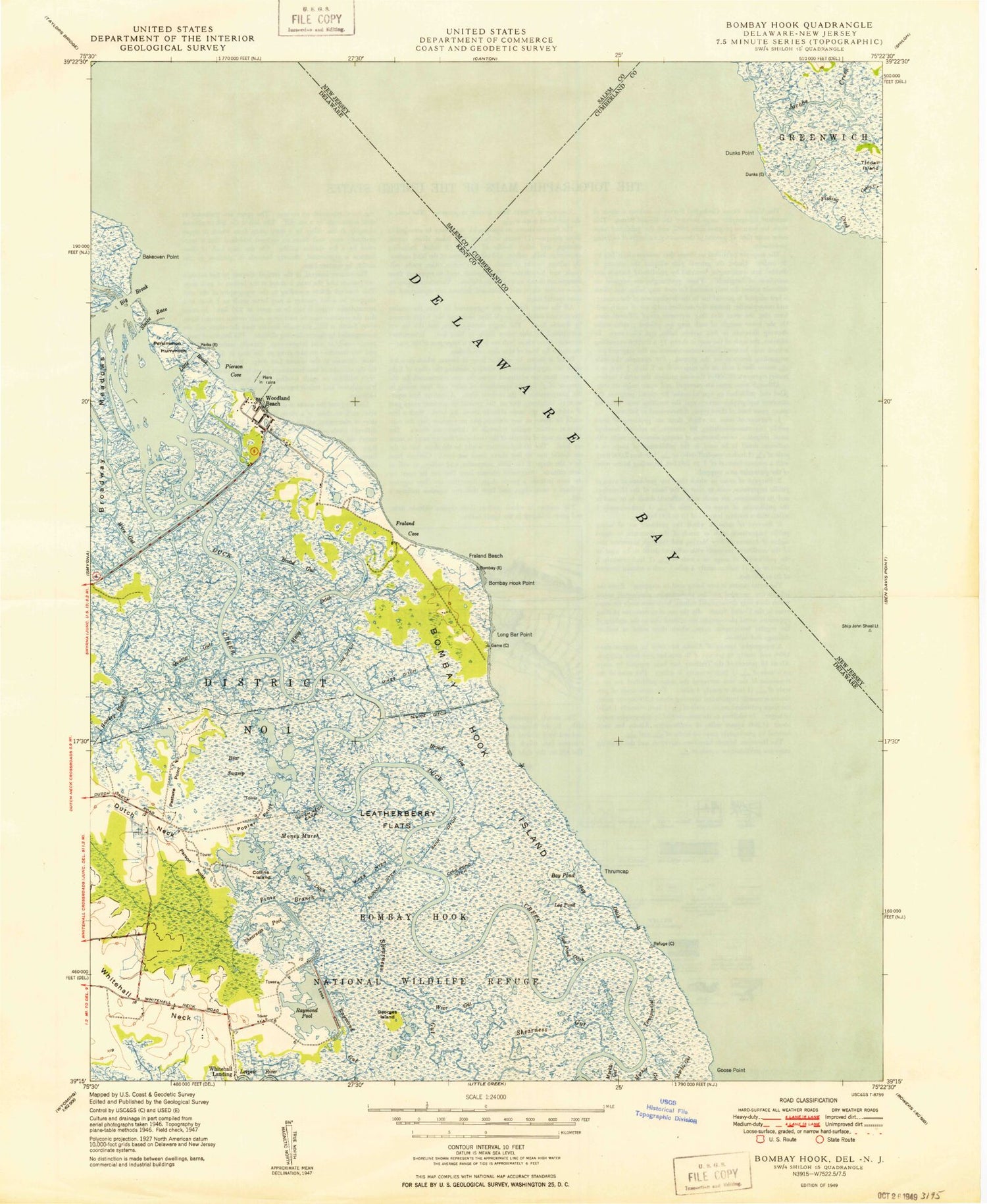
Classic USGS Bombay Hook Island Delaware 7.5'x7.5' Topo Map
Couldn't load pickup availability
Historical USGS topographic quad map of Bombay Hook Island in the states of Delaware, New Jersey. Map scale may vary for some years, but is generally around 1:24,000. Print size is approximately 24" x 27"
This quadrangle is in the following counties: Cumberland, Kent, New Castle, Salem.
The map contains contour lines, roads, rivers, towns, and lakes. Printed on high-quality waterproof paper with UV fade-resistant inks, and shipped rolled.
Contains the following named places: Arnold Point Shoal, Bakeoven Point, Bank Ditch, Bay Pond, Bear Swamp, Bear Swamp Pool, Bear Swamp Pool Dam, Big Break, Bombay Hook, Bombay Hook Island, Bombay Hook National Wildlife Refuge, Bombay Hook Point, Bombay Hook Point Shoal, Broad Gut, Collins Island, Cove Pond Ditch, Dunks Bar, Dunks Point, Dutch Creek Shoal, Dutch Neck, Dutch Neck Canal, Finis Branch, Fishing Creek, Fraland Beach, Fraland Cove, Georges Island, Goose Point, Hawkey Branch, Hay Ditch, Jacobs Creek, Leatherberry Flats, Lees Ditch, Line Ditch, Liston Range, Little Break, Log Pond, Long Bar Point, Matty Ditch, Mikes Ditch, Money Marsh, Myrkle Gut, Parson Point, Pasture Point, Persimmon Hummock, Pierson Cove, Poplar Point, Quarter Gut, Raymond Gut, Raymond Pool, Raymond Pool Dam, Salt Pond Ditch, Shearness Gut, Shearness Pool, Shearness Pool Dam, Ship John Shoal, Ship John Shoal Light, Slooch Ditch, Sluice Ditch, Sluice Race, Spinnell Udden, Terrapin Gut, Thrumcap, Whitehall Landing, Whitehall Neck, Wier Gut, Wire Gut, Woodland Beach