MyTopo
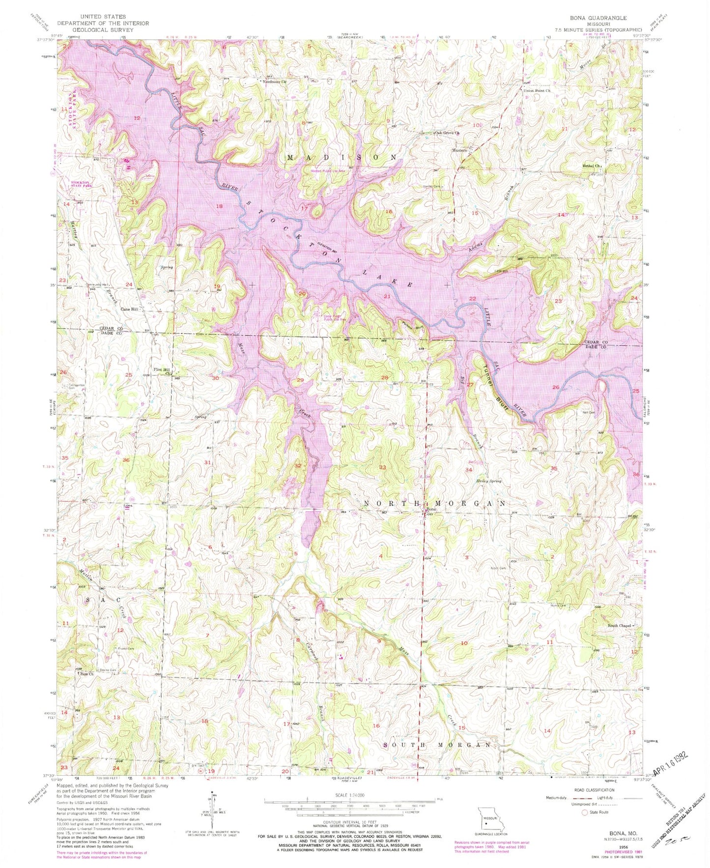
Classic USGS Bona Missouri 7.5'x7.5' Topo Map
Couldn't load pickup availability
Historical USGS topographic quad map of Bona in the state of Missouri. Map scale may vary for some years, but is generally around 1:24,000. Print size is approximately 24" x 27"
This quadrangle is in the following counties: Cedar, Dade.
The map contains contour lines, roads, rivers, towns, and lakes. Printed on high-quality waterproof paper with UV fade-resistant inks, and shipped rolled.
Contains the following named places: Adams Branch, Asbell Cemetery, Baird Lake, Baird Lake Dam, Bethel Church, Bethel School, Big Branch, Bona, Cane Hill, Cane Hill School, Carmack Branch, Carns Ford, Center School, Devine Cemetery, Flint Hill Church, Flint Hill School, Fullington Cemetery, Hailey Spring, Hartley, Hartley Cemetery, Hartley School, Masters, Maze Creek, Morris Cemetery, Mount Carmel Church, Mount Zion Cemetery, Mount Zion School, Needmore, Needmore Church, Neil Cemetery, Oak Grove Church, Perkins Bluff, Routh Chapel, Stockton State Park, Township of Madison, Township of North Morgan, Tunnel Bluff, Union Point Church, Zion Church, ZIP Code: 65635