MyTopo
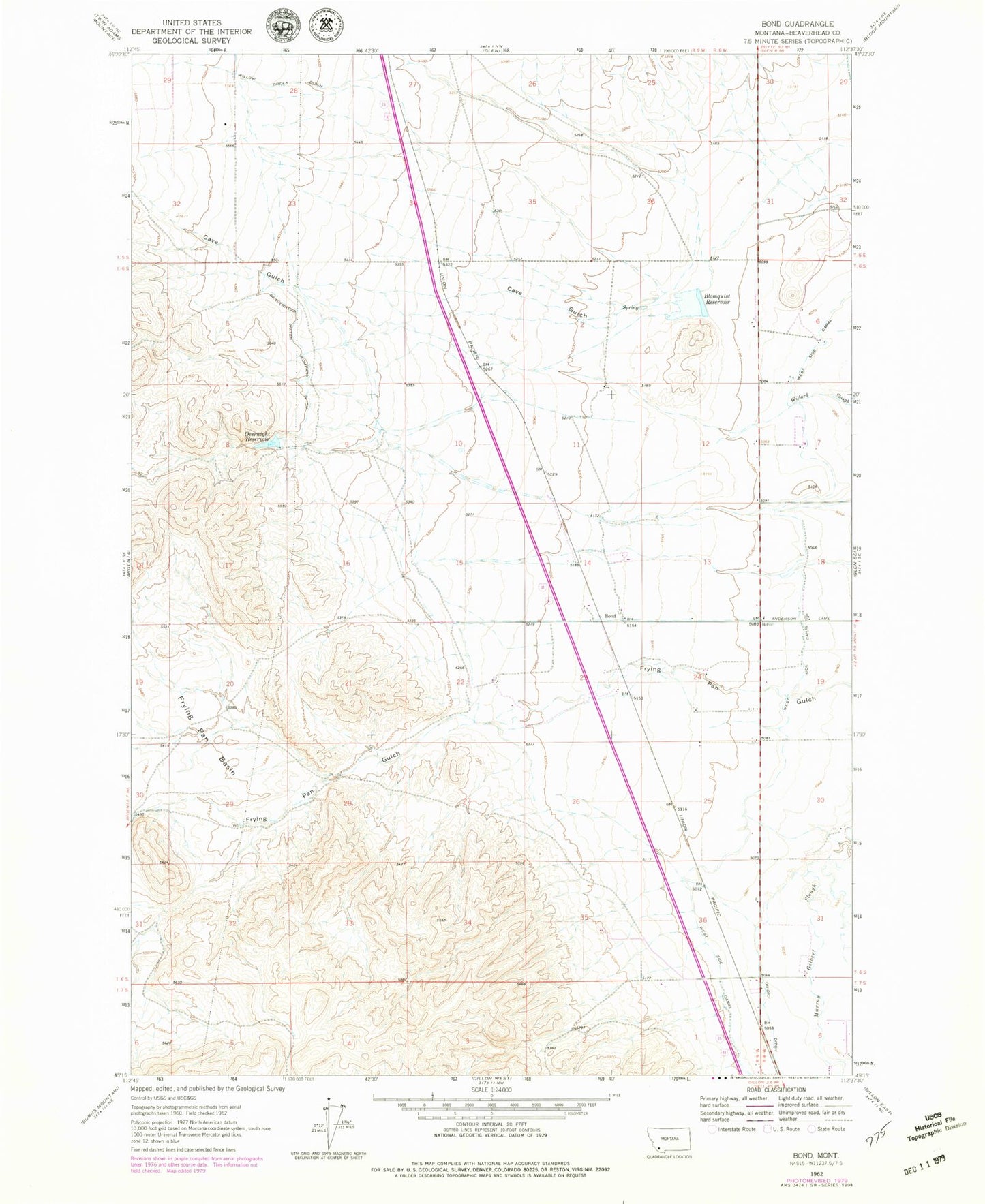
Classic USGS Bond Montana 7.5'x7.5' Topo Map
Couldn't load pickup availability
Historical USGS topographic quad map of Bond in the state of Montana. Map scale may vary for some years, but is generally around 1:24,000. Print size is approximately 24" x 27"
This quadrangle is in the following counties: Beaverhead.
The map contains contour lines, roads, rivers, towns, and lakes. Printed on high-quality waterproof paper with UV fade-resistant inks, and shipped rolled.
Contains the following named places: 06S08W18CCC_02 Well, 06S09W11DBB_01 Well, 06S09W13CDD_01 Well, 06S09W14BDCD01 Well, 06S09W15BBAB01 Well, 06S09W23ABB_01 Well, 07S09W23CACD02 Well, Blomquist Reservoir, Blomquist Reservoir Dam, Bond, Cave Gulch, Frying Pan Basin, Guidici Ditch, Overnight Reservoir, Overnight Reservoir Dam, West Side Canal, Willow Creek Ditch