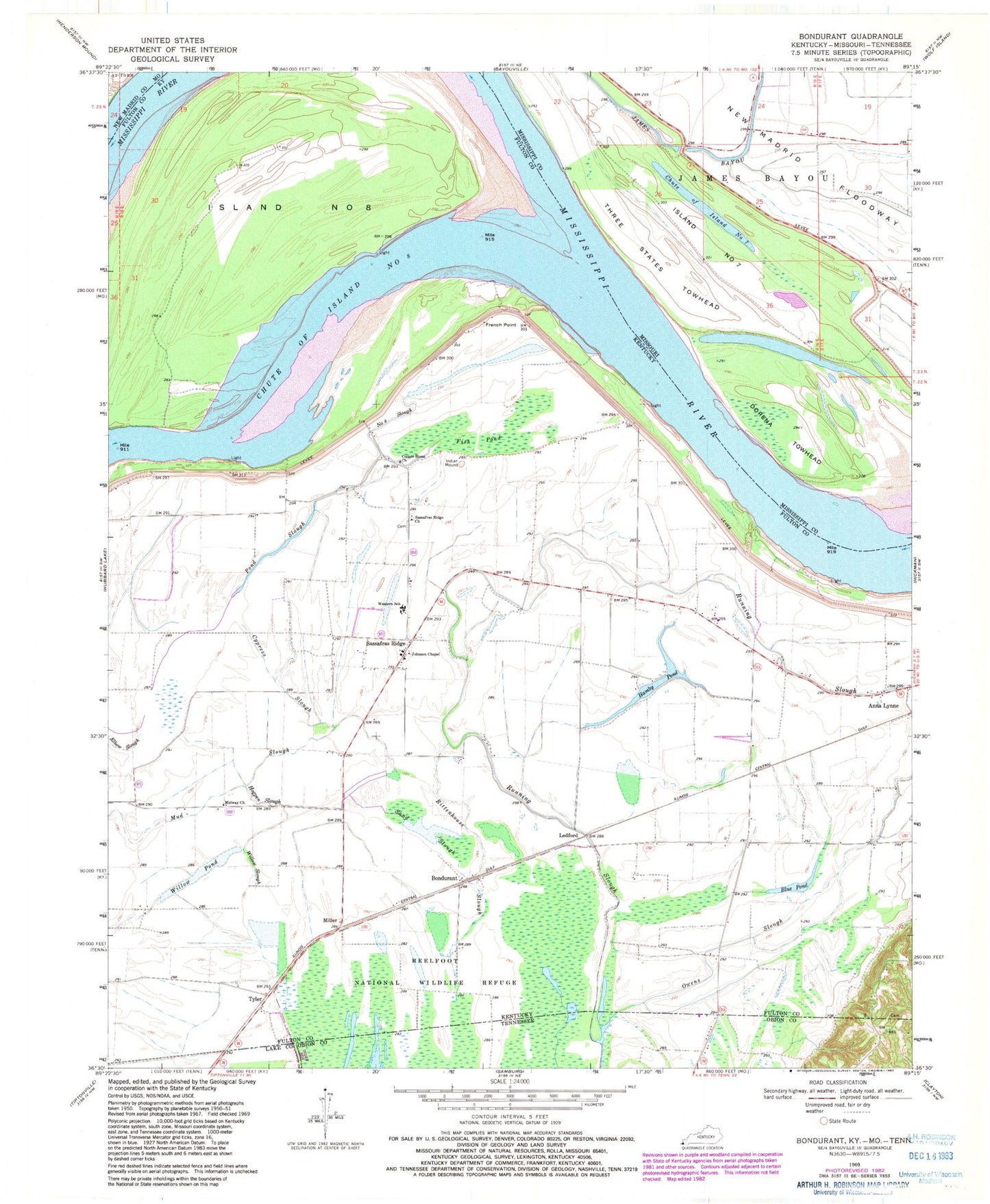
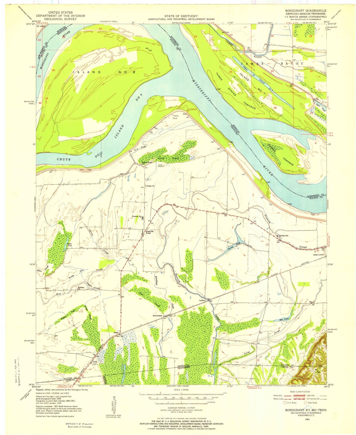
MyTopo
Classic USGS Bondurant Kentucky 7.5'x7.5' Topo Map
Couldn't load pickup availability
Historical USGS topographic quad map of Bondurant in the states of Kentucky, Missouri, Tennessee. Map scale may vary for some years, but is generally around 1:24,000. Print size is approximately 24" x 27"
This quadrangle is in the following counties: Fulton, Lake, Mississippi, New Madrid, Obion.
The map contains contour lines, roads, rivers, towns, and lakes. Printed on high-quality waterproof paper with UV fade-resistant inks, and shipped rolled.
Contains the following named places: Anna Lynne, Bend of Island Number 8, Blue Pond, Bondurant, Chute of Island Number 7, Corner Stone Church, Dorena Towhead, Fish Pond, French Point, Hamby Pond, Hogpen Slough, Indian Mound, Island Number 7, Island Number 8, Johnson Chapel, Ledford, Mabel, Midway Church, Miller, Mud Slough, Number 8 Slough, Open Pond, Owens Slough, Parker Landing, Pond Slough, Rittenhouse Slough, Running Slough, Sand Slough, Sassafras Ridge, Sassafras Ridge Church, Sassafras Ridge Community Cemetery, Three States, Three States School, Three States Towhead, Tyler, Western School, Willow Pond, Willow Slough