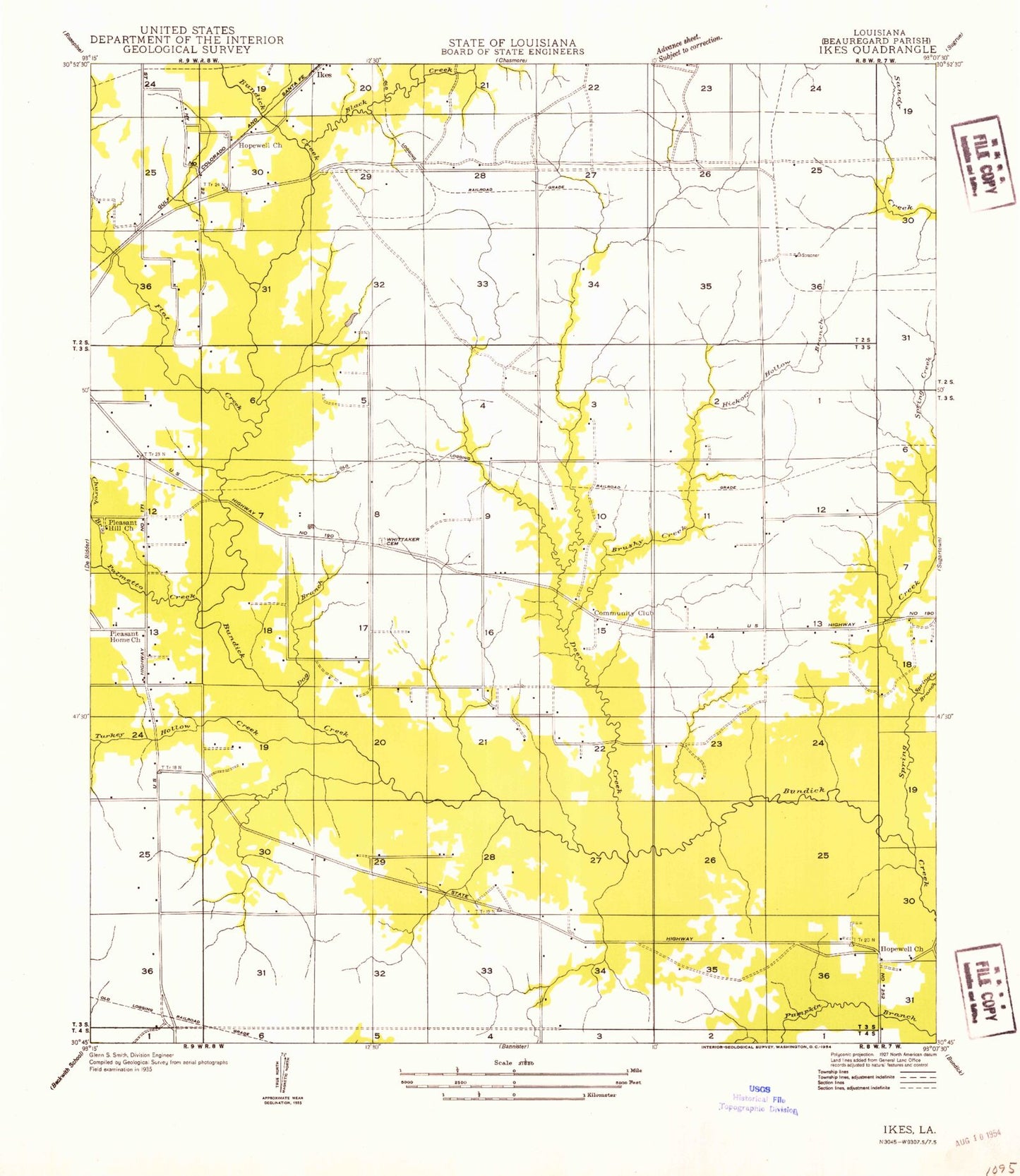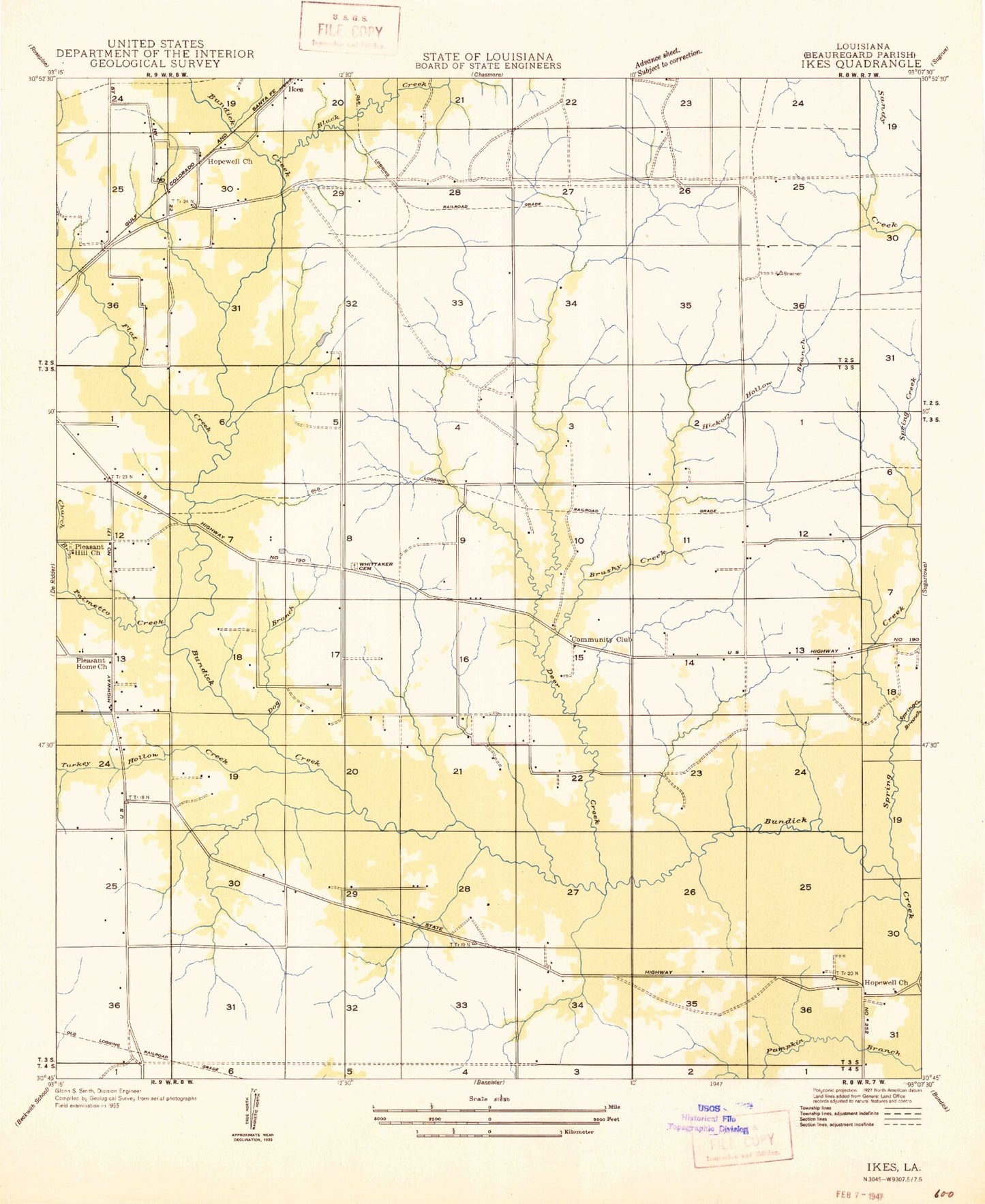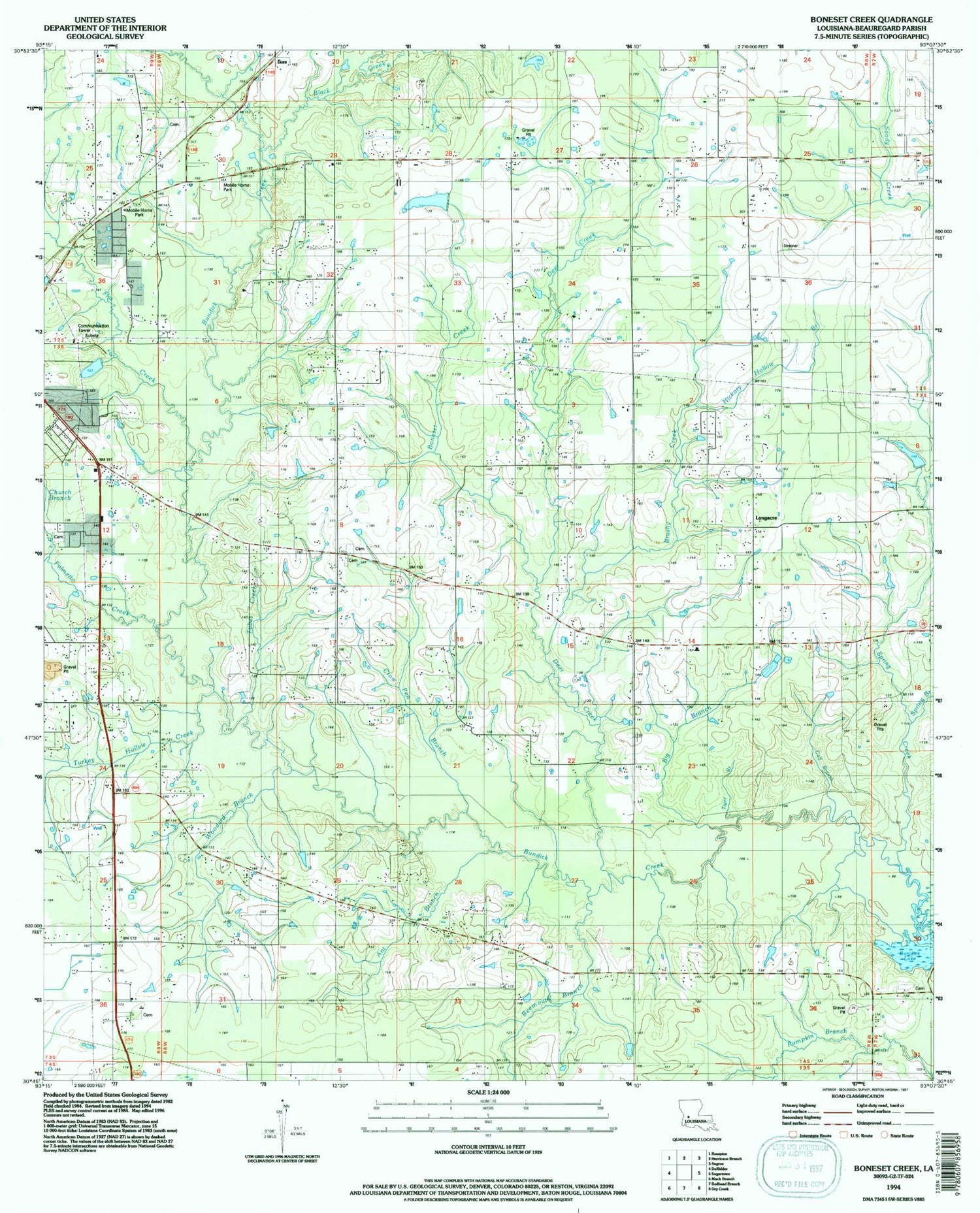
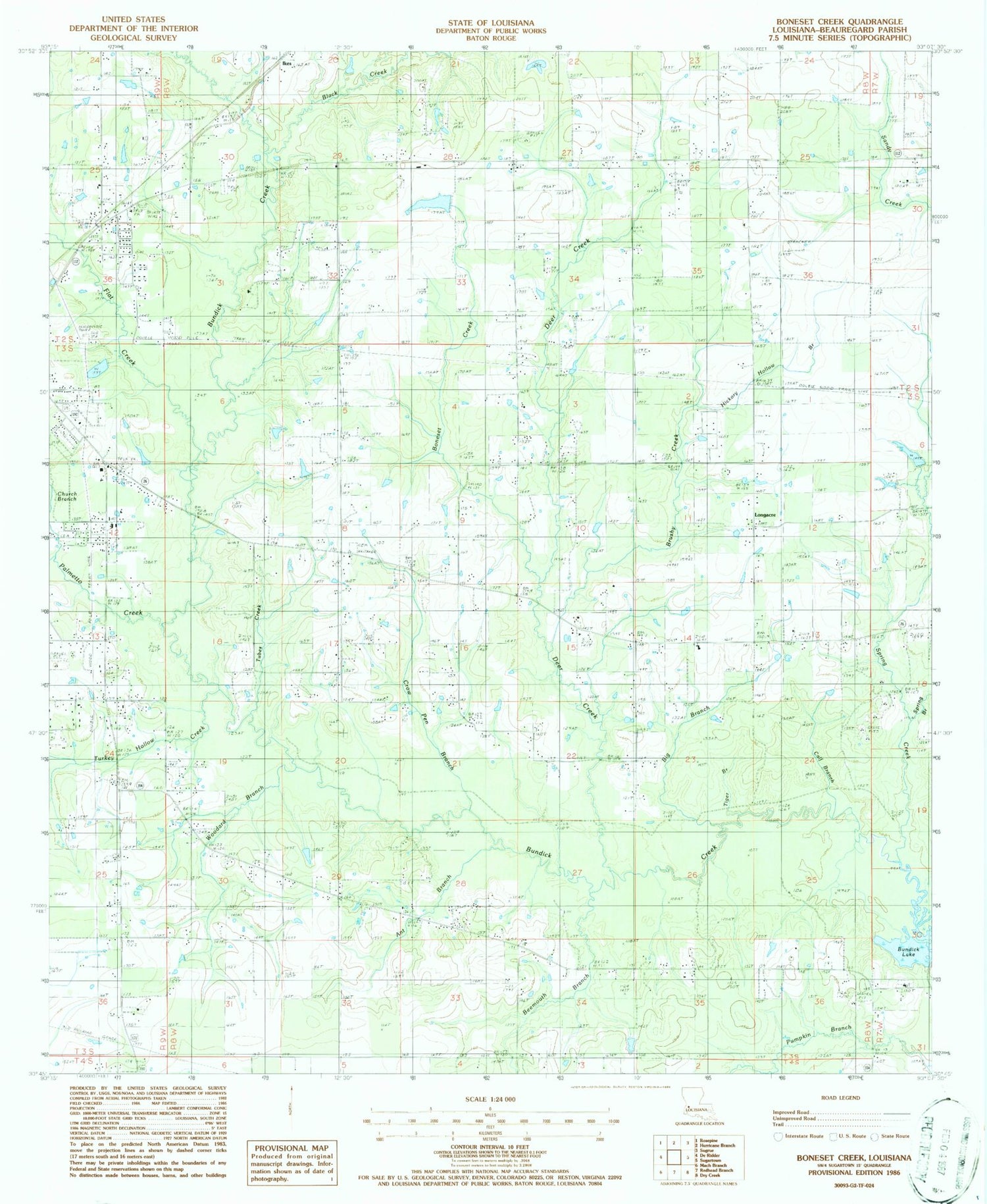


MyTopo
Classic USGS Boneset Creek Louisiana 7.5'x7.5' Topo Map
Couldn't load pickup availability
Historical USGS topographic quad map of Boneset Creek in the state of Louisiana. Map scale may vary for some years, but is generally around 1:24,000. Print size is approximately 24" x 27"
This quadrangle is in the following counties: Beauregard.
The map contains contour lines, roads, rivers, towns, and lakes. Printed on high-quality waterproof paper with UV fade-resistant inks, and shipped rolled.
Contains the following named places: A and B Mobile Home Park, Ant Branch, Beauregard Volunteer Fire Protection District 3 Longacre Station, Beauregard Volunteer Fire Protection District 4 Three Pine Station, Beemouth Branch, Big Branch, Black Creek, Boneset Creek, Brushy Creek, Calf Branch, Calvary Baptist Church, Church Branch, Church of God, Cile Baptist Church, Crow Pen Branch, Deer Creek, Flat Creek, Friendship Baptist Church, Hester Branch, Hickory Hollow Branch, Hopewell Baptist Church, Hopwell Cemetery, Ikes, Longacre, Louisiana Noname 63 Dam, Louisiana Noname 64 Dam, Mount Zion Primitive Baptist Church, Palmetto Creek, Parish Governing Authority District 3A, Parish Governing Authority District 3B, Pleasant Hill Baptist Church, Pleasant Hill Cemetery, Pleasant Hill School, Pleasant Home Church, Seventh Day Adventist Church, Shady Grove Church, Southern Magnolia Mennoite Church, Spring Branch, Spring Creek, Three Pines Church, Tiger Branch, Tubes Creek, Turkey Hollow Creek, Whitaker Cemetery, Woodard Branch, ZIP Code: 70634