MyTopo
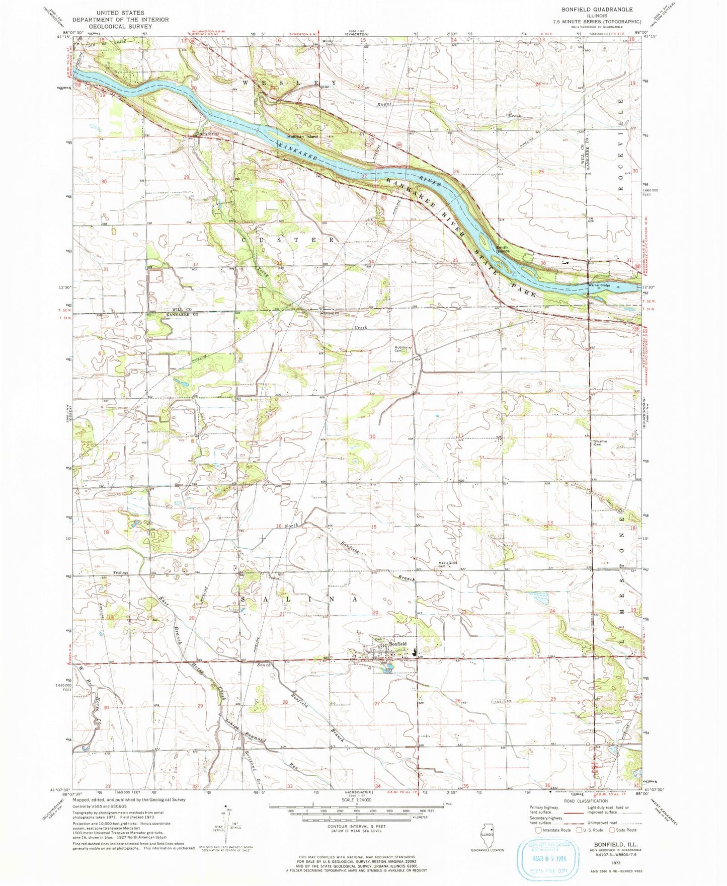
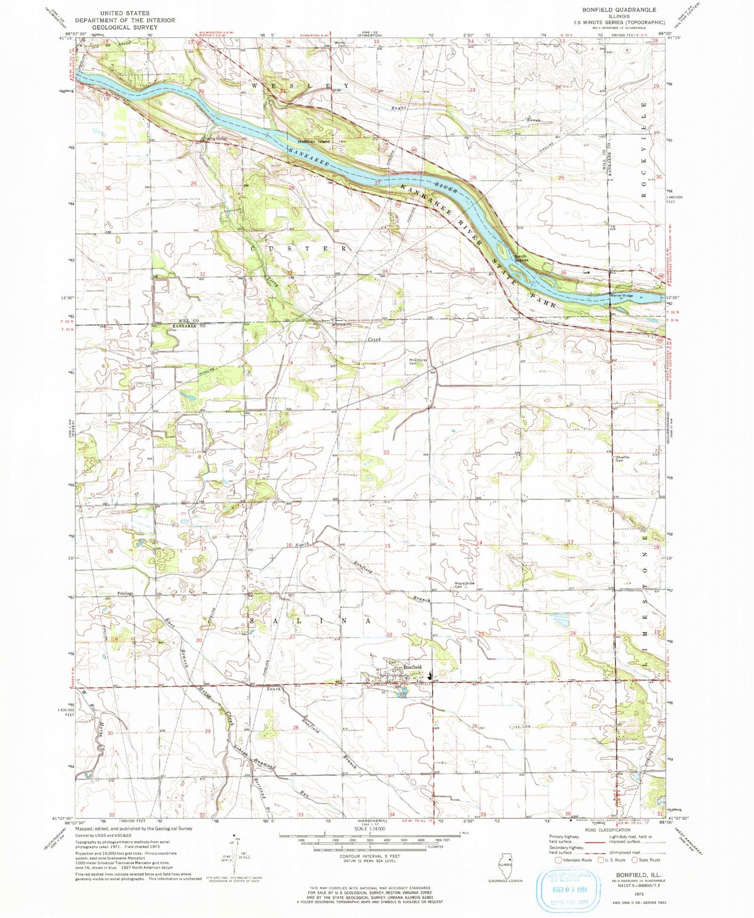
Classic USGS Bonfield Illinois 7.5'x7.5' Topo Map
Couldn't load pickup availability
Historical USGS topographic quad map of Bonfield in the state of Illinois. Map scale may vary for some years, but is generally around 1:24,000. Print size is approximately 24" x 27"
This quadrangle is in the following counties: Kankakee, Will.
The map contains contour lines, roads, rivers, towns, and lakes. Printed on high-quality waterproof paper with UV fade-resistant inks, and shipped rolled.
Contains the following named places: Beach Cemetery, Bertrand Branch, Bonfield, Bonfield Cemetery, Bonfield First United Methodist Church, Bonfield Grade School, Bonfield Post Office, Classic Landings, Forked Bend Farm, Frielings, Hawker Airport, Hoffman Island, Horse Lake, Kankakee River State Park, Lehigh Raymond Run, Maple Grove Cemetery, McDowell Farm Post Office, North Bonfield Branch, Rayns Creek, Salina Post Office, Salina Township Fire Protection District, Shreffler Cemetery, Smith Islands, South Bonfield Branch, Terry Creek, Township of Salina, Village of Bonfield, Warner Bridge, Wesley Cemetery, ZIP Code: 60913