
MyTopo
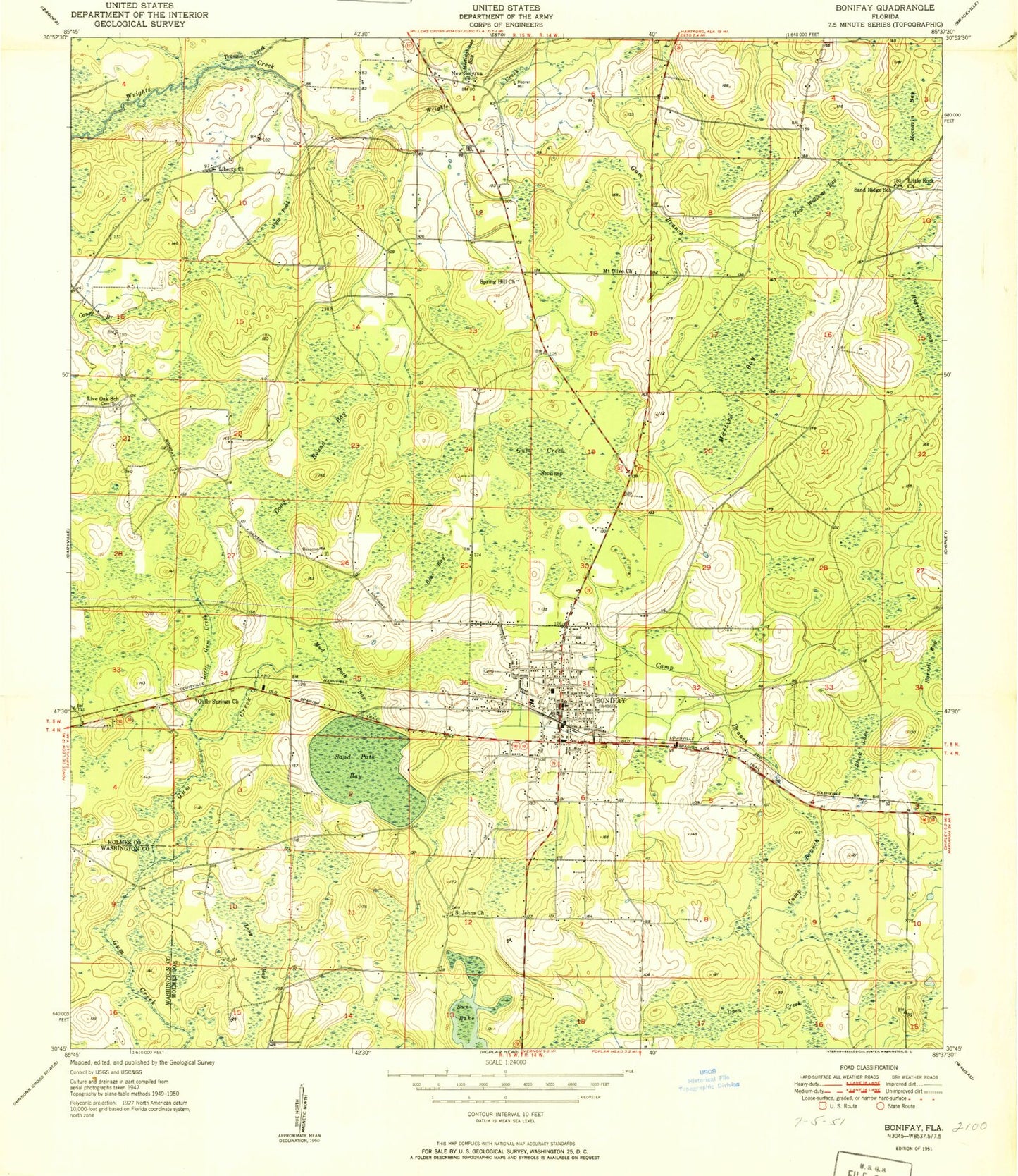
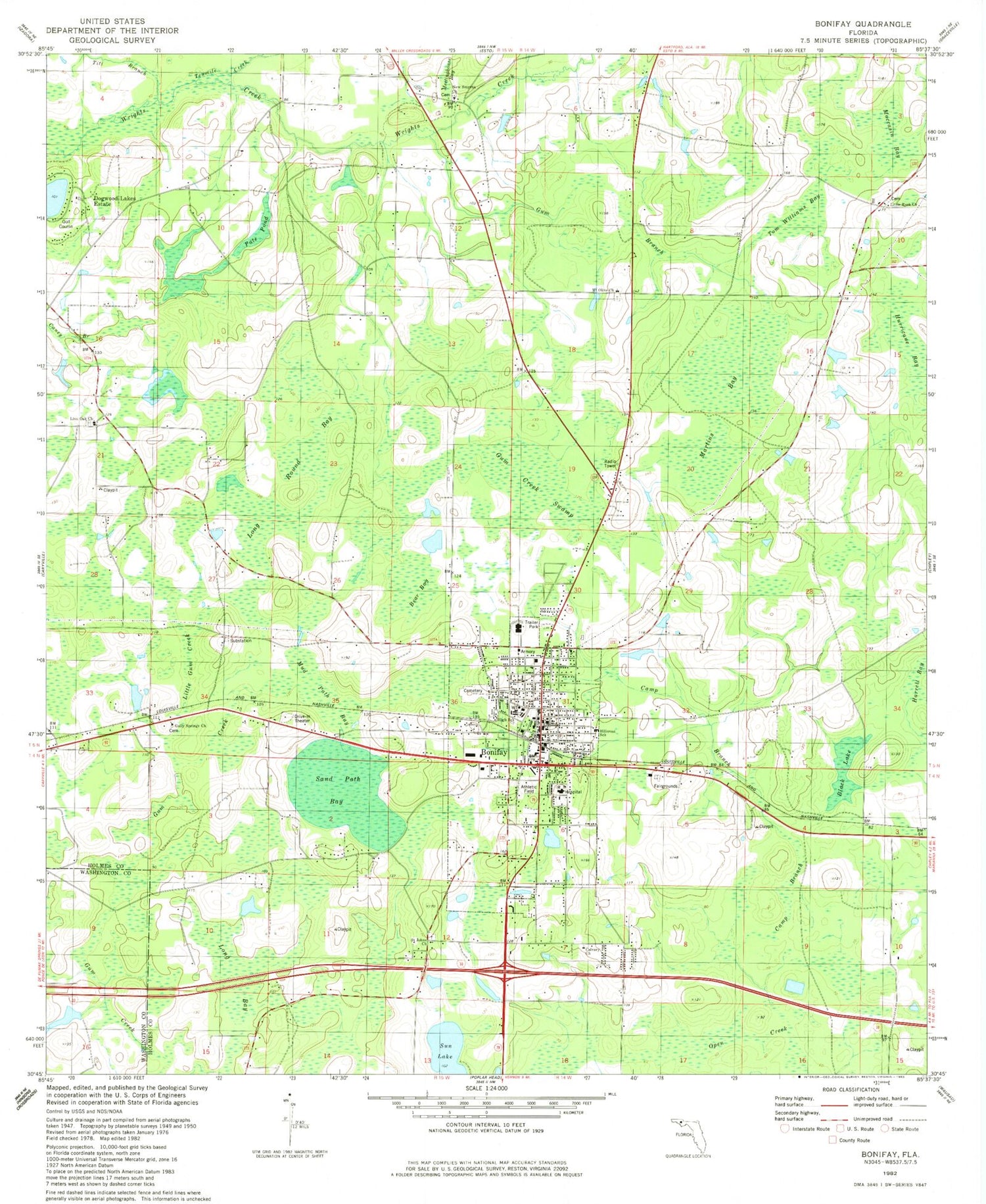
Classic USGS Bonifay Florida 7.5'x7.5' Topo Map
Couldn't load pickup availability
Historical USGS topographic quad map of Bonifay in the state of Florida. Map scale may vary for some years, but is generally around 1:24,000. Print size is approximately 24" x 27"
This quadrangle is in the following counties: Holmes, Washington.
The map contains contour lines, roads, rivers, towns, and lakes. Printed on high-quality waterproof paper with UV fade-resistant inks, and shipped rolled.
Contains the following named places: Bear Bay, Black Lake, Bonifay, Bonifay Division, Bonifay Elementary School, Bonifay Fire and Rescue, Bonifay Police Department, Bonifay Post Office, Camp Branch, City of Bonifay, Doctors Memorial Hospital, Doctors Memorial Hospital Heliport, Gully Springs Church, Gum Branch, Gum Creek Swamp, Harrell Bay, Hillcrest Special Education School, Holmes Correctional Institution, Holmes County Adult Education School, Holmes County Emergency Medical Services, Holmes County High School, Holmes County Sheriff's Office, Hoover Mill, Hurricane Bay, Liberty Church, Little Gum Creek, Little Rock Church, Live Oak School, Long Bay, Long Round Bay, Martins Bay, Meetinghouse Bay, Moccasin Bay, Mount Olive Church, Mud Path Bay, New Smyrna Church, Pate Pond, Saint Johns Church, Sand Path Bay, Sand Ridge School, Spring Hill Church, Still Cemetery, Sun Lake, Tenmile Creek, Tharpe Airport, Titi Branch, Tom Williams Bay, ZIP Code: 32425