MyTopo
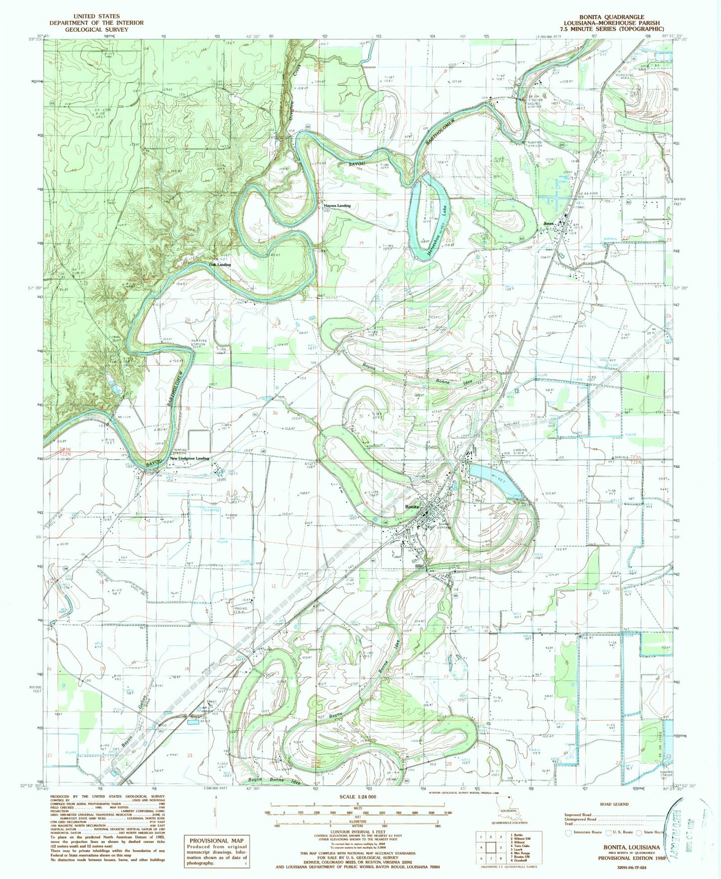
Classic USGS Bonita Louisiana 7.5'x7.5' Topo Map
Couldn't load pickup availability
Historical USGS topographic quad map of Bonita in the state of Louisiana. Map scale may vary for some years, but is generally around 1:24,000. Print size is approximately 24" x 27"
This quadrangle is in the following counties: Morehouse.
The map contains contour lines, roads, rivers, towns, and lakes. Printed on high-quality waterproof paper with UV fade-resistant inks, and shipped rolled.
Contains the following named places: 10th Ward Fire District 1 Bonita Volunteer Fire Department, 71223, Assembly of God Church, Bonita, Bonita Elementary School, Bonita Police Department, Bonita Post Office, Green Grove Church, Haynes Landing, Horseshoe Brake Dam, Horseshoe Lake, Jones, Jones Post Office, Lawson Chapel, Loverett Ferry, Mounds Church, New Landgrove Landing, New Saint Mary Church, Oak Landing, Overflow Creek, Saint Luke Church, Shackleford Lake Dam, Shady Grove Church, Victory Missionary Church, Village of Bonita, Ward Ten, Zachery Church