MyTopo
Classic USGS Bono Arkansas 7.5'x7.5' Topo Map
Couldn't load pickup availability
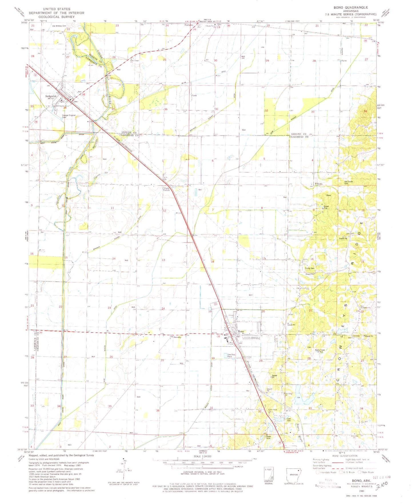
Historical USGS topographic quad map of Bono in the state of Arkansas. Map scale may vary for some years, but is generally around 1:24,000. Print size is approximately 24" x 27"
This quadrangle is in the following counties: Craighead, Greene, Lawrence.
The map contains contour lines, roads, rivers, towns, and lakes. Printed on high-quality waterproof paper with UV fade-resistant inks, and shipped rolled.
Contains the following named places: 56 School, 72416, Ames School, Bells Chapel Church, Bethel Church, Big Creek Site 10 Dam, Big Creek Site 10 Reservoir, Bohanan Slouth Ditch, Bono, Bono Fire Protection District, Bono Police Department, Bono Post Office, Bono School, City of Bono, Cross Road Church, Cullen Airport, Cypress Slough, Dorothy, East Cache River Ditch, Enterprise School, Fiftysix, Gum Slough Ditch, Guy Parden Pond, Guy Parden Pond Dam, Hackberry Island, Hendrix Chapel, Interprise Church, J L Craft Pond, J L Craft Pond Dam, KTEJ-TV (Jonesboro), Love Cemetery, March, Nalle, New Interprise Church, Number 26 Ditch, Oak Ridge, Oak Ridge Church, Oak Ridge School, Old Military Cemetery, Old Trinity Cemetery, Pauls Switch, Poplar Valley Church, Ralph Cox Pond, Ralph Cox Pond Dam, Sedgwick, Sedgwick Post Office, Shady Grove Church, Town of Sedgwick, Township of Big Creek, Township of Shady Grove, Trinity Branch, Trinity Cemetery, Trinity Methodist Church, Trinity School, West 56 School