MyTopo
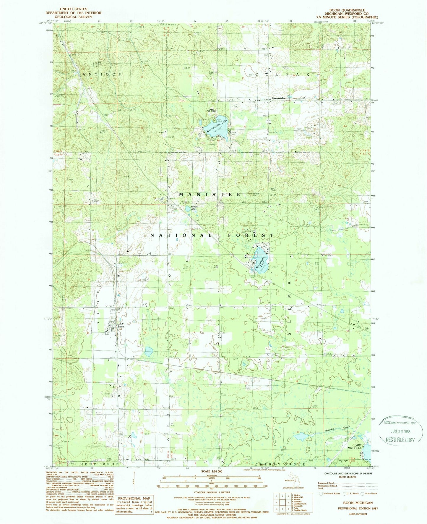
Classic USGS Boon Michigan 7.5'x7.5' Topo Map
Couldn't load pickup availability
Historical USGS topographic quad map of Boon in the state of Michigan. Map scale may vary for some years, but is generally around 1:24,000. Print size is approximately 24" x 27"
This quadrangle is in the following counties: Wexford.
The map contains contour lines, roads, rivers, towns, and lakes. Printed on high-quality waterproof paper with UV fade-resistant inks, and shipped rolled.
Contains the following named places: Altman Lake, Boon, Boon Baptist Church, Boon Census Designated Place, Boon Post Office, Boon Township Fire Department, Boyd School, Brandy Brook Waterfowl Area, Brandy Creek, Bunker Hill Golf Course, Bunyea Post Office, Clofax Township Park, Dayhuff Meauwataka Cemetery, East Cemetery, Foursquare Lighthouse Church, McNett School, Meauwataka, Meauwataka Free Methodist Church, Meauwataka Lake, Meauwataka Post Office, Millersville, Millersville Post Office, Millersville Station, Pilgrim Holiness Church, Selma Cemetery, Selma Center School, Township of Selma, West Cemetery, Wexford County, Woodward Lake, ZIP Code: 49618