
MyTopo
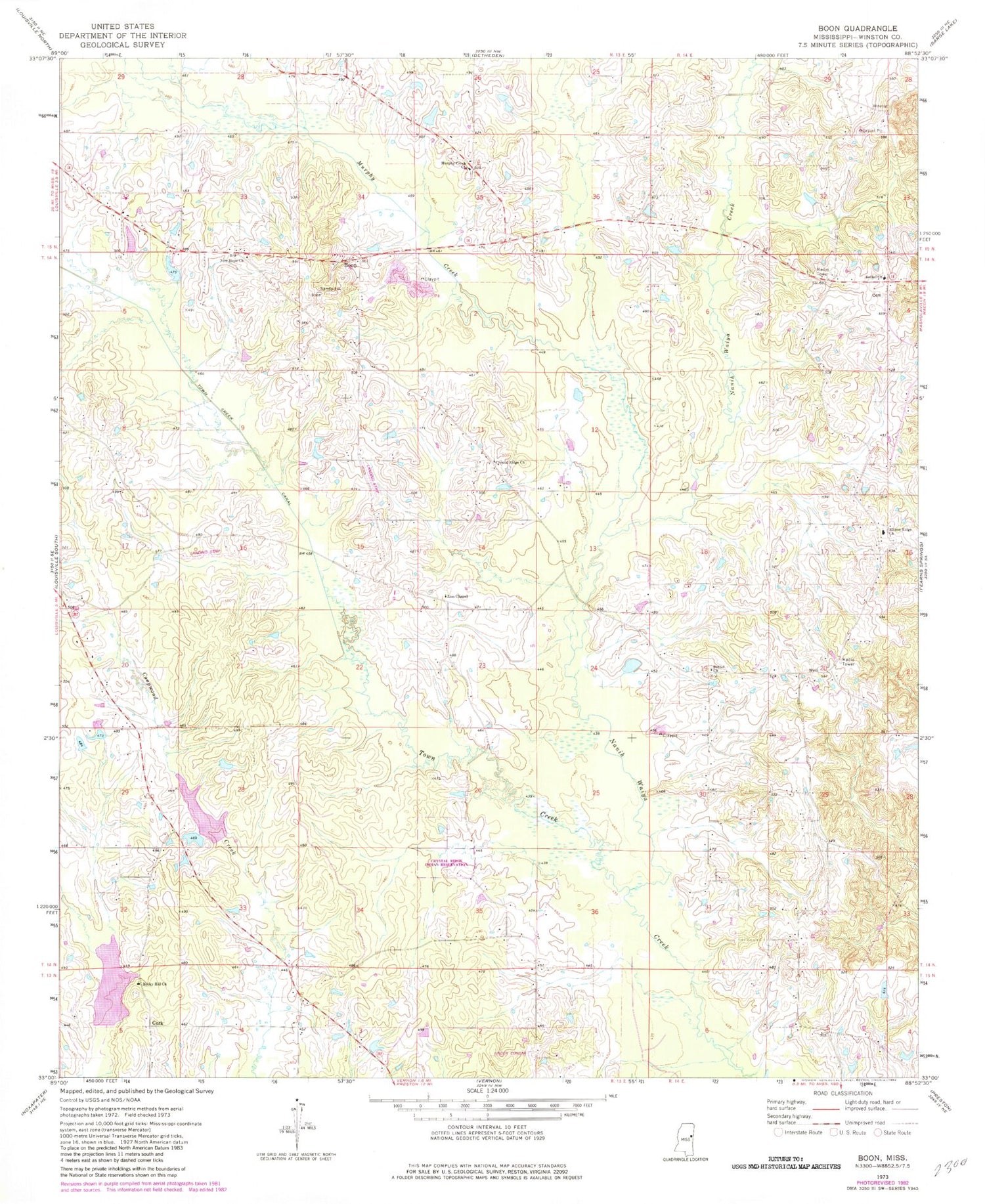
Classic USGS Boon Mississippi 7.5'x7.5' Topo Map
Couldn't load pickup availability
Historical USGS topographic quad map of Boon in the state of Mississippi. Map scale may vary for some years, but is generally around 1:24,000. Print size is approximately 24" x 27"
This quadrangle is in the following counties: Winston.
The map contains contour lines, roads, rivers, towns, and lakes. Printed on high-quality waterproof paper with UV fade-resistant inks, and shipped rolled.
Contains the following named places: Bethel Church, Boon, Crystal Ridge Church, Crystal Ridge Indian Reservation, East Winston Volunteer Fire Department, Ellison Ridge, Ellison Ridge Cemetery, Ellison Ridge Church, Kirk Family Cemetery, Murphy Creek, Murphy Creek Baptist Church Cemetery, Murphy Creek Church, New Hope Church, New Hope Methodist Church Cemetery, Randalls Bluff, Reed Lake, Rocky Hill Church, Rocky Hill United Methodist Church Cemetery, Supervisor District 2, Tallahaga Creek Watershed Structure 12 Dam, Tallahaga Creek Watershed Structure 13 Dam, Town Creek, Town Creek Canal, Zion Chapel


