MyTopo
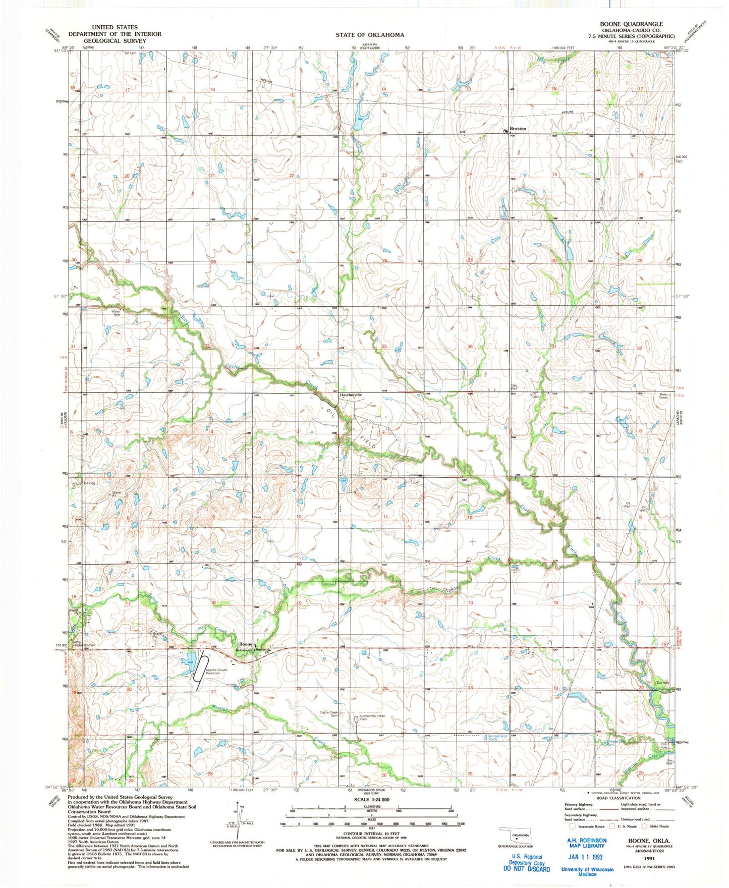
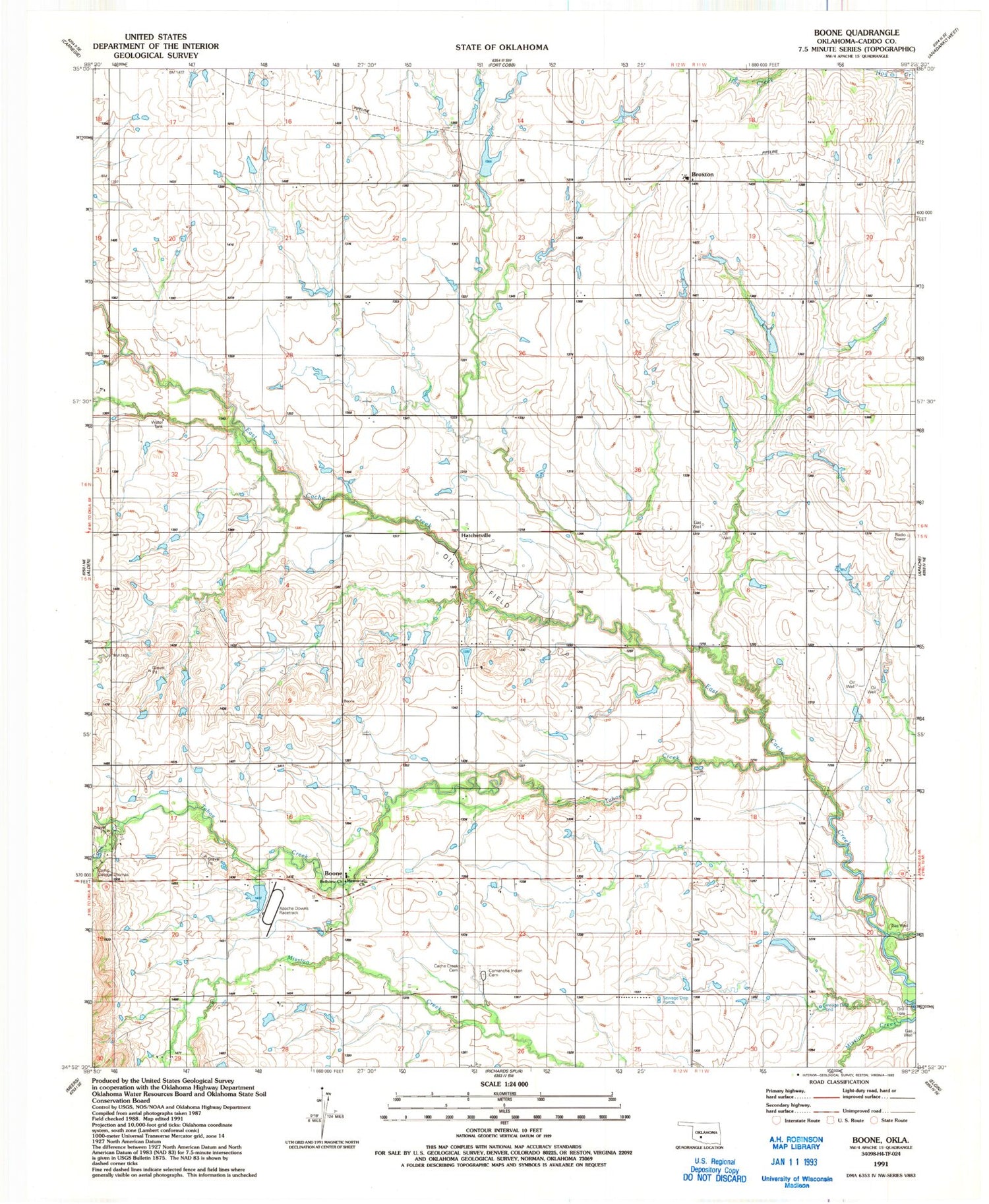
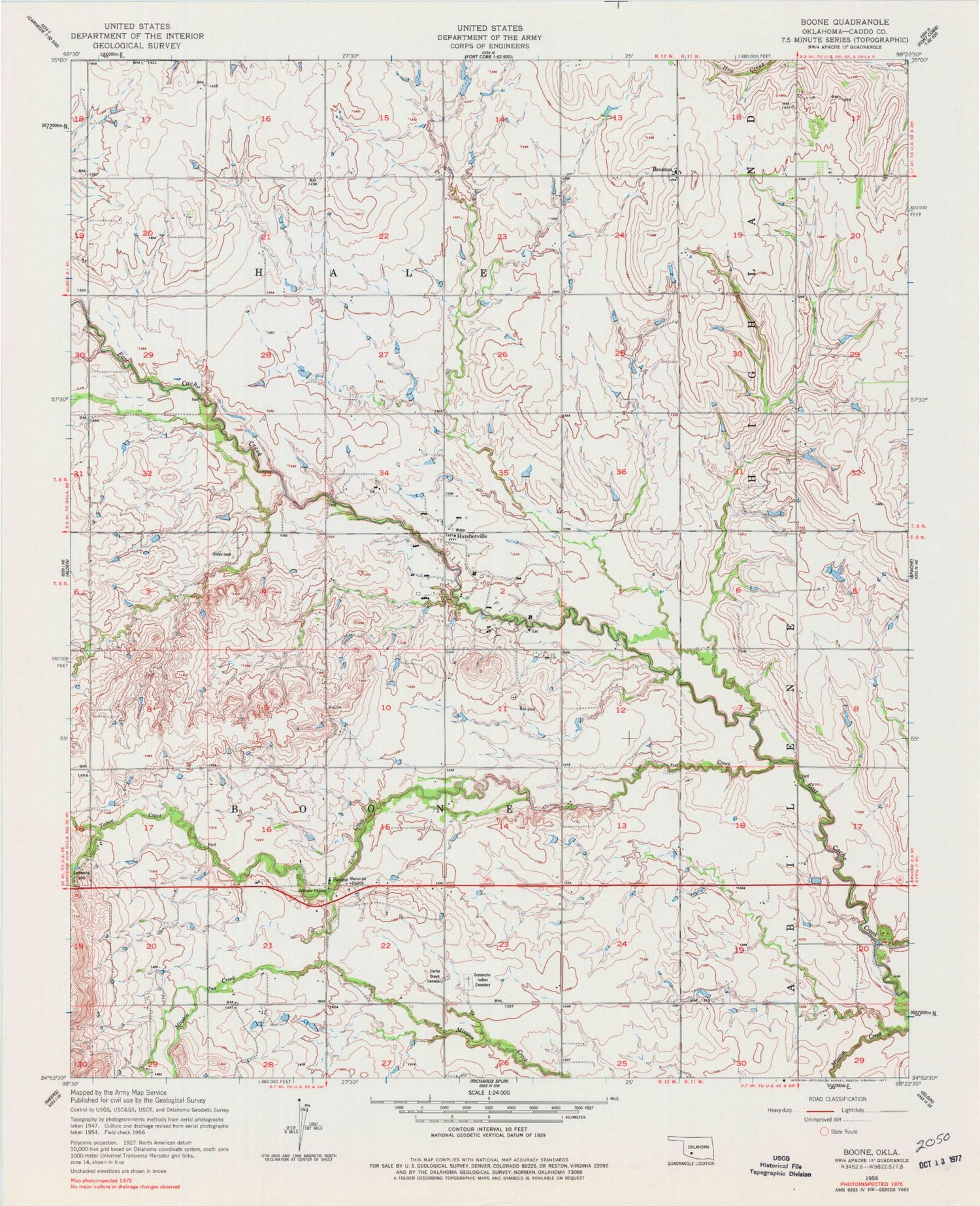
Classic USGS Boone Oklahoma 7.5'x7.5' Topo Map
Couldn't load pickup availability
Historical USGS topographic quad map of Boone in the state of Oklahoma. Map scale may vary for some years, but is generally around 1:24,000. Print size is approximately 24" x 27"
This quadrangle is in the following counties: Caddo.
The map contains contour lines, roads, rivers, towns, and lakes. Printed on high-quality waterproof paper with UV fade-resistant inks, and shipped rolled.
Contains the following named places: Apache Division, Apache Downs, Bellview Church, Boone, Boxelder Creek, Broxton, Broxton Fire Department, Cache Creek Cemetery, Camp George Thomas, Comanche Indian Cemetery, Cook Creek, Hatchetville, KRPT-FM (Anadarko), Memorial Church, Mount Zion Church, Oknoname 015026 Dam, Oknoname 015026 Reservoir, Tahoe Creek, Township of Boone, Township of Hale, ZIP Code: 73006