MyTopo
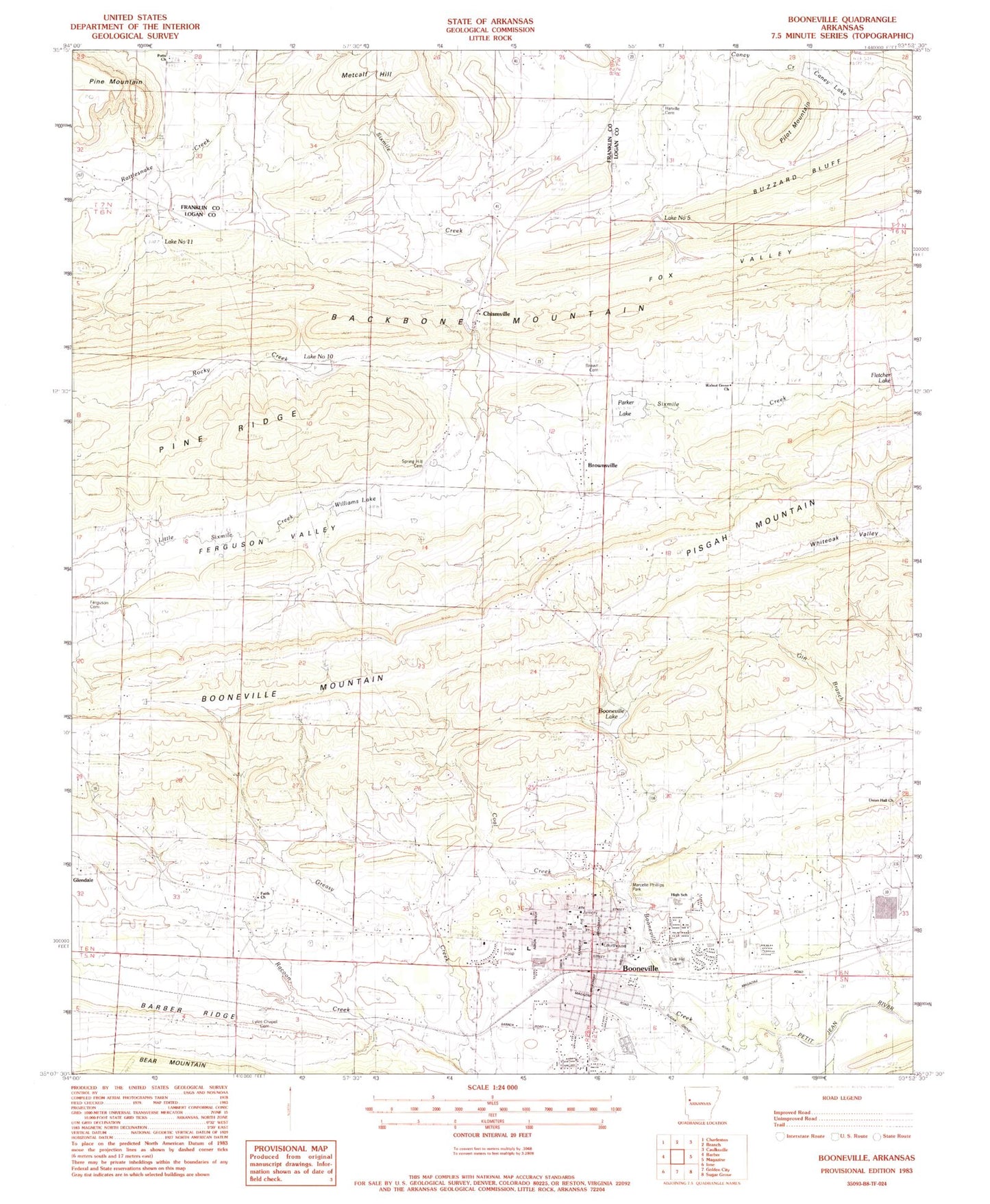
Classic USGS Booneville Arkansas 7.5'x7.5' Topo Map
Couldn't load pickup availability
Historical USGS topographic quad map of Booneville in the state of Arkansas. Map scale may vary for some years, but is generally around 1:24,000. Print size is approximately 24" x 27"
This quadrangle is in the following counties: Franklin, Logan.
The map contains contour lines, roads, rivers, towns, and lakes. Printed on high-quality waterproof paper with UV fade-resistant inks, and shipped rolled.
Contains the following named places: A R Hederick Elementary School, Bearcat Stadium, Boneville Seventh Day Adventist Church, Booneville, Booneville City Fire Department, Booneville Creek, Booneville Cumberland Presbyterian Church, Booneville Elementary School, Booneville Fire Station, Booneville High School, Booneville Junior High School, Booneville Lake, Booneville Library, Booneville Mountain, Booneville Police Department, Booneville Post Office, Booneville Reservoir Dam, Brown Cemetery, Brownsville, Buzzard Bluff, Caney Lake, Chismville, Chismville Extension Gas Field, Chismville Gas Field, City of Booneville, Coal Creek, Eastwood Baptist Church, Faith Church, Ferguson Valley, Ferguson Valley Cemetery, Fifth Street Church of Christ, First Assembly of God Church, First Baptist Church, First Freewill Baptist Church, First United Methodist Church, Fletcher Lake, Fox Valley, Full Gospel Christian Bible Church, Glendale Baptist Church, Harville Cemetery, Heritage Addition Church of Christ, Little Sixmile Creek, Logan County Courthouse, Lyles Chapel Cemetery, Marcelle Phillips Park, Mercy Hospital - Booneville, Mount Olive Church, Oak Hill Cemetery, Oak Manor Nursing Home, Parker Lake, Parkview Baptist Church, Pilot Mountain, Pine Mountain, Pine Ridge, Potts Church, Potts School, Racoon Creek, Ratcliff Rural Fire Substation, Rattlesnake Creek, Rocky Creek, Sixmile Creek Watershed Site 10 Dam, Sixmile Creek Watershed Site 10 Reservoir, Sixmile Creek Watershed Site 11 Dam, Sixmile Creek Watershed Site 11 Reservoir, Sixmile Creek Watershed Site Five Dam, Sixmile Creek Watershed Site Five Reservoir, Sixmile Creek Watershed Site Four Dam, Sixmile Creek Watershed Site Nine Dam, Sixmile Creek Watershed Site Seven Dam, Sixmile Creek Watershed Site Six Dam, Southside Assembly of God Church, Southside Baptist Church, Spring Hill Cemetery, Township of Boone, Township of Washburn, Union Hall Baptist Church, Union School, Victory Baptist Church, Walnut Grove Cumberland Presbyterian Church, Whiteoak School, Williams Lake, Woodland Heights Church of Christ