MyTopo
Classic USGS Boons Lake Georgia 7.5'x7.5' Topo Map
Couldn't load pickup availability
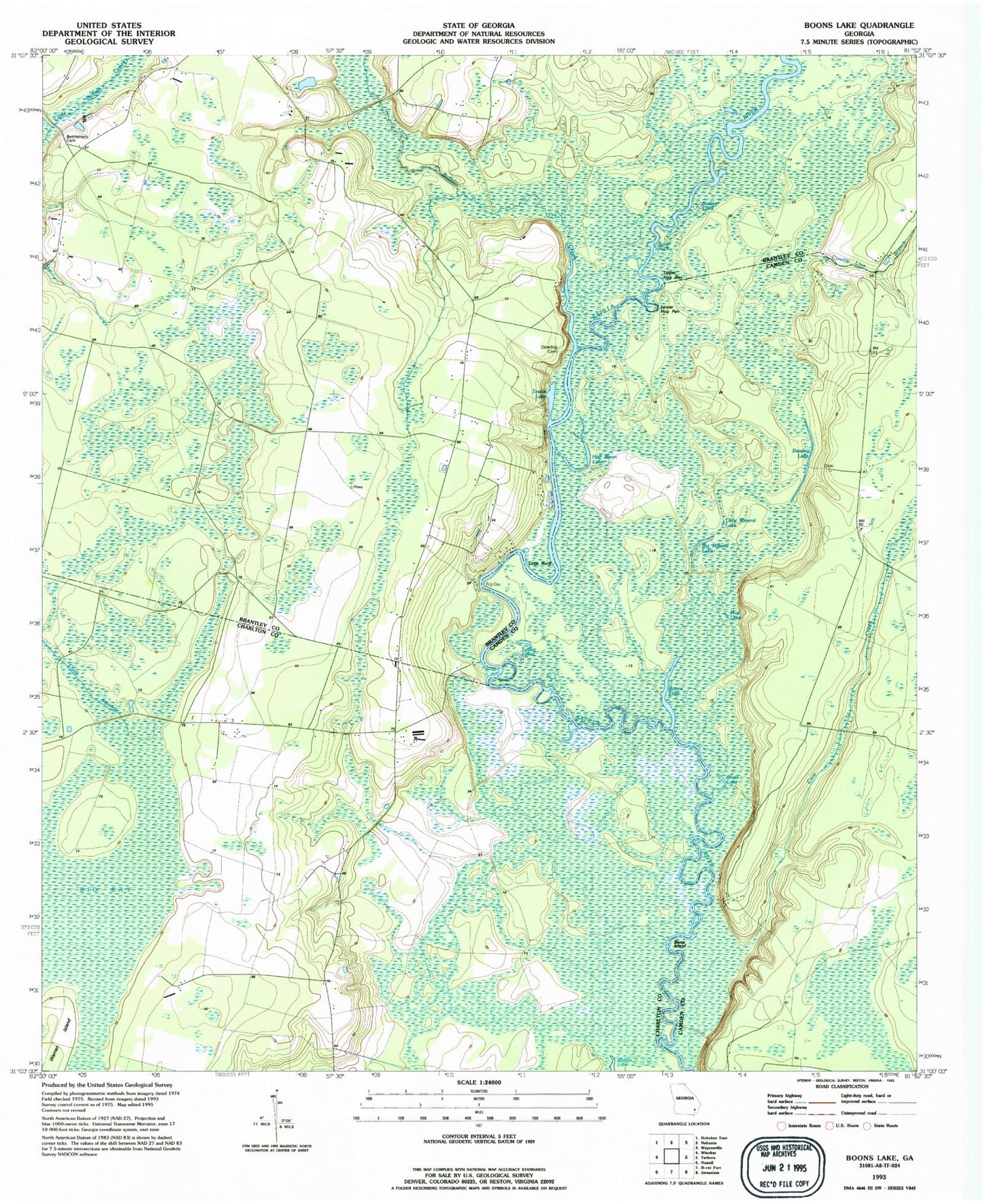
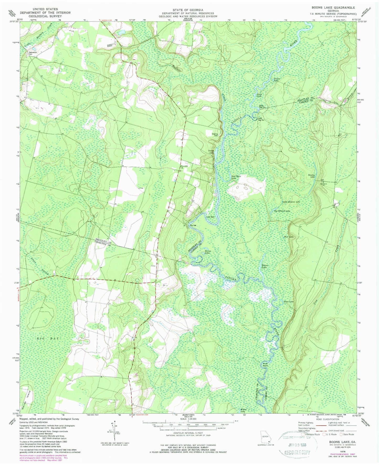
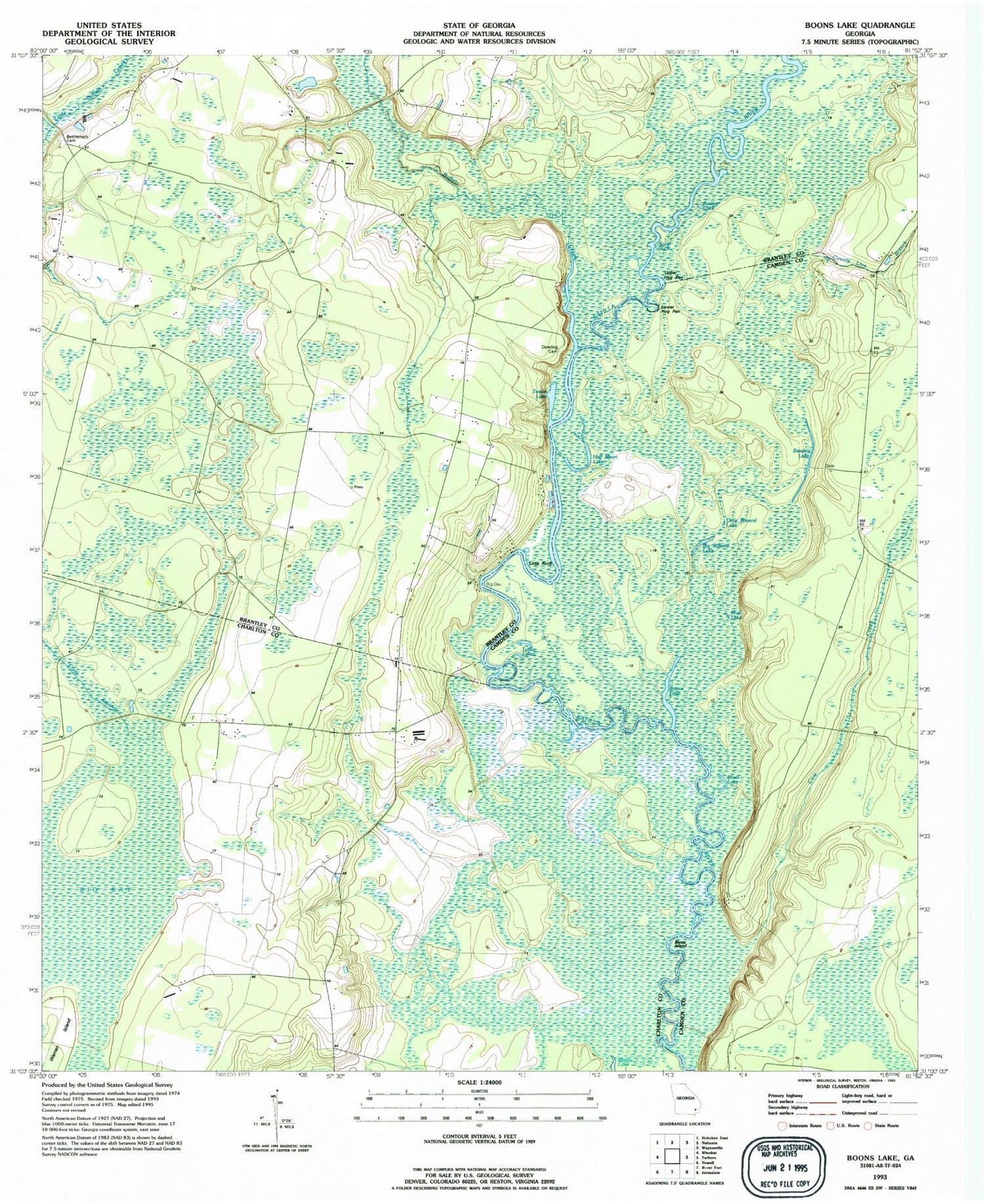
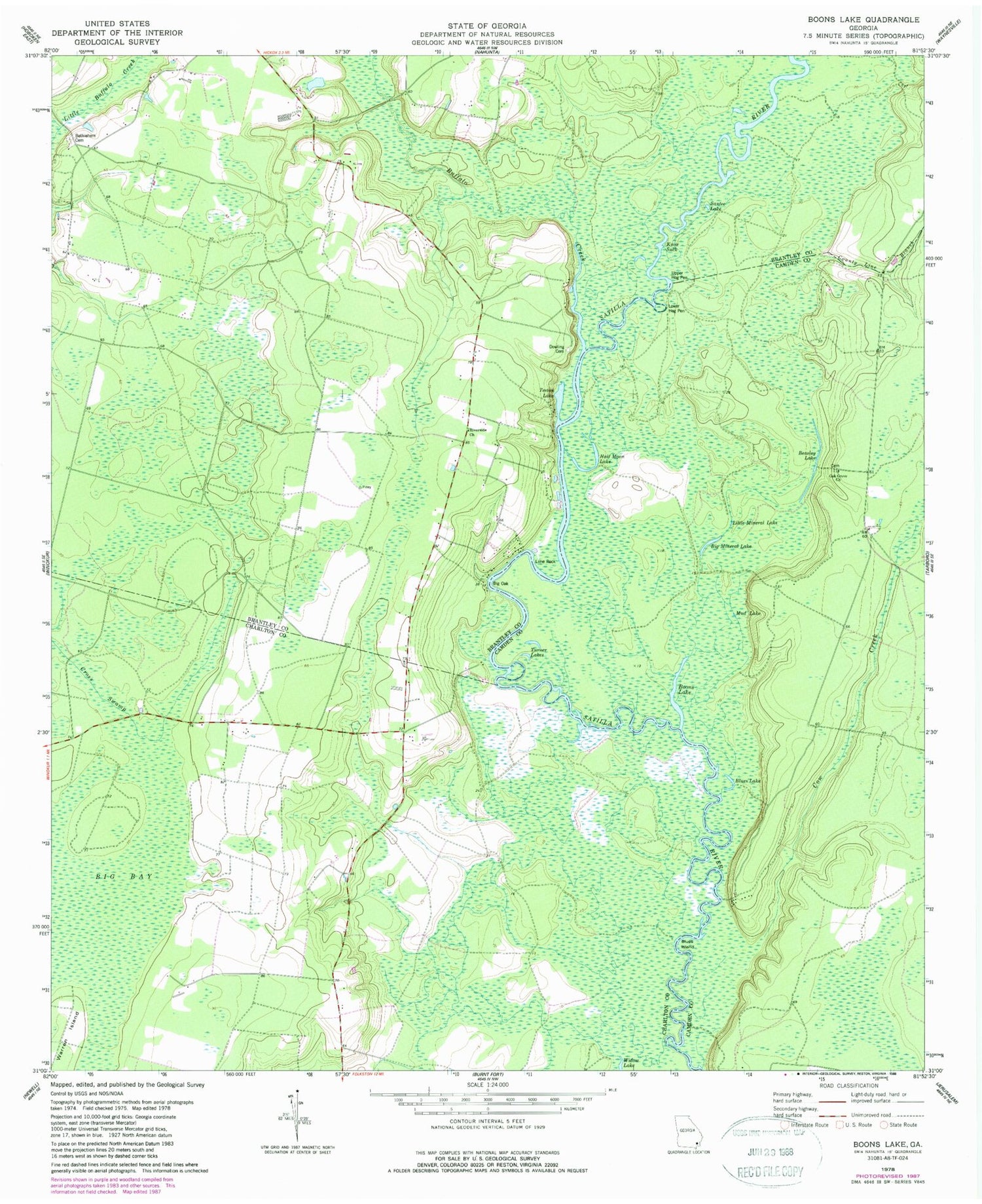
Historical USGS topographic quad map of Boons Lake in the state of Georgia. Map scale may vary for some years, but is generally around 1:24,000. Print size is approximately 24" x 27"
This quadrangle is in the following counties: Brantley, Camden, Charlton.
The map contains contour lines, roads, rivers, towns, and lakes. Printed on high-quality waterproof paper with UV fade-resistant inks, and shipped rolled.
Contains the following named places: Beasley Lake, Bethlehem Cemetery, Bethlehem Church, Big Bay, Big Mineral Lake, Big Oak, Blues Island, Blues Lake, Boons Lake, Box Landing, Buffalo Creek, Buffalo Reaches, County Line Branch, Cow Creek, Davidson Landing, Davidson School, Dowling Cemetery, Dubberly Landing, Gold Mine Landing, Half Moon Lake, Knee Buckle, Knox Suck, Langs Old Still, Lime Rock, Little Mineral Lake, Lower Hog Pen, Lower Hog Pen Bluff, Merrows Landing, Mills Ferry, Mud Lake, Oak Grove Baptist Church, Oak Grove School, Oquin Bluff, Oquin Ferry, Oquin School, Riverside Church, Santee Lake, Slades Old Field Landing, Still Lake, Teston Lake, Turner Lakes, Upper Hog Pen, Upper Hog Pen Bluff, Widow Lake