MyTopo
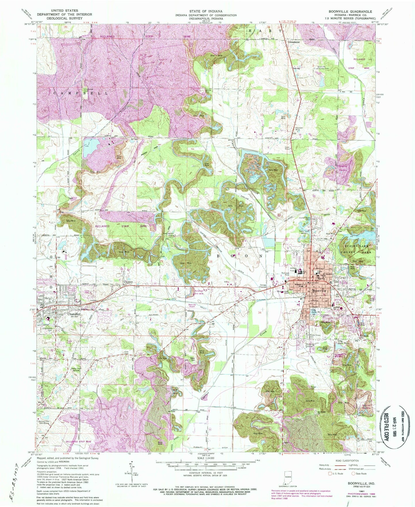
Classic USGS Boonville Indiana 7.5'x7.5' Topo Map
Couldn't load pickup availability
Historical USGS topographic quad map of Boonville in the state of Indiana. Map scale may vary for some years, but is generally around 1:24,000. Print size is approximately 24" x 27"
This quadrangle is in the following counties: Warrick.
The map contains contour lines, roads, rivers, towns, and lakes. Printed on high-quality waterproof paper with UV fade-resistant inks, and shipped rolled.
Contains the following named places: Ascension Saint Vincent Warrick Hospital, Baker Cemetery, Boonville, Boonville Airport, Boonville Country Club, Boonville Fire Department, Boonville High School, Boonville Junior High School, Boonville Police Department, Boonville Post Office, Breckenridge Park, Bullivant Park, Carter Traylor Ditch, Center, Chandler, Chandler Elementary School, Chandler Police Department, Chandler Post Office, Chandler Volunteer Fire Department, City Lake Number One, City Lake Number Two, City of Boonville, Clarke School, Clutter Stone Cemetery, Crossroads Cemetery, Ellis Cemetery, Faith Free Will Baptist Church, Greenbrier, Greenwood Cemetery, Hines Ditch, Houston Mine, Izaak Walton League Building, Jarretts, Kelly Ditch, Maple Grove Cemetery, Mount Gilead Church, Oakdale Elementary School, Perigo Cemetery, Pursley Ditch, Rolling Acres, Rolling Hills Golf Course, Saint Clements School, Scales Lake County Park, Shaw Mine, Thornburg Cemetery, Town of Chandler, Township of Boon, Warrick County, Washing Recirculating Reservoir, Washing-Recirculating Reservoir Dam, WBNL-AM (Boonville), WBNL-FM (Boonville), Wesley Chapel Cemetery, Whittaker Ditch, Williams School, WNIN-TV (Evansville), WTVW-TV (Evansville), ZIP Code: 47601