
MyTopo
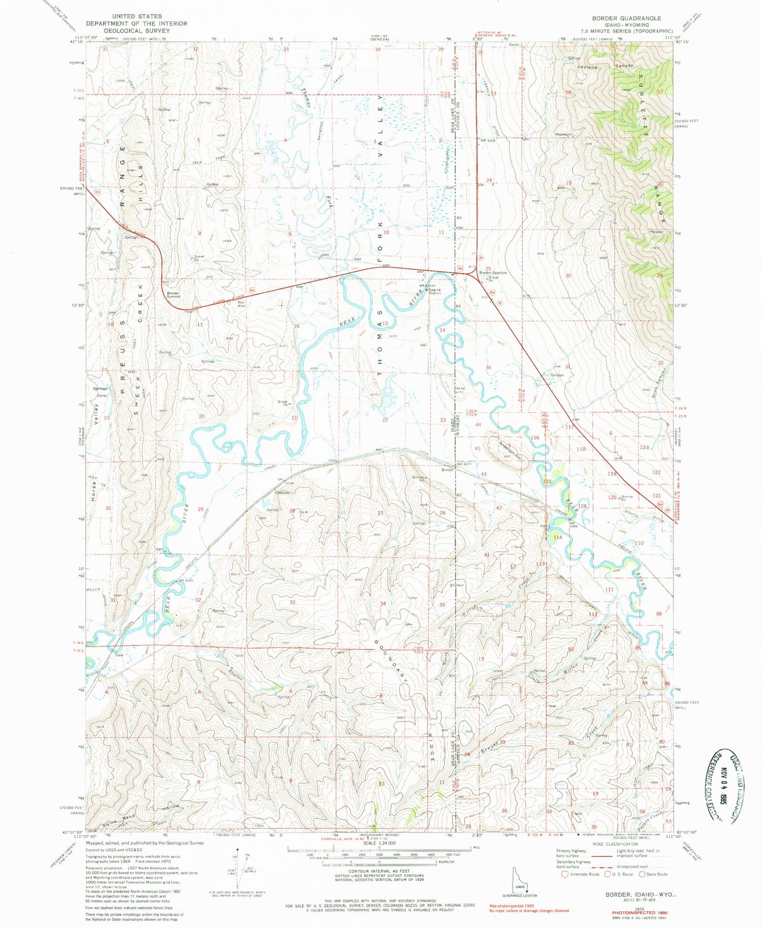
Classic USGS Border Idaho 7.5'x7.5' Topo Map
Couldn't load pickup availability
Historical USGS topographic quad map of Border in the states of Idaho, Wyoming. Map scale may vary for some years, but is generally around 1:24,000. Print size is approximately 24" x 27"
This quadrangle is in the following counties: Bear Lake, Lincoln.
The map contains contour lines, roads, rivers, towns, and lakes. Printed on high-quality waterproof paper with UV fade-resistant inks, and shipped rolled.
Contains the following named places: Border, Border Junction, Border Summit, Chausse, Cook Canal, Erwine Creek, Etcheverry Ditch, Farm Service Agency Interest of Idaho, Francis Ditch, Groo Canyon, Horse Valley, Layland Canyon, Miller Ditch, North Willow Creek, Rocky Point Ditch, Sights Ditch, South Willow Creek, Taylor Creek, Thomas Fork, Thomas Fork Valley


