MyTopo
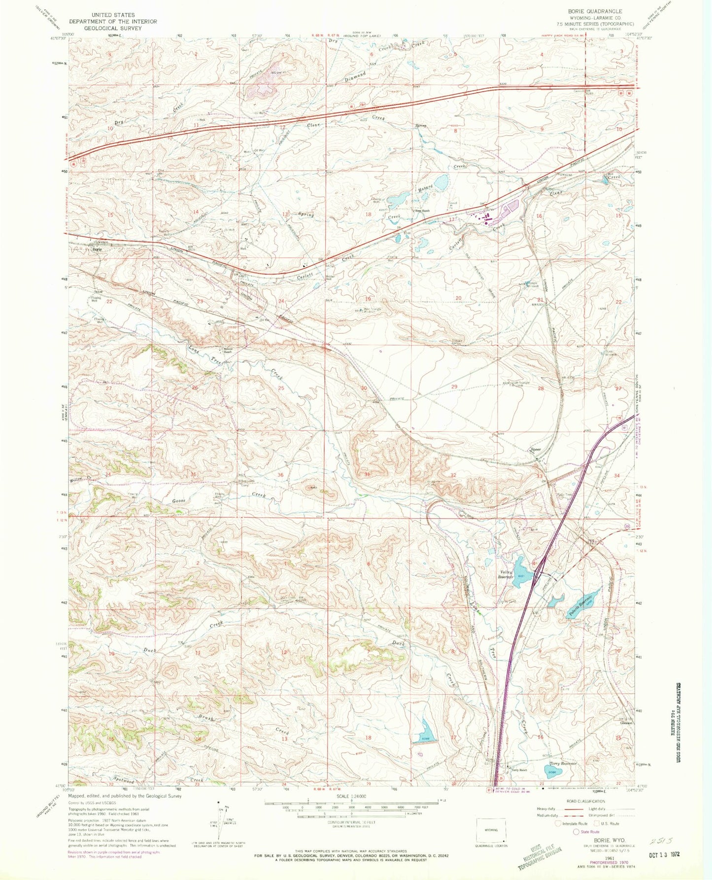
Classic USGS Borie Wyoming 7.5'x7.5' Topo Map
Couldn't load pickup availability
Historical USGS topographic quad map of Borie in the state of Wyoming. Map scale may vary for some years, but is generally around 1:24,000. Print size is approximately 24" x 27"
This quadrangle is in the following counties: Laramie.
The map contains contour lines, roads, rivers, towns, and lakes. Printed on high-quality waterproof paper with UV fade-resistant inks, and shipped rolled.
Contains the following named places: 7XL Dam, 7XL Reservoir, 82001, Belvoir Ranch, Borie, Borie Oil Field, Brush Creek, Clear Creek Dam, Clear Creek Reservoir, Corlett Creek, Dry Creek, Duck Creek, Duck Creek Camp, Elkar Well, Finnerty Well, Gleason Number 2 Dam, Goose Creek, Hashknife Camp, Hazard Creek, KLWY-TV (Cheyenne), Polaris Dam, Polaris Ditch, Polaris Reservoir, Rees Ranch, South Triangle Windmill, Speer, Speer Windmill, Spotswood Number 2 Dam, Spotswood Reservoir Number 2, Spring Creek, Terry Ranch, Terry Reservoir, Triangle Camp, Triangle Windmill, Valley Camp, Valley Reservoir, Webber Well, West Triangle Windmill, Willow Creek, Willow Creek Camp