MyTopo
Classic USGS Borrego Palm Canyon California 7.5'x7.5' Topo Map
Couldn't load pickup availability
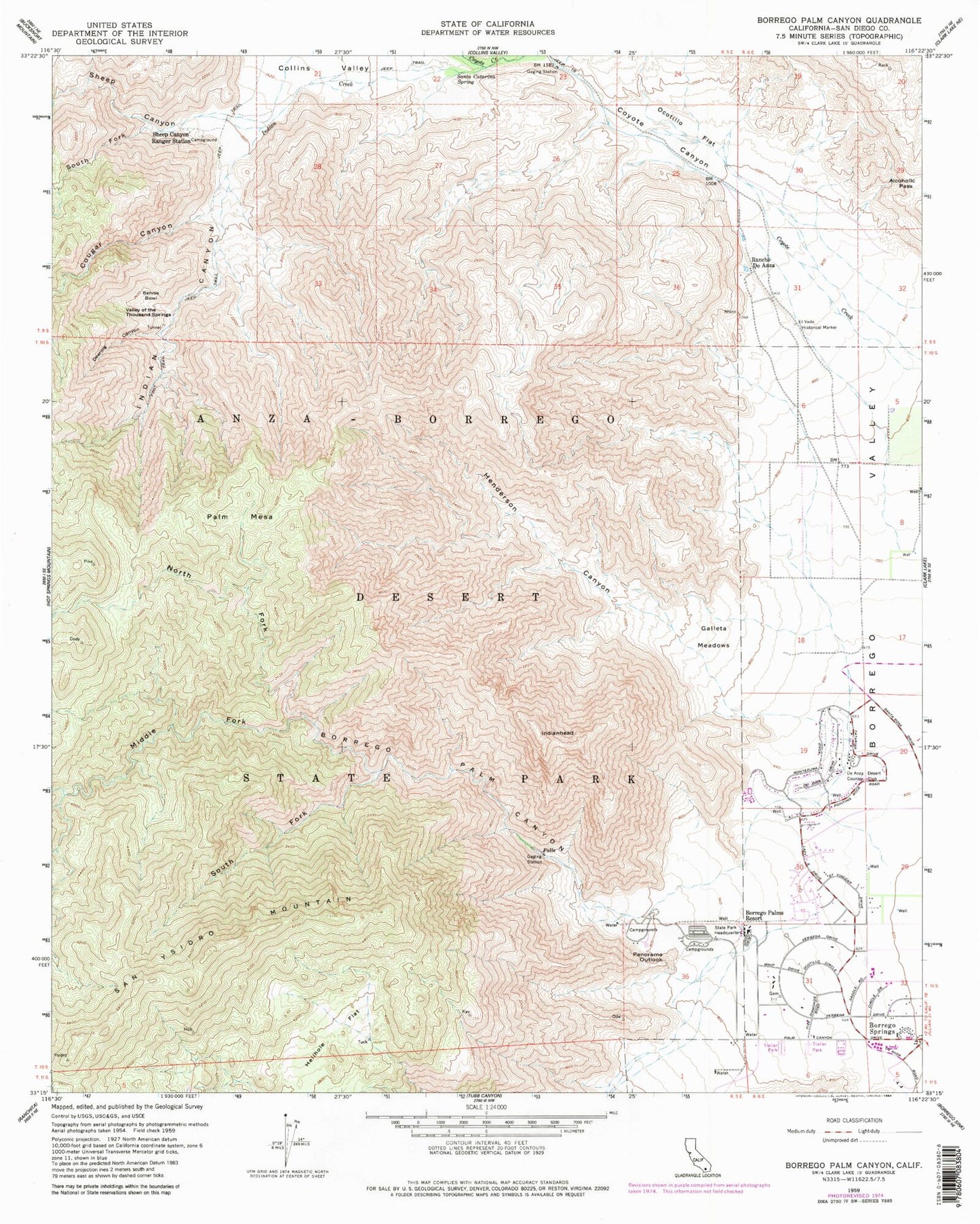
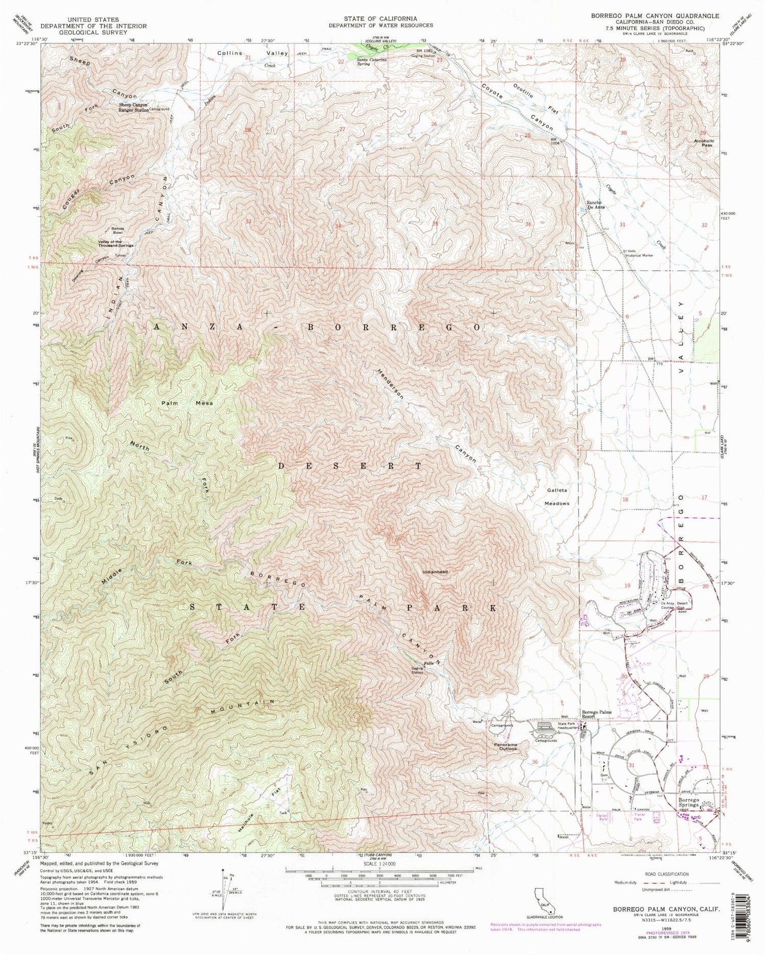
Historical USGS topographic quad map of Borrego Palm Canyon in the state of California. Typical map scale is 1:24,000, but may vary for certain years, if available. Print size: 24" x 27"
This quadrangle is in the following counties: San Diego.
The map contains contour lines, roads, rivers, towns, and lakes. Printed on high-quality waterproof paper with UV fade-resistant inks, and shipped rolled.
Contains the following named places: Alcoholic Pass, Anza-Borrego Desert State Park Headquarters, Bennis Bowl, Borrego Palms Resort, Deering Canyon, El Vado Historical Marker, Galleta Meadows, Hellhole Flat, Henderson Canyon, Indian Creek, Ocotillo Flat, Panorama Outlook, Rancho De Anza, Santa Catarina Spring, Sheep Canyon Ranger Station, Valley of the Thousand Springs, Borrego Palm Canyon, Indian Canyon, Palm Mesa, Box Canyon, Collins Valley, Cougar Canyon, Coyote Canyon, Middle Fork Borrego Palm Canyon, North Fork Borrego Palm Canyon, San Ysidro Mountain, Sheep Canyon, South Fork Sheep Canyon, Borrego Springs, Landells Heliport, De Anza Desert Country Club, South Fork Borrego Palm Canyon, Indianhead, Borrego Palm Canyon Campground, Borrego Lutheran Church, Borrego Springs Branch San Diego County Library, Borrego Springs Chamber of Commerce, Borrego Springs High School, Borrego Springs Post Office, The Church of Jesus Christ of Latter Day Saints, Community United Methodist Church, Desert Gardens Campground, Desert Sands Mobile Home Park, First Baptist Church, Holiday Home Mobile Home Park, Saint Barnabas Episcopal Church, Saint Richards Catholic Church, Seventh Day Adventist Church, The Mall Shopping Center, The Plaza Shopping Center, San Diego County Sheriff's Office Borrego Springs, Saint Richard Catholic Church Parish Cemetery