
MyTopo
Classic USGS Boru Spring Montana 7.5'x7.5' Topo Map
Couldn't load pickup availability
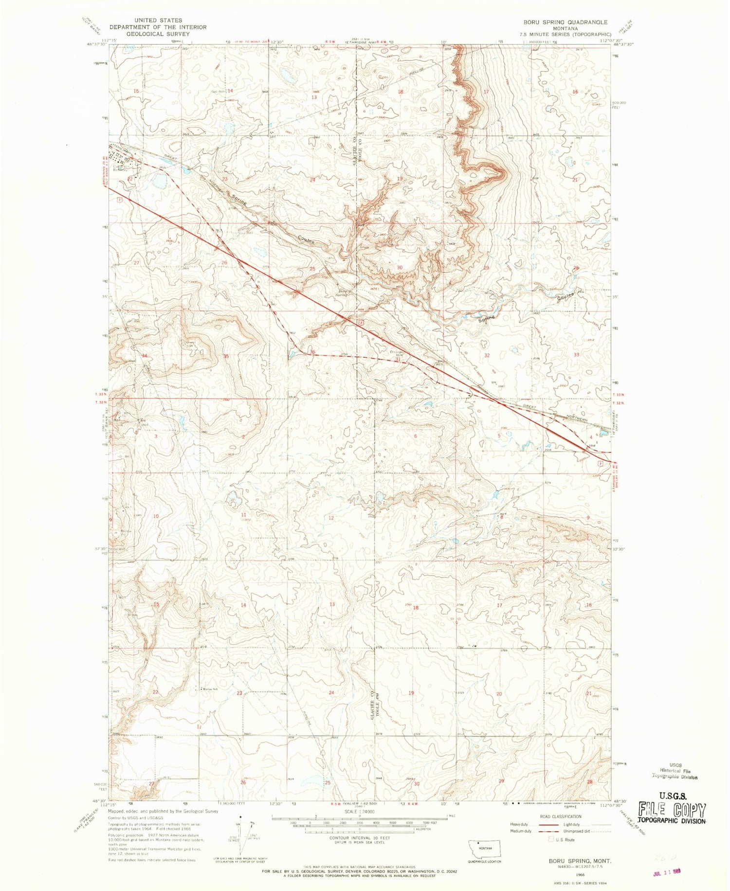
Historical USGS topographic quad map of Boru Spring in the state of Montana. Map scale may vary for some years, but is generally around 1:24,000. Print size is approximately 24" x 27"
This quadrangle is in the following counties: Glacier, Toole.
The map contains contour lines, roads, rivers, towns, and lakes. Printed on high-quality waterproof paper with UV fade-resistant inks, and shipped rolled.
Contains the following named places: 32N04W08CB__01 Well, 32N04W18ADAA01 Well, 32N04W20BB__01 Well, 32N04W20DA__01 Well, 32N04W21BA__01 Well, 32N04W28AB__01 Well, 32N05W10DB__01 Well, 32N05W11DD__01 Well, 32N05W13AB__01 Well, 32N05W14AA__01 Well, 32N05W14DA__01 Well, 32N05W22AD__01 Well, 32N05W23BB__01 Well, 32N05W24DB__01 Well, 32N05W25AA__01 Well, 32N05W25DD__01 Well, 33N04W31BD__01 Well, 33N04W31DD__01 Well, 33N05W13BB__01 Well, 33N05W13CC__01 Well, 33N05W22AB__01 Well, 33N05W23BB__01 Well, 33N05W26AB__01 Well, Boru, Boru Spring, Cut Bank Refinery, Marias School, Union Oil Company of California Spur


