MyTopo
Classic USGS Bosco Louisiana 7.5'x7.5' Topo Map
Couldn't load pickup availability
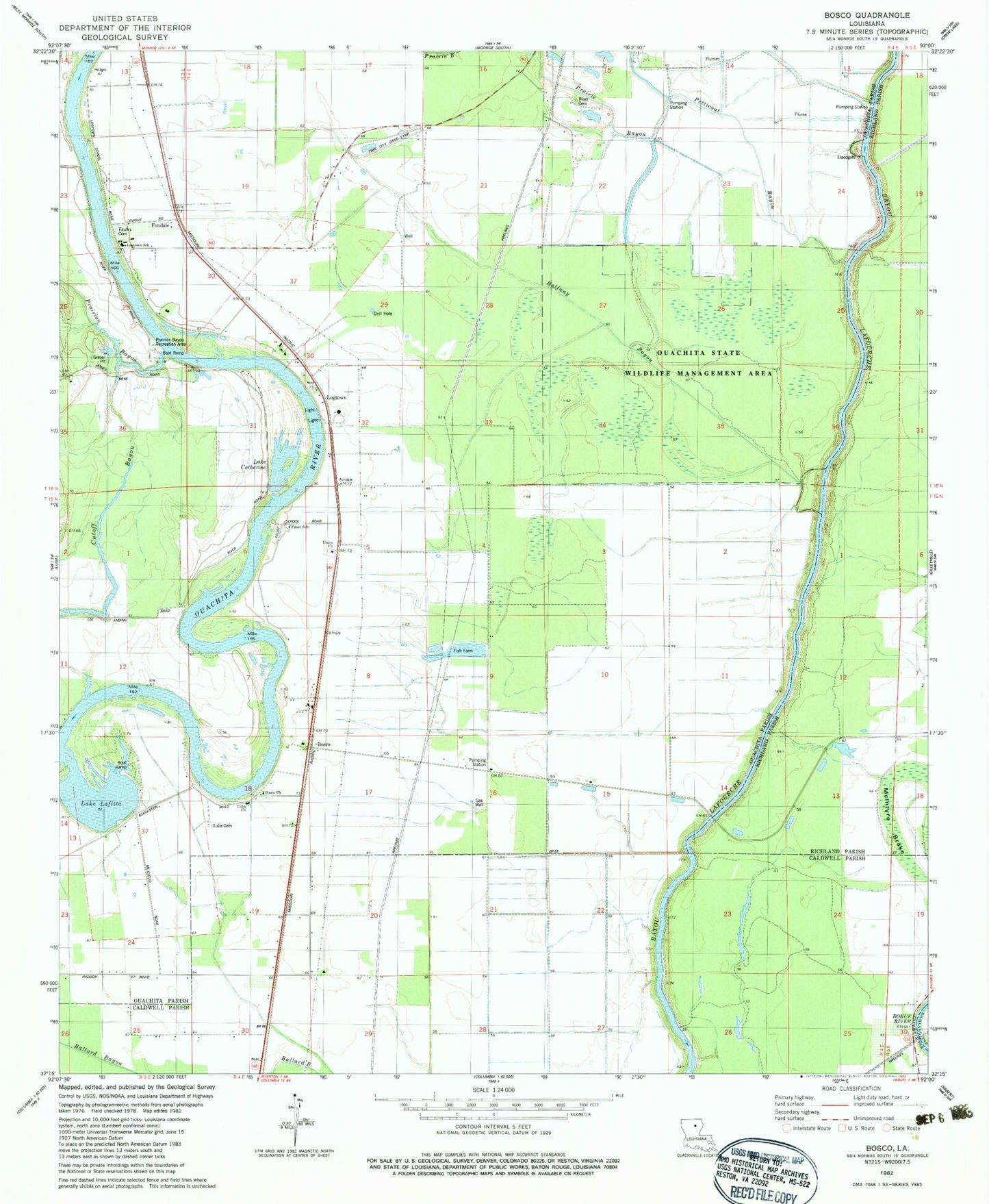
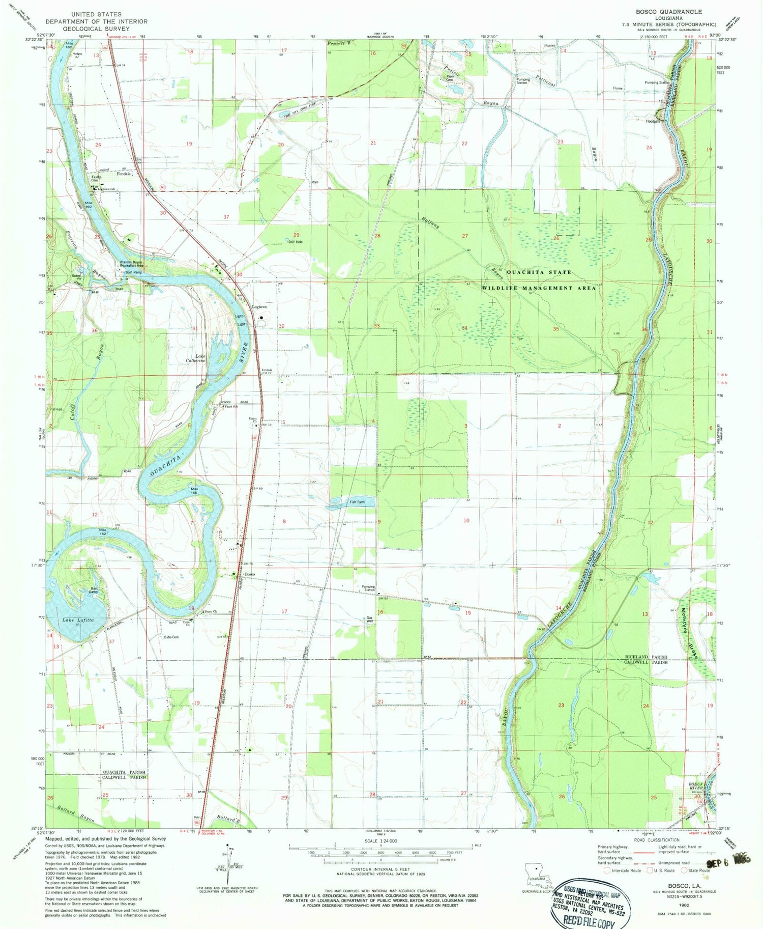
Historical USGS topographic quad map of Bosco in the state of Louisiana. Map scale may vary for some years, but is generally around 1:24,000. Print size is approximately 24" x 27"
This quadrangle is in the following counties: Caldwell, Ouachita, Richland.
The map contains contour lines, roads, rivers, towns, and lakes. Printed on high-quality waterproof paper with UV fade-resistant inks, and shipped rolled.
Contains the following named places: Bosco, Bosco Church, Croton Grove Landing, Cuba, Cuba Cemetery, Cuba Church Gas Field, Cuba Missionary Baptist Church, Cutoff Bayou, Faulks Cemetery, Faust School, Filhiol, Fondale, Halfway Bayou, Lake Catherine, Lake Lafitta, Logtown, Logtown Elementary School, Logtown Landing, Lower Bosco Landing, McIntyre Brake, McLain, Northeast Cuba Church Gas Field, Ouachita Parish Fire Protection District 1 Station 11 Bosco, Ouachita Parish Fire Protection District 1 Station 7, Ouachita State Wildlife Management Area, Parish Governing Authority District F, Petticoat Bayou, Prairie Bayou, Prairion Bayou, Prairion Bayou Recreation Area, Riser Cemetery, Twin City Drag Strip, Union Church, Upper Bosco Landing, Watkins Landing, Westside Landing