MyTopo
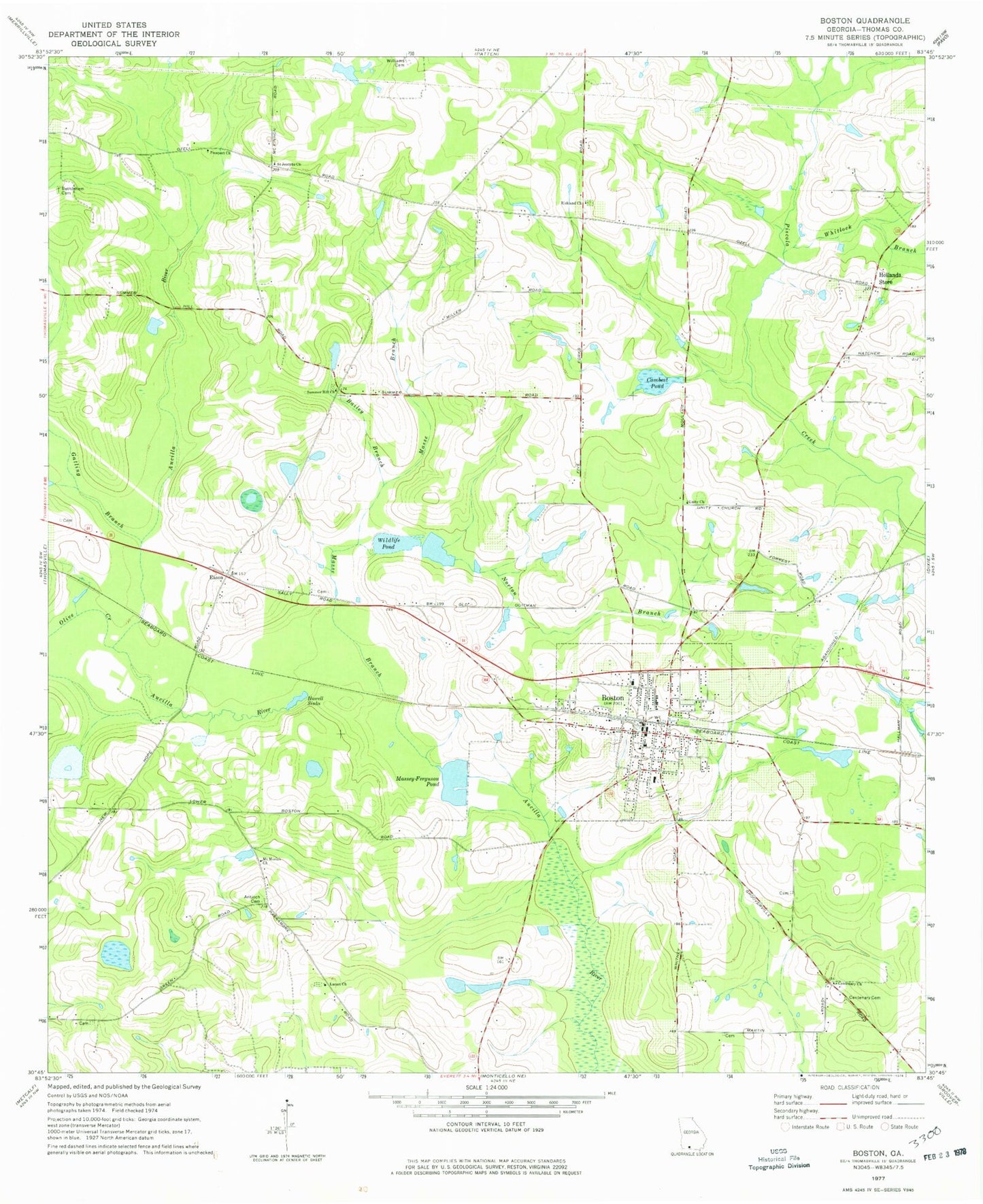
Classic USGS Boston Georgia 7.5'x7.5' Topo Map
Couldn't load pickup availability
Historical USGS topographic quad map of Boston in the state of Georgia. Map scale is 1:24000. Print size is approximately 24" x 27"
This quadrangle is in the following counties: Thomas.
The map contains contour lines, roads, rivers, towns, and lakes. Printed on high-quality waterproof paper with UV fade-resistant inks, and shipped rolled.
Contains the following named places: Antioch (historical), Antioch Cemetery, Bailey Branch, Barnes Cemetery, Bethlehem Cemetery, Boston, Boston Carnegie Branch Moultrie-Colquitt County Library, Boston Cemetery, Boston Community Cemetery, Boston Division, Boston Fire Department Station 4, Boston Police Station, Boston Post Office, Bryan Lake, Bryan Lake Dam, Cambest Pond, Carr Cemetery, Centenary Cemetery, Centenary Church, City of Boston, Eason, Gatling Branch, Hollands Store, Howell Sinks, Lacact Church, Masse Branch, Massey-Ferguson Pond, McMurray Cemetery, Mitchell Family Cemetery, Moodys Pond (historical), Moore Cemetery, Mount Moriah Church, New Hope Church, Norton Branch, Olive Creek, Prospect Church, Richland Cemetery, Richland Church, Saint Josephs Church, Summer Hill Church, Summerhill Cemetery, Turner Pond, Unity Church, Whitlock Branch, Wildlife Pond, Wildlife Pond Dam, Williams Cemetery, WTUF-FM (Boston)