MyTopo
Classic USGS Boswell Mountain Oregon 7.5'x7.5' Topo Map
Couldn't load pickup availability
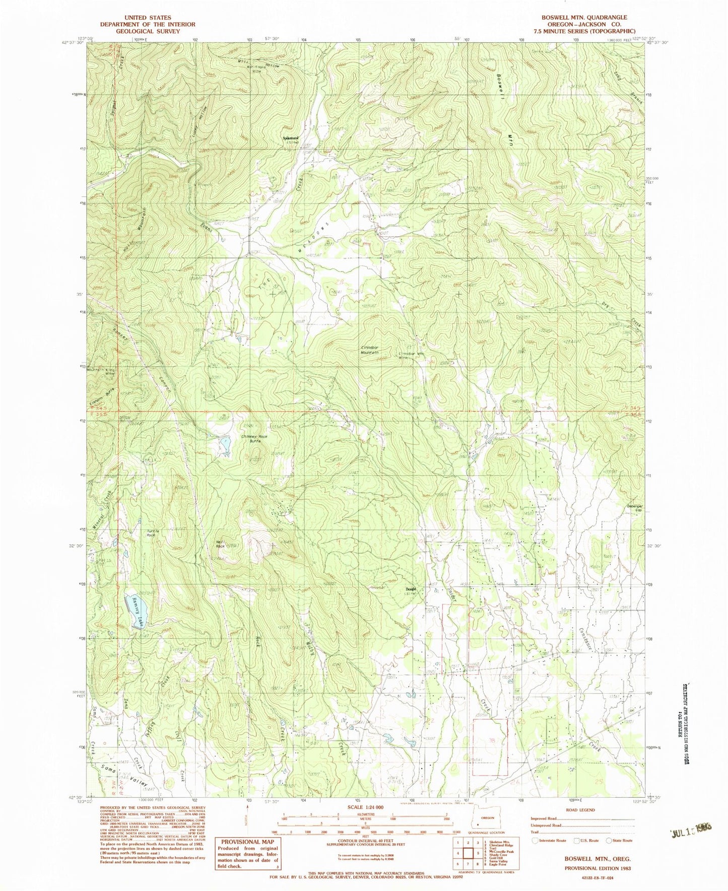
Historical USGS topographic quad map of Boswell Mountain in the state of Oregon. Map scale may vary for some years, but is generally around 1:24,000. Print size is approximately 24" x 27"
This quadrangle is in the following counties: Jackson.
The map contains contour lines, roads, rivers, towns, and lakes. Printed on high-quality waterproof paper with UV fade-resistant inks, and shipped rolled.
Contains the following named places: Antioch Cemetery, Beagle, Beagle Post Office, Beagle Sky Ranch Airport, Bingham Reservoir, Boswell Mountain, Chimney Rock Butte, Cinnabar Mountain, Cinnabar Mountain Mine, Cliff Ranch, Coulter Reservoir Number One, Coulter Reservoir Number Two, Despain Reservoir, Drake Ranch, Firefly Ranch Airfield, Gribble Reservoir, Hull Mountain, Hunt Reservoir, Kirkham Reservoir, Lucky Hollow, Mack Reservoir, Meadow Graves, Meadows School, Mill Hollow, Moore Reservoir, Mountain King Mine, Mystery Creek, Neil Rock, Patillo Ditches, Peffley Creek, Price Reservoir, Rexrood Springs, Sams Valley Dam, Sams Valley Division, Sams Valley Reservoir, Schmidt Reservoirs, Secluded Lake Reservoir, Short Creek, Simpson Dam, Simpson Reservoir, Snider Creek Airport, Spignet Creek, Spikenard, Spikenard Post Office, Straus Spring, The Meadows, Thomas Mill Post Office, Turtle Rock, War Eagle Mine, ZIP Code: 97503