MyTopo
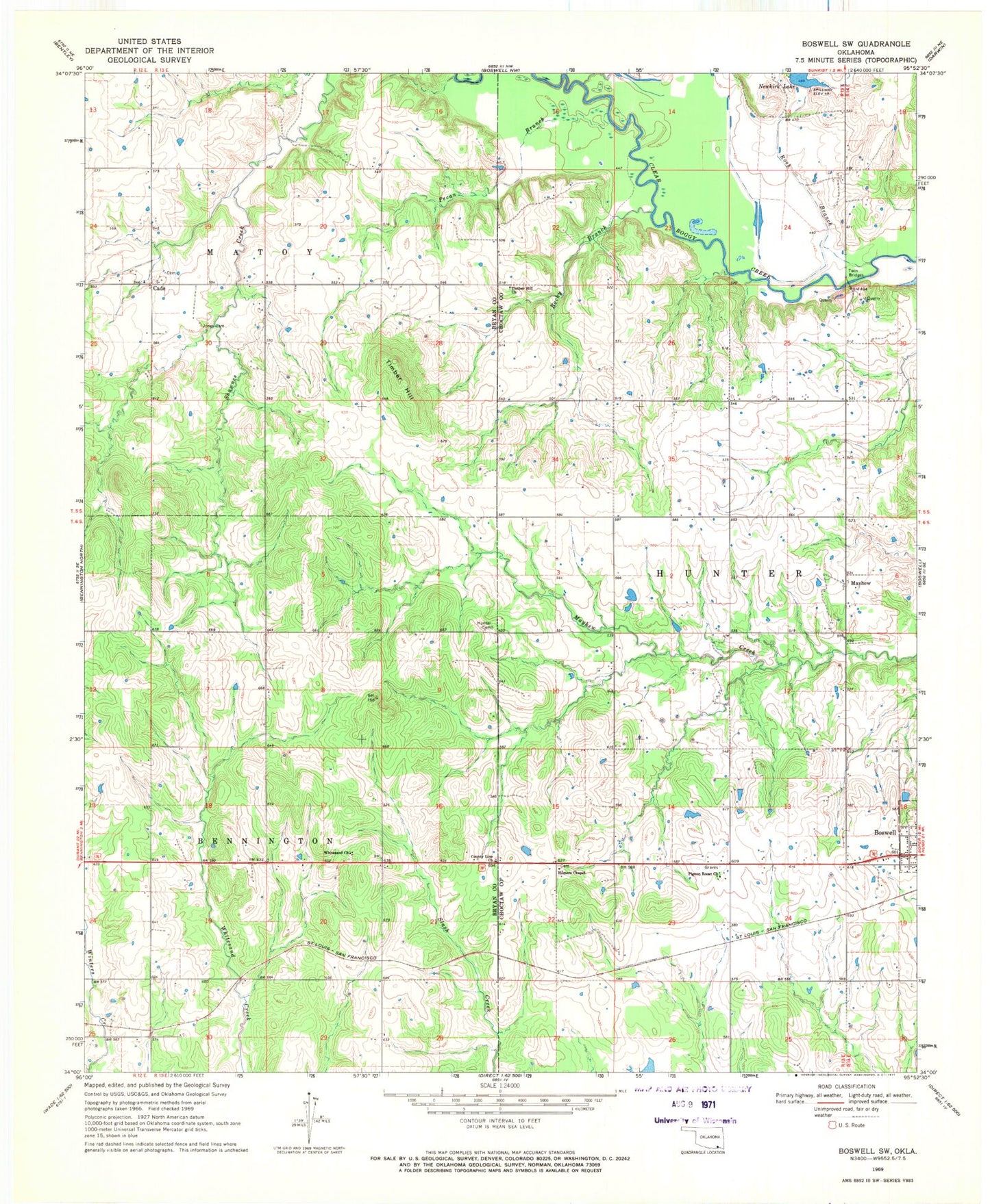
Classic USGS Boswell SW Oklahoma 7.5'x7.5' Topo Map
Couldn't load pickup availability
Historical USGS topographic quad map of Boswell SW in the state of Oklahoma. Map scale may vary for some years, but is generally around 1:24,000. Print size is approximately 24" x 27"
This quadrangle is in the following counties: Bryan, Choctaw.
The map contains contour lines, roads, rivers, towns, and lakes. Printed on high-quality waterproof paper with UV fade-resistant inks, and shipped rolled.
Contains the following named places: Boswell State Park, Cade, Cold Springs Creek, County Line Church, East Bryan Division, Homers Chapel, Homer's Chapel Cemetery, Hunter Cemetery, Jones Cemetery, Lake Newkirk Dam, Mayhew, Pecan Branch, Pigeon Roost Cemetery, Pigeon Roost Church, Rocky Branch, Ross Branch, Timber Hill, Timber Hill Church, Twin Bridges, Whitesand Church