MyTopo
Classic USGS Boswell Arkansas 7.5'x7.5' Topo Map
Couldn't load pickup availability
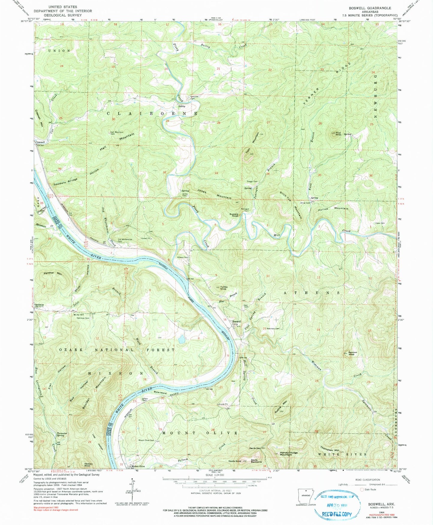
Historical USGS topographic quad map of Boswell in the state of Arkansas. Map scale may vary for some years, but is generally around 1:24,000. Print size is approximately 24" x 27"
This quadrangle is in the following counties: Izard, Stone.
The map contains contour lines, roads, rivers, towns, and lakes. Printed on high-quality waterproof paper with UV fade-resistant inks, and shipped rolled.
Contains the following named places: Allison - Sylamore Volunteer Fire Station 5, Athens Cemetery, Bailey Creek, Bearhead Branch, Bee Hollow, Blue Branch, Bone Island, Boswell, Boswell Baptist Church, Boulder Mountain, Buzzard Roost, Cook Cemetery, Creswell, Devils Backbone, Devils Gap, Devils Knob, Flat Hollow, Goodwin Bridge Hollow, Gorby, Hall Mountain, Hall Mountain Cemetery, Harvey Hodge Mountain, Hickory Knob, Hollow Mountain, Huff Spring Creek, Islet Branch, Jeffery Cemetery, Jones Cemetery, Jones Mountain, Knob Branch, Lost Hollow, Mill Creek, Mount Joy Church, Mount Olive, Mount Olive Cemetery, Mount Olive Census Designated Place, Old Whitehouse Cemetery, Old Whitehouse Creek, Optimus Cemetery, Palestine Cemetery, Panther Knob, Panther Mountain, Pearogue Branch, Pearogue Cemetery, Pilot Knob, Piney Creek, Robinson Cemetery, Ruthie Mountain, Ruthie Mountain Volunteer Fire Department, Shop Hollow, Slick Top Mountain, Staggs Cemetery, Sugarloaf Creek, Sycamore Creek, Tarwater Spring, Thompson Mountain, Township of Athens, Township of Claiborne, Township of Mount Olive, Turkey Knob, Twin Mountain, Verner Ridge, Vest, Vest Cemetery, Vest Spring Branch, Ward Branch, White Cemetery, Wideman Creek