
MyTopo
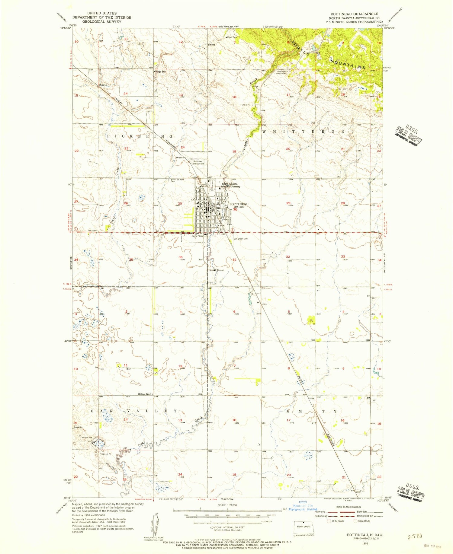
Classic USGS Bottineau North Dakota 7.5'x7.5' Topo Map
Couldn't load pickup availability
Historical USGS topographic quad map of Bottineau in the state of North Dakota. Map scale may vary for some years, but is generally around 1:24,000. Print size is approximately 24" x 27"
This quadrangle is in the following counties: Bottineau.
The map contains contour lines, roads, rivers, towns, and lakes. Printed on high-quality waterproof paper with UV fade-resistant inks, and shipped rolled.
Contains the following named places: Bottineau, Bottineau Ambulance Service, Bottineau Central School, Bottineau City Hall, Bottineau City Landfill, Bottineau Country Club, Bottineau County Courthouse, Bottineau County Historical Museum, Bottineau County Jail, Bottineau County Library, Bottineau County Sheriff's Office, Bottineau Junior-Senior High School, Bottineau Municipal Airport, Bottineau Post Office, Bottineau Rural Volunteer Fire Department, C N Nelson Science Center, City of Bottineau, Dakota College at Bottineau, Dakota College at Bottineau Library, Good Samaritan Society-Bottineau, Gross Hall, Knudson Student Center, Lath House, Mead Hall, Milligan Hall, Molberg Center, Mount Saint Mark Cemetery, Oak Creek Cemetery, Old Main Building, Saint Andrew's Health Center - Hospital, School Number 1, Thatcher Hall, Tommy Turtle Park, Tommy Turtle Statue, Township of Amity, Township of Whitteron, Vinje School, ZIP Code: 58318


