
MyTopo
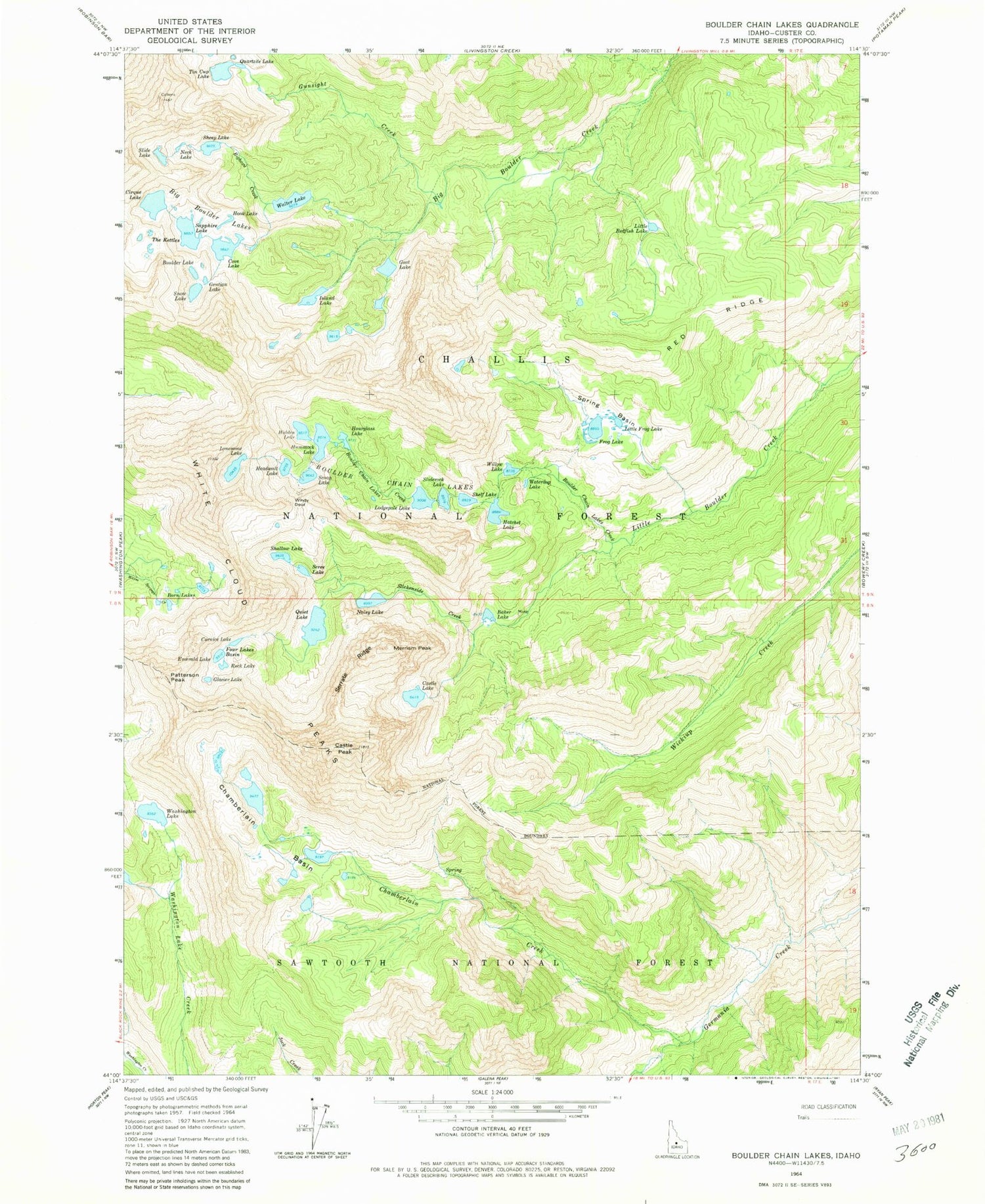
USGS Classic Boulder Chain Lakes Idaho 7.5'x7.5' Topo Map
Couldn't load pickup availability
Historical USGS topographic quad map of Boulder Chain Lakes in the state of Idaho. Scale: 1:24000. Print size: 24" x 27"
This quadrangle is in the following counties: Custer.
The map contains contour lines, roads, rivers, towns, lakes, and grids including latitude / longitude and UTM / MGRS. Printed on high-quality waterproof paper with UV fade-resistant inks.
Contains the following named places: Bighorn Creek, Baker Lake, Big Boulder Lakes, Boorn Lakes, Boulder Chain Lakes Creek, Boulder Chain Lakes, Boulder Lake, Castle Lake, Castle Peak, Chamberlain Basin, Chamberlain Creek, Cirque Lake, Cornice Lake, Cove Lake, Emerald Lake, Four Lakes Basin, Frog Lake, Frog Lakes, Gentian Lake, Glacier Lake, Goat Lake, Gunsight Creek, Headwall Lake, Hidden Lake, Hook Lake, Hourglass Lake, Hummock Lake, Island Lake, Little Frog Lake, Little Redfish Lake, Lodgepole Lake, Merriam Peak, Neck Lake, Noisy Lake, Patterson Peak, Quiet Lake, Rock Lake, Sapphire Lake, Scoop Lake, Scree Lake, Serrate Ridge, Shallow Lake, Sheep Lake, Shelf Lake, Slickenside Creek, Slide Lake, Sliderock Lake, Snow Lake, Spring Basin, The Kettles, Tin Cup Lake, Tiny Lake, Walker Lake, Washington Lake, Waterdog Lake, White Cloud Peaks, Willow Lake, Windy Devil, Lonesome Lake, Red Ridge, Hatchet Lake, Quartzite Lake, Red Ridge


