MyTopo
Classic USGS Boulder Mountain Arizona 7.5'x7.5' Topo Map
Couldn't load pickup availability
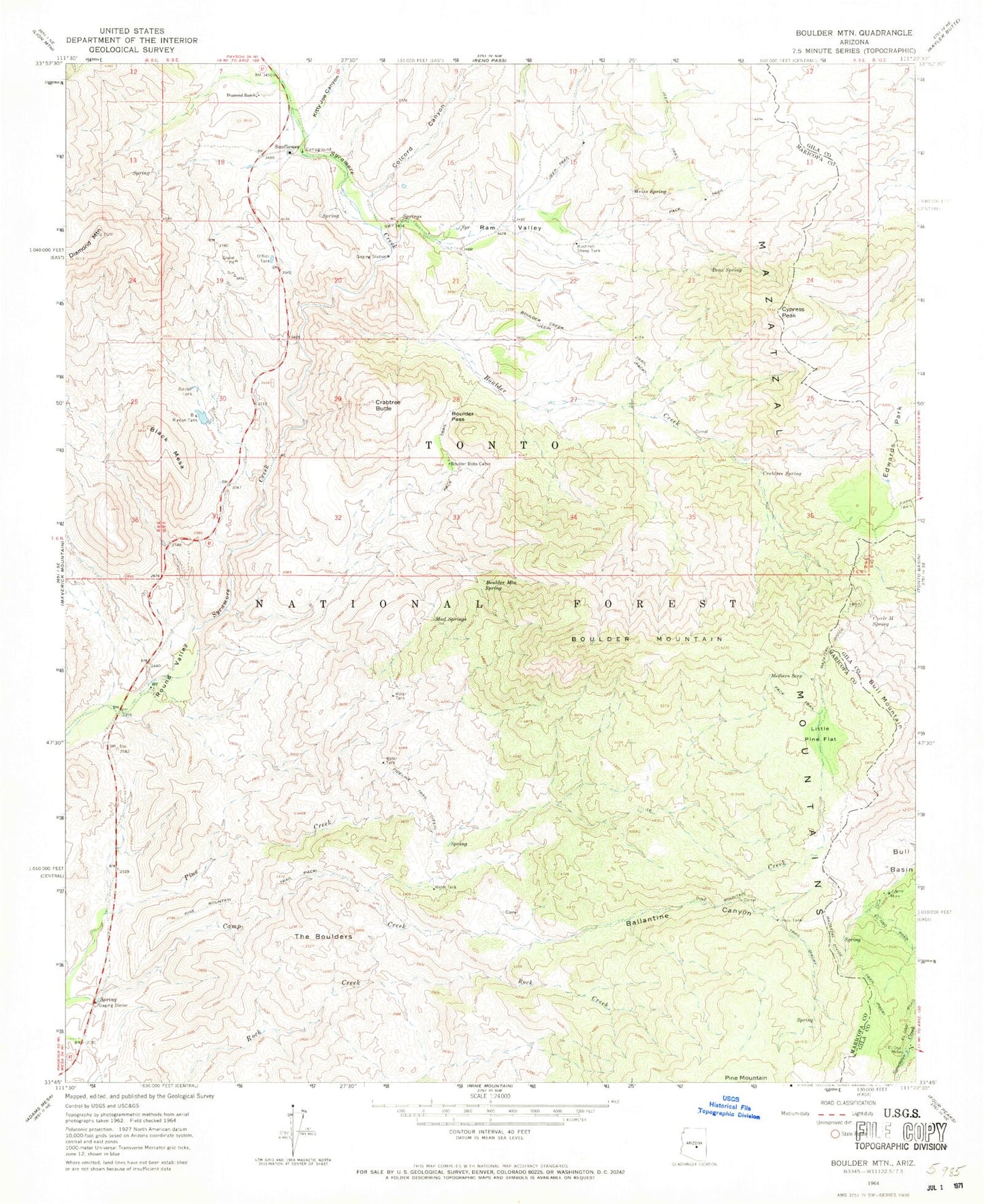
Historical USGS topographic quad map of Boulder Mountain in the state of Arizona. Map scale may vary for some years, but is generally around 1:24,000. Print size is approximately 24" x 27"
This quadrangle is in the following counties: Gila, Maricopa.
The map contains contour lines, roads, rivers, towns, and lakes. Printed on high-quality waterproof paper with UV fade-resistant inks, and shipped rolled.
Contains the following named places: Ballantine Canyon, Ballantine Trailhead, Bear Spring, Big Rincon Tank, Black Mesa, Boulder Bobs Cabin, Boulder Creek, Boulder Creek Trail, Boulder Mountain, Boulder Mountain Spring, Boulder Pass, Boulder Tank, Bull Mountain, Bushnell Sheep Tank, Camp Creek Spring, Circle M Spring, Colcord Canyon, Crabtree Butte, Crabtree Spring, Cypress Peak, Cypress Spring, Diamond Mountain, Diamond Ranch, East Diamond Spring, El Oso Mine, Holbrook Ridge, Jolene Mine, Juniper Spring, Kitty Joe Canyon, Little Pine Flat, Lookout Point, Medlers Seep, Mud Springs, O'Neil Spring, O'Neil Tank, Pine Mountain Trail, Pipeline Trail, Ram Valley, Rincon Pass, Rincon Tank, Rock Tank, Steer Spring, Sunflower, Sunflower Spring, The Boulders, Tunnel Spring, Weiss Spring