MyTopo
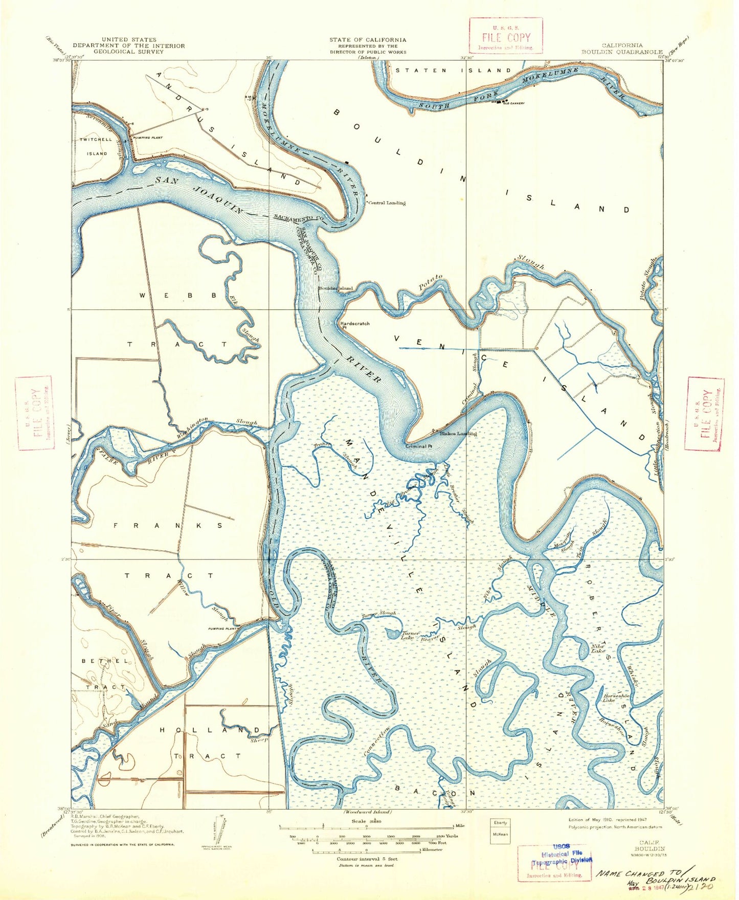
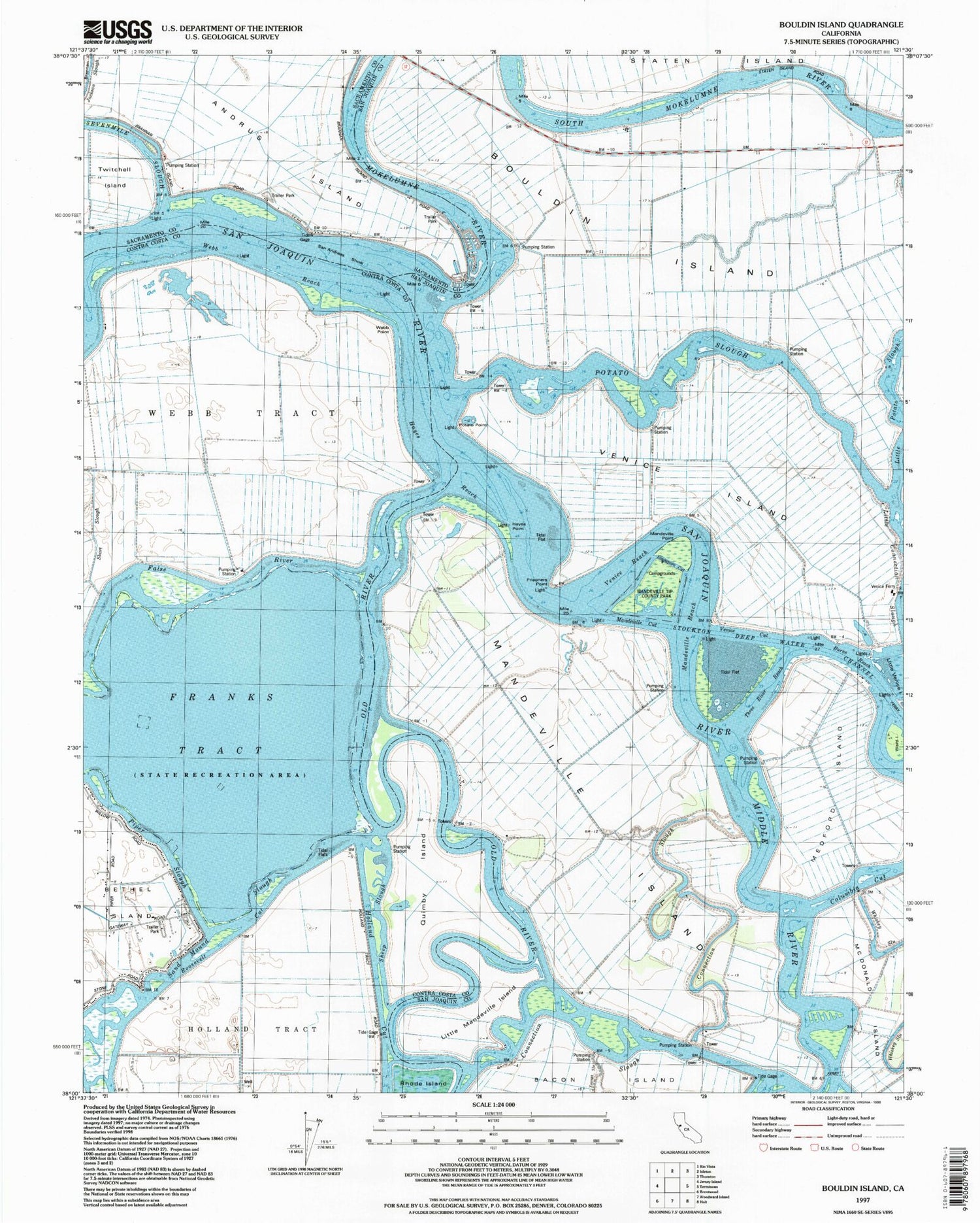
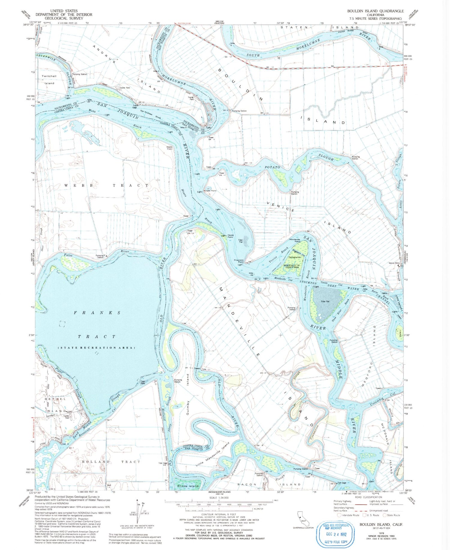
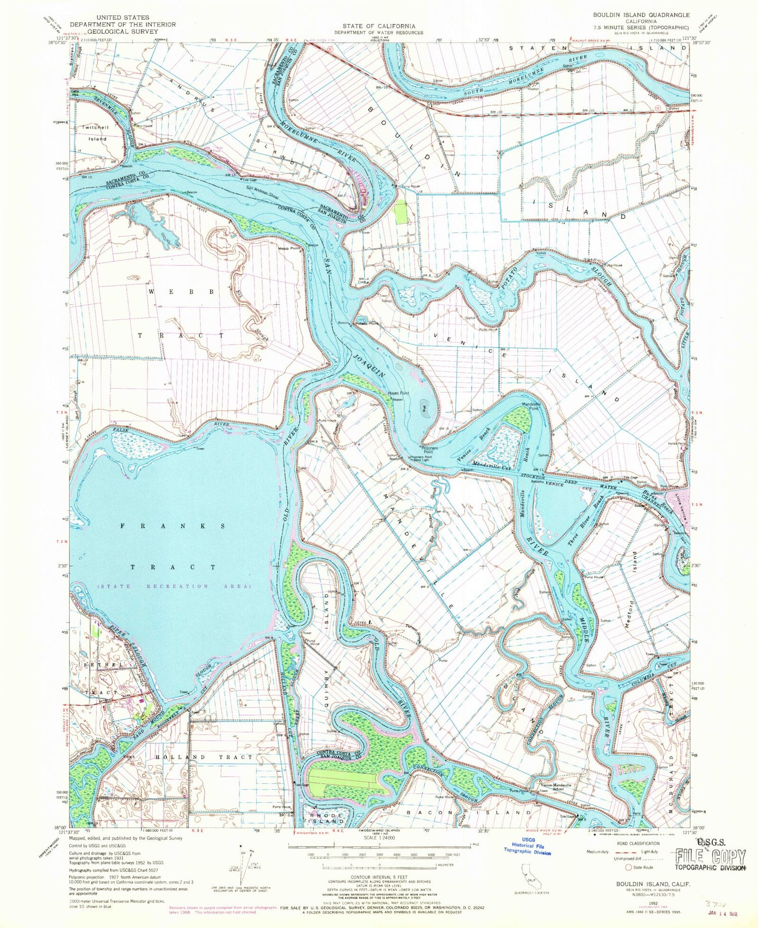
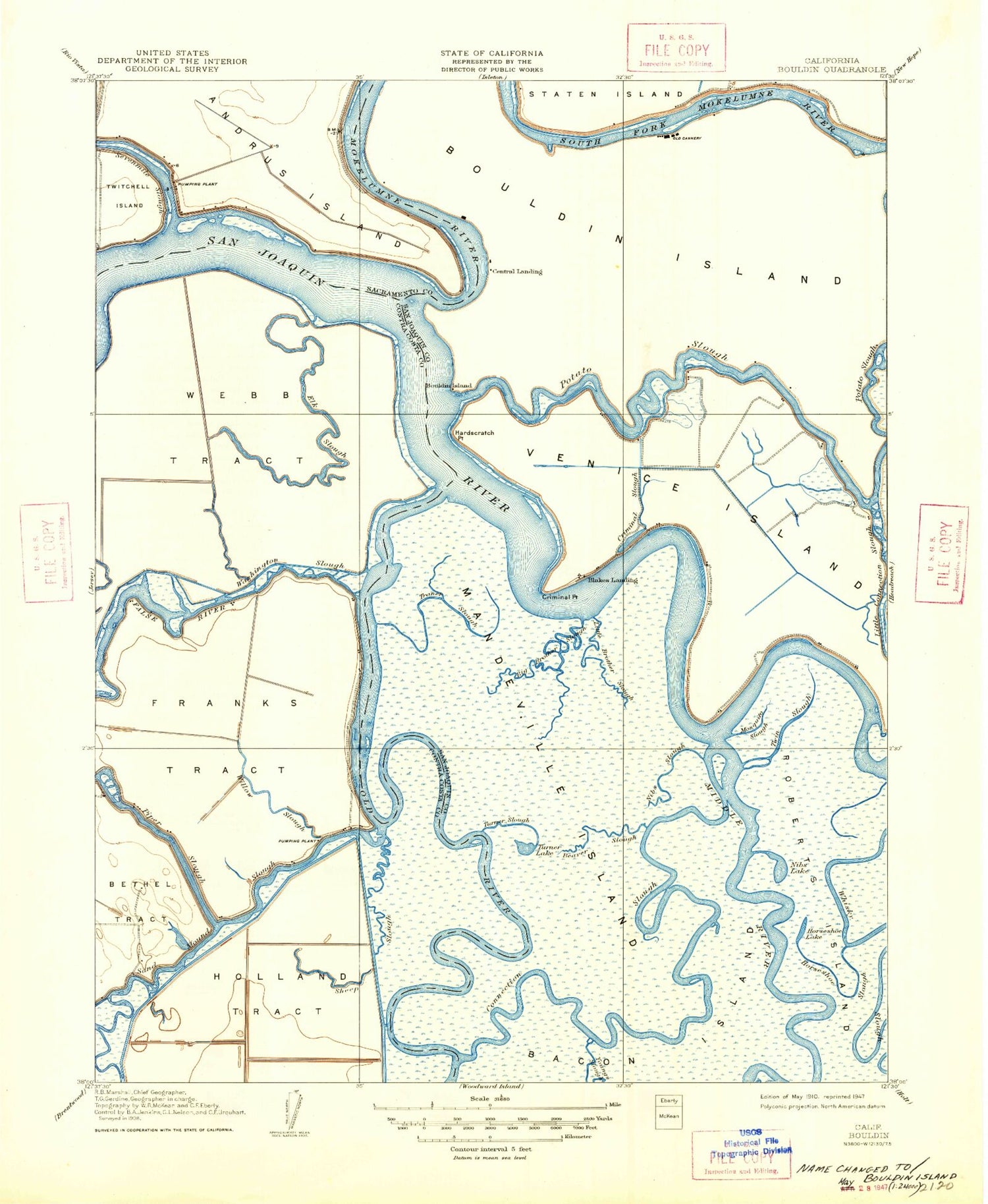
Classic USGS Bouldin Island California 7.5'x7.5' Topo Map
Couldn't load pickup availability
Historical USGS topographic quad map of Bouldin Island in the state of California. Map scale is 1:24000. Print size is approximately 24" x 27"
This quadrangle is in the following counties: Contra Costa, Sacramento, San Joaquin.
The map contains contour lines, roads, rivers, towns, and lakes. Printed on high-quality waterproof paper with UV fade-resistant inks, and shipped rolled.
Contains the following named places: Beaver Slough, Beaver Slough, Beaver Slough, Blakes Landing, Blakes Landing, Blakes Landing, Bouldin Island, Bouldin Island, Bouldin Island, Burns Reach, Burns Reach, Burns Reach, Central Landing, Central Landing, Central Landing, Columbia Cut, Columbia Cut, Columbia Cut, Connection Slough, Connection Slough, Connection Slough, Criminal Slough, Criminal Slough, Criminal Slough, Hayes Point, Hayes Point, Hayes Point, Hayes Reach, Hayes Reach, Hayes Reach, Holland Cut, Holland Cut, Holland Cut, Little Mandeville Island, Little Mandeville Island, Little Mandeville Island, Little Venice Island, Little Venice Island, Little Venice Island, Mandeville Cut, Mandeville Cut, Mandeville Cut, Mandeville Island, Mandeville Island, Mandeville Island, Mandeville Point, Mandeville Point, Mandeville Point, Mandeville Reach, Mandeville Reach, Mandeville Reach, Mandeville Tip County Park, Mandeville Tip County Park, Mandeville Tip County Park, Medford Island, Medford Island, Medford Island, Middle River, Middle River, Middle River, Mokelumne River, Mokelumne River, Mokelumne River, Nibs Slough, Nibs Slough, Nibs Slough, Old River, Old River, Old River, Potato Point, Potato Point, Potato Point, Potato Slough, Potato Slough, Potato Slough, Prisoners Point, Prisoners Point, Prisoners Point, Prisoners Point Bend Light (historical), Prisoners Point Bend Light (historical), Prisoners Point Bend Light (historical), Quimby Island, Quimby Island, Quimby Island, Rhode Island, Rhode Island, Rhode Island, Roosevelt Cut, Roosevelt Cut, Roosevelt Cut, Sacramento County Sheriff - Brannan Island Service Center, Sacramento County Sheriff - Brannan Island Service Center, Sacramento County Sheriff - Brannan Island Service Center, San Andreas Shoal, San Andreas Shoal, San Andreas Shoal, Sand Mound Slough, Sand Mound Slough, Sand Mound Slough, Sheep Slough, Sheep Slough, Sheep Slough, Short Slough, Short Slough, Short Slough, Singapore Cut, Singapore Cut, Singapore Cut, Stockton Deep Water Channel, Stockton Deep Water Channel, Stockton Deep Water Channel, Three River Reach, Three River Reach, Three River Reach, Turner Lake (historical), Turner Lake (historical), Turner Lake (historical), Turner Slough (historical), Turner Slough (historical), Turner Slough (historical), Venice Cut, Venice Cut, Venice Cut, Venice Ferry, Venice Ferry, Venice Ferry, Venice Island, Venice Island, Venice Island, Venice Reach, Venice Reach, Venice Reach, Venice-Mandeville School (historical), Venice-Mandeville School (historical), Venice-Mandeville School (historical), Ward Island, Ward Island, Ward Island, Webb Point, Webb Point, Webb Point, Webb Reach, Webb Reach, Webb Reach, Webb Tract, Webb Tract, Webb Tract