MyTopo
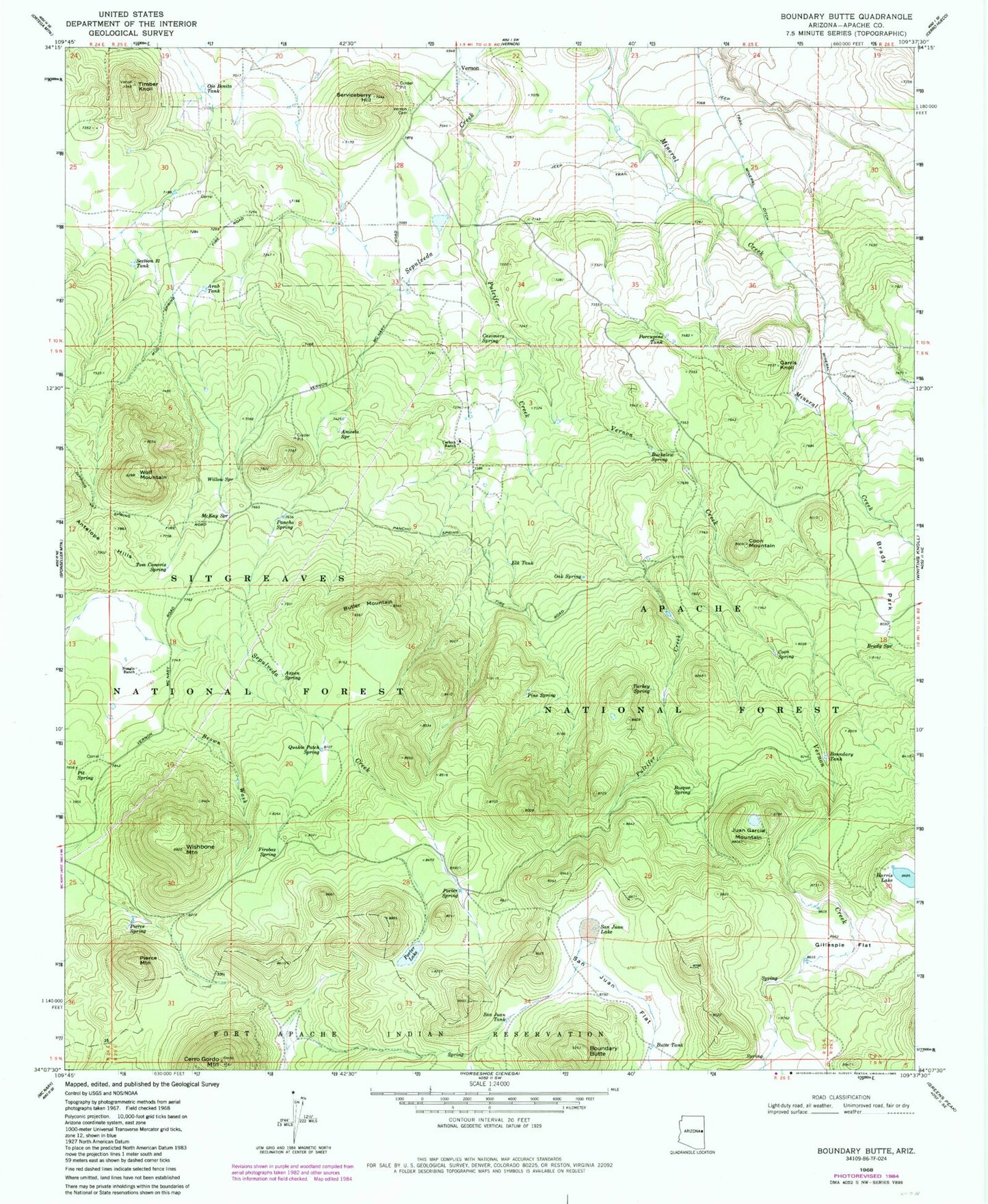
Classic USGS Boundary Butte Arizona 7.5'x7.5' Topo Map
Couldn't load pickup availability
Historical USGS topographic quad map of Boundary Butte in the state of Arizona. Typical map scale is 1:24,000, but may vary for certain years, if available. Print size: 24" x 27"
This quadrangle is in the following counties: Apache.
The map contains contour lines, roads, rivers, towns, and lakes. Printed on high-quality waterproof paper with UV fade-resistant inks, and shipped rolled.
Contains the following named places: Boundary Butte, Aniceto Spring, Arab Tank, Aspen Spring, Bosque Spring, Boundary Tanks, Brady Park, Brady Spring, Brown Wash, Buckelew Spring, Butler Mountain, Butte Tank, Carlock Ranch, Casimero Spring, Cerro Gordon Mountain, Coon Mountain, Coon Spring, Elk Tank, Firebox Spring, Garris Knoll, Gillespie Flat, Harris Lake, Juan Garcia Mountain, McKay Spring, Mineral Ditch, Naegle Ranch, Oak Spring, Ojo Bonito Tank, Pancho Spring, Pierce Mountain, Pierce Spring, Pine Spring, Pit Spring, Porcupine Tank, Porter Lake, Porter Spring, Pulcifer Creek, Quakie Patch Spring, San Juan Flat, San Juan Lake, San Juan Tanks, Section Thirty Tank, Serviceberry Hill, Timber Knoll, Tom Canovis Spring, Turkey Spring, Vernon Cemetery, Vernon Creek, Willow Spring, Wishbone Mountain, Wolf Mountain, Boundary Spring Tank, Naegle Tank, Pancho Spring, Pine Spring, Circle Tank, Aniceto Cinder Pit, Aniceto Tank, Private Tank, Section Six Tank, Jog Tank, Aniceto Knoll, Lee Tank, Bear Tank, Silver Spring, Gust Reservoir, Gust Spring, Boundary Tank, Butler Tak, Pancho Tank, Section Twenty Tank, Gillespie Tank, Gillespie Spring, Bosque Tank, Lee Spring, Goodman Spring, Vernon Elementary School